Maps of Wandsworth
London X.50 - OS London Town Plan
1 : 1056 Topographic maps Ordnance Survey Ordnance Survey
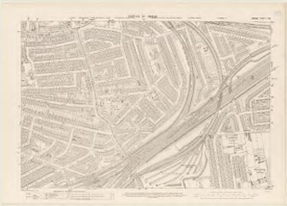
London (1915- Numbered sheets) VIII.8 (includes: Battersea; Chelsea; Fulham) - 25 Inch Map
1 : 2500 Topographic maps Ordnance Survey Ordnance Survey
London (Edition of 1894-96) C (includes: Battersea; Chelsea; Fulham) - 25 Inch Map
1 : 2500 Topographic maps Ordnance Survey Ordnance Survey
London (First Editions c1850s) LXIV (includes: Battersea; Chelsea; Fulham) - 25 Inch Map
1 : 2500 Topographic maps Ordnance Survey Ordnance Survey
London X.NE - OS Six-Inch Map
1 : 10560 Topographic maps Ordnance Survey Ordnance Survey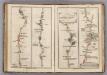
Newington to Ryegate.
1 : 63360 Cary, John
Charles Booth's descriptive map of London poverty 1889
Charles Booth
London SW.
1 : 15840 Stanford, Edward
Thames and Metropolis Improvement plan
Martin, John
A PLAN of the ROADS Under the DIRECTION and CARE of this TRUST and divers Roads Adjacent.
1 : 16351 The title of this road map of Kensington and Chelsea appears in a panel above the plan, with the compass star at top right and scale bar at bottom left. The roads within the Kensington and Hyde Park Trust are indicated by a shadowed line; the king's private roads by a double line; the common roads by a double dotted line; and the footpaths by a single dotted line. Turnpikes and junctions are numbered for reference with distances given in a table down the left side of the plate. Roberts, R.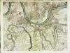
An exact survey of the city's of London Westminster , X
1 Blatt : 53 x 71 cm John Rocque
London Sheet N - OS Six-Inch Map
1 : 10560 Topographic maps Ordnance Survey Ordnance Survey
London Sheet N - OS Six-Inch Map
1 : 10560 Topographic maps Ordnance Survey Ordnance Survey
Middlesex XXI - OS Six-Inch Map
1 : 10560 Topographic maps Ordnance Survey Ordnance Survey
Insurance Plan of London Western District Vol. A: Key Plan
1 : 21120 This "key plan" indicates coverage of the Goad 1901 series of fire insurance maps of London that were originally produced to aid insurance companies in assessing fire risks. The building footprints, their use (commercial, residential, educational, etc.), the number of floors and the height of the building, as well as construction materials (and thus risk of burning) and special fire hazards (chemicals, kilns, ovens) were documented in order to estimate premiums. Names of individual businesses, property lines, and addresses were also often recorded. Together these maps provide a rich historical shapshot of the commercial activity and urban landscape of towns and cities at the time. The British Library holds a comprehensive collection of fire insurance plans produced by the London-based firm Charles E. Goad Ltd. dating back to 1885. These plans were made for most important towns and cities of the British Isles at the scales of 1:480 (1 inch to 40 feet), as well as many foreign towns at 1:600 (1 inch to 50 feet). Chas E Goad Limited Chas E Goad Limited
Map shewing the situation of all premises licensed for the sale of intoxicating liquors in the County of London
London County Council
TQ27 - OS 1:25,000 Provisional Series Map
1 : 25000 Topographic maps Ordnance Survey Ordnance Survey
Nouvelle carte du gouvernement civil d'Angleterre et de celuy de la ville de Londres
2 Karten : Kupferdruck ; Bildgrösse 35 x 45 cm Châtelain s.n.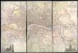
Map of LONDON From Actual Survey COMPREHENDING THE Various Improvements to 1851HUMBLY DEDICATED TO Her Most Gracious Majesty QUEEN VICTORIA By the Proprietors E. RUFF & Co.
This is a later edition of the Greenwoods' map of London first issued in 1827. Set within a decorative border, the map features title at top right, view of Westminster Abbey with key to symbols and colours at bottom left and view of St. Paul's Cathedral with reference table at bottom right. Greenwood, Christopher and John
NEW PLAN OF LONDON AND THE ENVIRONS from an Original Survey EXTENDING 6 3/4 Miles North & South in which all New and Intended Buildings and Improvements are carefully Inserted
This folding map is set within a decorative border. The title and imprint feature at top right, the compass star at middle right, and scale bar at bottom left. The river, open spaces and the built-up area in the city are delineated in colour. This is the fourth edition of a map first issued by Thompson in 1823, updated with the addition of St. Katherine's Dock and the housing developments in the Marylebone and Mile End areas. Thompson, George
London [11], uit: Geognostische Karte des Oesterreichischen Kaiserstaates mit einem grossen Theile Deutschland's u. Italien / hauptsachlich nach ... Haidinger's geognostischer Karte dieses Staates bearb. von Josef Scheda
1 : 3000000 titelvariant: General-Karte von Europa in 25 Blättern; Annotatie: Bijlage bij: General-Karte von Europa in 25 Blättern. - 1:2.592.000. - 1845-1847 Scheda, Joseph Wien : K.K. Militär. Geografisch. Institut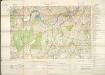
Militärgeographische Angaben über England.
Generalstab des Heeres, Abteilung für Kriegskarten u. Vermessungswesen IV. Mil.-Geo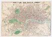
Whitbread's new plan of London
1 : 21500 Whitbread, J J. Whitbread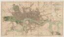
London in miniature : with the surrounding villages, an entire new plan in which the improvements both present and intended are actually reduced (by permission) from the surveys of the several proprietors : the whole laide down from the best authorities
1 : 16000 Mogg, Edward Edward Mogg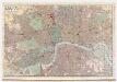
Indicator map of London : with the recent improvements, 1880
C. Smith & Son C. Smith & Son
Map of London : made from an actual survey in the years 1824, 1825, & 1826
1 : 63360 C. & J. Greenwood C. & J. Greenwood
Philip's new plan of London, 1873
1 : 18900 George Philip & Son George Philip & Son
Laurie and Whittle's New map of London with its environs, &c. Including the Recent Improvements.
From Great Britain
London
From Great Britain