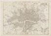
Maps of Hammersmith and Fulham
London X.25 - OS London Town Plan
1 : 1056 Topographic maps Ordnance Survey Ordnance Survey
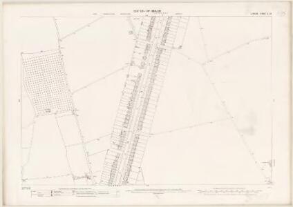
Surrey II.14 (includes: Barnes; Fulham; Wandsworth Borough) - 25 Inch Map
1 : 2500 Topographic maps Ordnance Survey Ordnance Survey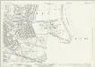
Surrey II.14 (includes: Barnes; Fulham; Wandsworth Borough) - 25 Inch Map
1 : 2500 Topographic maps Ordnance Survey Ordnance Survey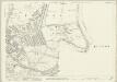
Surrey II.14 (includes: Barnes; Fulham; Wandsworth Borough) - 25 Inch Map
1 : 2500 Topographic maps Ordnance Survey Ordnance Survey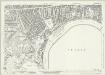
London (1915- Numbered sheets) VIII.2 (includes: Barnes; Chiswick St Nicholas; Hammersmith) - 25 Inch Map
1 : 2500 Topographic maps Ordnance Survey Ordnance Survey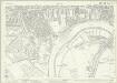
London (1915- Numbered sheets) VIII.2 (includes: Barnes; Chiswick St Nicholas; Hammersmith) - 25 Inch Map
1 : 2500 Topographic maps Ordnance Survey Ordnance Survey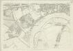
London (First Editions c1850s) LI (includes: Barnes; Chiswick St Nicholas; Hammersmith) - 25 Inch Map
1 : 2500 Topographic maps Ordnance Survey Ordnance Survey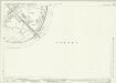
Middlesex XXI.6 (includes: Barnes; Mortlake; Wandsworth Borough) - 25 Inch Map
1 : 2500 Topographic maps Ordnance Survey Ordnance Survey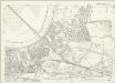
London (1915- Numbered sheets) VIII.6 (includes: Barnes; Mortlake; Wandsworth Borough) - 25 Inch Map
1 : 2500 Topographic maps Ordnance Survey Ordnance Survey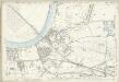
London (Edition of 1894-96) XCVIII (includes: Barnes; Mortlake; Wandsworth Borough) - 25 Inch Map
1 : 2500 Topographic maps Ordnance Survey Ordnance Survey
London (First Editions c1850s) LXII (includes: Barnes; Mortlake; Wandsworth Borough) - 25 Inch Map
1 : 2500 Topographic maps Ordnance Survey Ordnance Survey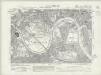
Surrey II.SW - OS Six-Inch Map
1 : 10560 Topographic maps Ordnance Survey Ordnance Survey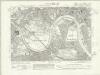
Surrey II.SW - OS Six-Inch Map
1 : 10560 Topographic maps Ordnance Survey Ordnance Survey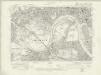
Surrey II.SW - OS Six-Inch Map
1 : 10560 Topographic maps Ordnance Survey Ordnance Survey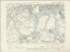
Surrey II.SW - OS Six-Inch Map
1 : 10560 Topographic maps Ordnance Survey Ordnance Survey
London X.NW - OS Six-Inch Map
1 : 10560 Topographic maps Ordnance Survey Ordnance Survey
An exact survey of the city's of London Westminster , X
1 Blatt : 53 x 71 cm John Rocque
London Sheet N - OS Six-Inch Map
1 : 10560 Topographic maps Ordnance Survey Ordnance Survey
London Sheet N - OS Six-Inch Map
1 : 10560 Topographic maps Ordnance Survey Ordnance Survey
Middlesex XXI - OS Six-Inch Map
1 : 10560 Topographic maps Ordnance Survey Ordnance Survey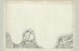
Surrey II - OS Six-Inch Map
1 : 10560 Topographic maps Ordnance Survey Ordnance Survey
Map shewing the situation of all premises licensed for the sale of intoxicating liquors in the County of London
London County Council
TQ27 - OS 1:25,000 Provisional Series Map
1 : 25000 Topographic maps Ordnance Survey Ordnance Survey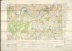
Militärgeographische Angaben über England.
Generalstab des Heeres, Abteilung für Kriegskarten u. Vermessungswesen IV. Mil.-Geo
MILNE'S PLAN of the CITIES of LONDON and WESTMINSTER, circumjacent TOWNS and PARISHES &c. laid down from a TRIGONOMETRICAL SURVEY taken in the YEARS 1795-1799
This is one of six sheets forming Milne's map of the area twenty miles around London. It was the first to make use of the 'Trygonometrical Survey' founded in 1791. This sheet covers the area to the west and south-west of the capital. It shows all the field boundaries and indicates land use with a complex system of letters and colours. The key is featured on the top corners. The borders of the map are divided in minutes and seconds, giving scale, angles of observations and magnetic variations. Thomas Milne trained as an estate surveyor and worked on the first Ordnance Survey map of Kent. Milne, Thomas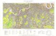
Great Britain [Second land utilisation survey] 1:25,000
Coleman, Alice Isle of Thanet Geographical Association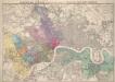
Stanford’s Map of London, shewing the Areas granted to the Electric Light Supply Companies
Edward STANFORD
LONDON Drawn and engraved expressly for the POST OFFICE DIRECTORY
Map of London published by Benjamin Rees Davies for the Post Office Directory with title and scale bar in table at top right. The London post codes W, N, N.E., E, S.E., S and S.W. are indicated. Davies, Benjamin Rees
Carte topographique de le comté de Middlesex, 3
1 Blatt : 53 x 70 cm John Rocque