Maps of Oxford

Oxford (Hills) - OS One-Inch Revised New Series
1 : 63360 Topographic maps Ordnance Survey Ordnance Survey
Oxford (Outline) - OS One-Inch Revised New Series
1 : 63360 Topographic maps Ordnance Survey Ordnance Survey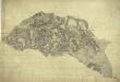
Woodstock
1 : 31680 The map of the area surrounding the Royal Wychwood Forest and Oxford was drawn by teaching draughtsman at the Tower of London, William Stanley. After inaccuracies were found in the plan during routine checks in 1820, Stanley hastened to explain that the employment by the Board of Ordnance of local civilian surveyors "of various abilities" to carry out much of the mapping meant that accuracy was often sacrificed for speed as these civilian personnel were paid according to the number of miles surveyed and drawn. An ochre-coloured turnpike road forms a boundary from Shipton Down at the top left of the map to Yarnton at the centre right. The cumulative mileage appears alongside the route in figures. The close attention Stanley pays to communication routes emphasises the military focus of these studies. Stanley, William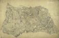
Bampton
1 : 31680 William Stanley was listed as a first class Military surveyor and draughtsman at the Drawing Room of the Tower of London. In 1821, he was asked to revise this plan by the Ordnance Survey's Superintendent, William Mudge. Stanley wrote to explain that he had "a great deal of trouble" in finding his field books and sketches "in consequence of its being so long since it was done, about 10 years." The dirty and torn condition of the drawing most likely results from constant travelling between the Tower and the surveyors in the field for amendments and corrections. Inns named include "Tumble Down Dick", "Rose and Crown", and "Kingstones Inn". Tollgates are also noted. Stanley, William
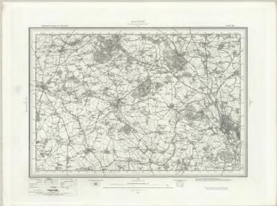
SP41 - OS 1:25,000 Provisional Series Map
1 : 25000 Topographic maps Ordnance Survey Ordnance Survey
SP30 - OS 1:25,000 Provisional Series Map
1 : 25000 Topographic maps Ordnance Survey Ordnance Survey
SP31 - OS 1:25,000 Provisional Series Map
1 : 25000 Topographic maps Ordnance Survey Ordnance Survey
SP40 - OS 1:25,000 Provisional Series Map
1 : 25000 Topographic maps Ordnance Survey Ordnance Survey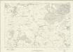
Oxfordshire XXV - OS Six-Inch Map
1 : 10560 Topographic maps Ordnance Survey Ordnance Survey
Oxfordshire XXV - OS Six-Inch Map
1 : 10560 Topographic maps Ordnance Survey Ordnance Survey
Oxfordshire XXXI - OS Six-Inch Map
1 : 10560 Topographic maps Ordnance Survey Ordnance Survey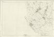
Oxfordshire XXXI - OS Six-Inch Map
1 : 10560 Topographic maps Ordnance Survey Ordnance Survey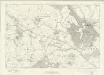
Oxfordshire XXVI - OS Six-Inch Map
1 : 10560 Topographic maps Ordnance Survey Ordnance Survey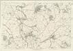
Oxfordshire XXVI - OS Six-Inch Map
1 : 10560 Topographic maps Ordnance Survey Ordnance Survey
Berkshire I - OS Six-Inch Map
1 : 10560 Topographic maps Ordnance Survey Ordnance Survey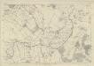
Oxfordshire XXXII - OS Six-Inch Map
1 : 10560 Topographic maps Ordnance Survey Ordnance Survey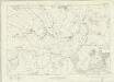
Berkshire V - OS Six-Inch Map
1 : 10560 Topographic maps Ordnance Survey Ordnance Survey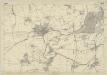
Oxfordshire XXXVIII - OS Six-Inch Map
1 : 10560 Topographic maps Ordnance Survey Ordnance Survey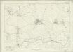
Berkshire IV - OS Six-Inch Map
1 : 10560 Topographic maps Ordnance Survey Ordnance Survey
Oxfordshire XXXVII - OS Six-Inch Map
1 : 10560 Topographic maps Ordnance Survey Ordnance Survey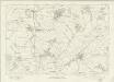
Oxfordshire XXVII - OS Six-Inch Map
1 : 10560 Topographic maps Ordnance Survey Ordnance Survey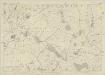
Oxfordshire XXVII - OS Six-Inch Map
1 : 10560 Topographic maps Ordnance Survey Ordnance Survey
Berkshire II - OS Six-Inch Map
1 : 10560 Topographic maps Ordnance Survey Ordnance Survey
Oxfordshire XXXIII - OS Six-Inch Map
1 : 10560 Topographic maps Ordnance Survey Ordnance Survey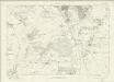
Berkshire VI - OS Six-Inch Map
1 : 10560 Topographic maps Ordnance Survey Ordnance Survey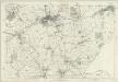
Berkshire VI - OS Six-Inch Map
1 : 10560 Topographic maps Ordnance Survey Ordnance Survey
SP20 - OS 1:25,000 Provisional Series Map
1 : 25000 Topographic maps Ordnance Survey Ordnance Survey
SP21 - OS 1:25,000 Provisional Series Map
1 : 25000 Topographic maps Ordnance Survey Ordnance Survey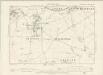
Oxfordshire XXV.NW - OS Six-Inch Map
1 : 10560 Topographic maps Ordnance Survey Ordnance Survey