Maps of Sunderland
Durham III.SE - OS Six-Inch Map
1 : 10560 Topographic maps Ordnance Survey Ordnance Survey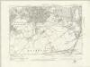
Durham III.SE - OS Six-Inch Map
1 : 10560 Topographic maps Ordnance Survey Ordnance Survey
Durham III.SE - OS Six-Inch Map
1 : 10560 Topographic maps Ordnance Survey Ordnance Survey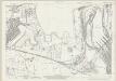
Durham III.12 (includes: Jarrow; South Shields) - 25 Inch Map
1 : 2500 Topographic maps Ordnance Survey Ordnance Survey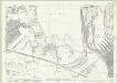
Durham III.12 (includes: Jarrow; South Shields) - 25 Inch Map
1 : 2500 Topographic maps Ordnance Survey Ordnance Survey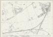
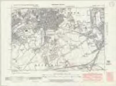
Durham III.16 (includes: Boldon; Jarrow; South Shields) - 25 Inch Map
1 : 2500 Topographic maps Ordnance Survey Ordnance Survey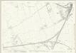
Durham III.16 (includes: Boldon; Jarrow; South Shields) - 25 Inch Map
1 : 2500 Topographic maps Ordnance Survey Ordnance Survey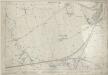
Durham III.16 (includes: Boldon; Jarrow; South Shields) - 25 Inch Map
1 : 2500 Topographic maps Ordnance Survey Ordnance Survey
Durham III.15 (includes: Boldon; Hebburn; Heworth; Jarrow) - 25 Inch Map
1 : 2500 Topographic maps Ordnance Survey Ordnance Survey
Durham III.15 (includes: Boldon; Hebburn; Heworth; Jarrow) - 25 Inch Map
1 : 2500 Topographic maps Ordnance Survey Ordnance Survey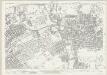
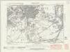
Durham III.11 (includes: Hebburn; Jarrow; Wallsend) - 25 Inch Map
1 : 2500 Topographic maps Ordnance Survey Ordnance Survey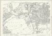
Durham III.11 (includes: Hebburn; Jarrow; Wallsend) - 25 Inch Map
1 : 2500 Topographic maps Ordnance Survey Ordnance Survey
River Tyne Docks ... Albert Edward Dock (Northumberland and Tyne Docks): sheet 2-6
1 : 480 This detailed 1894 plan of River Tyne Docks is one of a series of three sheets in an atlas originally produced to aid insurance companies in assessing fire risks. The building footprints, their use (commercial, residential, educational, etc.), the number of floors and the height of the building, as well as construction materials (and thus risk of burning) and special fire hazards (chemicals, kilns, ovens) were documented in order to estimate premiums. Names of individual businesses, property lines, and addresses were also often recorded. Together these maps provide a rich historical shapshot of the commercial activity and urban landscape of towns and cities at the time. The British Library holds a comprehensive collection of fire insurance plans produced by the London-based firm Charles E. Goad Ltd. dating back to 1885. These plans were made for most important towns and cities of the British Isles at the scales of 1:480 (1 inch to 40 feet), as well as many foreign towns at 1:600 (1 inch to 50 feet). Chas E Goad Limited Chas E Goad Limited
River Tyne Docks ... Albert Edward Dock (Northumberland and Tyne Docks): sheet 2-4
1 : 480 This detailed 1894 plan of River Tyne Docks is one of a series of three sheets in an atlas originally produced to aid insurance companies in assessing fire risks. The building footprints, their use (commercial, residential, educational, etc.), the number of floors and the height of the building, as well as construction materials (and thus risk of burning) and special fire hazards (chemicals, kilns, ovens) were documented in order to estimate premiums. Names of individual businesses, property lines, and addresses were also often recorded. Together these maps provide a rich historical shapshot of the commercial activity and urban landscape of towns and cities at the time. The British Library holds a comprehensive collection of fire insurance plans produced by the London-based firm Charles E. Goad Ltd. dating back to 1885. These plans were made for most important towns and cities of the British Isles at the scales of 1:480 (1 inch to 40 feet), as well as many foreign towns at 1:600 (1 inch to 50 feet). Chas E Goad Limited Chas E Goad Limited
River Tyne Docks ... Albert Edward Dock (Northumberland and Tyne Docks): sheet 2-5
1 : 480 This detailed 1894 plan of River Tyne Docks is one of a series of three sheets in an atlas originally produced to aid insurance companies in assessing fire risks. The building footprints, their use (commercial, residential, educational, etc.), the number of floors and the height of the building, as well as construction materials (and thus risk of burning) and special fire hazards (chemicals, kilns, ovens) were documented in order to estimate premiums. Names of individual businesses, property lines, and addresses were also often recorded. Together these maps provide a rich historical shapshot of the commercial activity and urban landscape of towns and cities at the time. The British Library holds a comprehensive collection of fire insurance plans produced by the London-based firm Charles E. Goad Ltd. dating back to 1885. These plans were made for most important towns and cities of the British Isles at the scales of 1:480 (1 inch to 40 feet), as well as many foreign towns at 1:600 (1 inch to 50 feet). Chas E Goad Limited Chas E Goad Limited
River Tyne Docks ... Albert Edward Dock (Northumberland and Tyne Docks): sheet 2-3
1 : 480 This detailed 1894 plan of River Tyne Docks is one of a series of three sheets in an atlas originally produced to aid insurance companies in assessing fire risks. The building footprints, their use (commercial, residential, educational, etc.), the number of floors and the height of the building, as well as construction materials (and thus risk of burning) and special fire hazards (chemicals, kilns, ovens) were documented in order to estimate premiums. Names of individual businesses, property lines, and addresses were also often recorded. Together these maps provide a rich historical shapshot of the commercial activity and urban landscape of towns and cities at the time. The British Library holds a comprehensive collection of fire insurance plans produced by the London-based firm Charles E. Goad Ltd. dating back to 1885. These plans were made for most important towns and cities of the British Isles at the scales of 1:480 (1 inch to 40 feet), as well as many foreign towns at 1:600 (1 inch to 50 feet). Chas E Goad Limited Chas E Goad Limited
River Tyne Docks ... Albert Edward Dock (Northumberland and Tyne Docks): sheet 2-2
1 : 480 This detailed 1894 plan of River Tyne Docks is one of a series of three sheets in an atlas originally produced to aid insurance companies in assessing fire risks. The building footprints, their use (commercial, residential, educational, etc.), the number of floors and the height of the building, as well as construction materials (and thus risk of burning) and special fire hazards (chemicals, kilns, ovens) were documented in order to estimate premiums. Names of individual businesses, property lines, and addresses were also often recorded. Together these maps provide a rich historical shapshot of the commercial activity and urban landscape of towns and cities at the time. The British Library holds a comprehensive collection of fire insurance plans produced by the London-based firm Charles E. Goad Ltd. dating back to 1885. These plans were made for most important towns and cities of the British Isles at the scales of 1:480 (1 inch to 40 feet), as well as many foreign towns at 1:600 (1 inch to 50 feet). Chas E Goad Limited Chas E Goad Limited
River Tyne Docks ... Albert Edward Dock (Northumberland and Tyne Docks): sheet 2-7
1 : 480 This detailed 1894 plan of River Tyne Docks is one of a series of three sheets in an atlas originally produced to aid insurance companies in assessing fire risks. The building footprints, their use (commercial, residential, educational, etc.), the number of floors and the height of the building, as well as construction materials (and thus risk of burning) and special fire hazards (chemicals, kilns, ovens) were documented in order to estimate premiums. Names of individual businesses, property lines, and addresses were also often recorded. Together these maps provide a rich historical shapshot of the commercial activity and urban landscape of towns and cities at the time. The British Library holds a comprehensive collection of fire insurance plans produced by the London-based firm Charles E. Goad Ltd. dating back to 1885. These plans were made for most important towns and cities of the British Isles at the scales of 1:480 (1 inch to 40 feet), as well as many foreign towns at 1:600 (1 inch to 50 feet). Chas E Goad Limited Chas E Goad Limited
River Tyne Docks ... Albert Edward Dock (Northumberland and Tyne Docks): sheet 2-8
1 : 480 This detailed 1894 plan of River Tyne Docks is one of a series of three sheets in an atlas originally produced to aid insurance companies in assessing fire risks. The building footprints, their use (commercial, residential, educational, etc.), the number of floors and the height of the building, as well as construction materials (and thus risk of burning) and special fire hazards (chemicals, kilns, ovens) were documented in order to estimate premiums. Names of individual businesses, property lines, and addresses were also often recorded. Together these maps provide a rich historical shapshot of the commercial activity and urban landscape of towns and cities at the time. The British Library holds a comprehensive collection of fire insurance plans produced by the London-based firm Charles E. Goad Ltd. dating back to 1885. These plans were made for most important towns and cities of the British Isles at the scales of 1:480 (1 inch to 40 feet), as well as many foreign towns at 1:600 (1 inch to 50 feet). Chas E Goad Limited Chas E Goad Limited
River Tyne Docks ... Albert Edward Dock (Northumberland and Tyne Docks): sheet 2-1
1 : 480 This detailed 1894 plan of River Tyne Docks is one of a series of three sheets in an atlas originally produced to aid insurance companies in assessing fire risks. The building footprints, their use (commercial, residential, educational, etc.), the number of floors and the height of the building, as well as construction materials (and thus risk of burning) and special fire hazards (chemicals, kilns, ovens) were documented in order to estimate premiums. Names of individual businesses, property lines, and addresses were also often recorded. Together these maps provide a rich historical shapshot of the commercial activity and urban landscape of towns and cities at the time. The British Library holds a comprehensive collection of fire insurance plans produced by the London-based firm Charles E. Goad Ltd. dating back to 1885. These plans were made for most important towns and cities of the British Isles at the scales of 1:480 (1 inch to 40 feet), as well as many foreign towns at 1:600 (1 inch to 50 feet). Chas E Goad Limited Chas E Goad Limited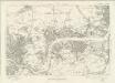
Durham III - OS Six-Inch Map
1 : 10560 Topographic maps Ordnance Survey Ordnance Survey
Durham III - OS Six-Inch Map
1 : 10560 Topographic maps Ordnance Survey Ordnance Survey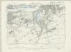
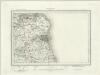
Northumberland XCVIII.NE - OS Six-Inch Map
1 : 10560 Topographic maps Ordnance Survey Ordnance Survey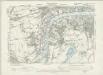
Northumberland XCVIII.NW - OS Six-Inch Map
1 : 10560 Topographic maps Ordnance Survey Ordnance Survey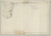
Northumberland XCVIII - OS Six-Inch Map
1 : 10560 Topographic maps Ordnance Survey Ordnance Survey
NZ36 & Parts of NZ46 - OS 1:25,000 Provisional Series Map
1 : 25000 Topographic maps Ordnance Survey Ordnance Survey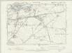
Northumberland XCVIII.SW - OS Six-Inch Map
1 : 10560 Topographic maps Ordnance Survey Ordnance Survey
The Course of River Tyne from Newcastle to Tynemouth
This is a detailed map of the course of the River Tyne from Newcastle to the mouth of Tynemouth River, it dates from around 1590. On the basis of style it can be attributed to Richard Poulter, a mariner accomplished in chart making. It is possible that Poulter’s name and the cartouche have been lost when the map was cropped. The map shows the sandbanks and sounding at low tide and notes the need for beacons to be placed on rocks which are submerged at high tide. Water depths at high tide are also indicated. The intersecting lines which cover the map are lines of constant bearing known as rhumb lines. These radiate from compass roses and allow the sailor to plot a course from harbour to harbour using dividers and straight edge. It is likely that this chart was prepared for presentation to a government official who would have power to implement the changes suggested. A possible recipient could be Lord Burghley, Elizabeth Secretary of State. Poulter, Richard
Sunderland (Hills) - OS One-Inch Revised New Series
1 : 63360 Topographic maps Ordnance Survey Ordnance Survey