Maps of Moorenweis

Bobingen, Liechtenberg, Babern, Möhringen a okolí]
Mollova mapová sbírka Bodenehr, Gabriel Bodenehr, Gabriel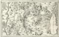
Landsperger Gegend
Mollova mapová sbírka Bodenehr, Gabriel Bodenehr, Gabriel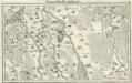
Marggraffschafft Burgau
Mollova mapová sbírka Bodenehr, Gabriel Bodenehr, Gabriel
180. Angsburg, uit: Topographische Uebersichtskarte des Deutschen Reiches / herausgegeben v. d. Kartogr. Abt. d. Königl. Preuß. Landesaufnahme
1 : 200000 titelvariant: Topogr. Übersichtskarte des Deutschen Reiches; Annotatie: Titel boven bladen ook: Topogr. Übersichtskarte des Deutschen Reiches; Annotatie geografische gegevens: Op elk blad twee maatstokken: 10 Kilometer = 5,5 cm; 1 geogr. Meile = 3,6 cm; Legenda onder op elk blad Königlich Preußische Landesaufnahme. Kartographische Abtheilung [S.l : Königlich Preußische Landesaufnahme, Kartographische Abtheilung]
Augsburg
1 : 200000 Herder, Benjamin
München - Augsburg - Ulm

München 143, uit: Special-Karte von Mittel-Europa / nach amtlichen Quellen bearbeitet von W. Liebenow
1 : 300000 titelvariant: W. Liebenow's Mittel-Europa; Annotatie: Titel boven de bladen: W. Liebenow's Mittel-Europa Johannes Wilhelm Liebenow 1822-1897 Frankfurt a. M. : Ludwig Ravenstein
Theatrum des Krieges in der Marggrafschaft Burgau
Mollova mapová sbírka Stridbeck, Johann Stridbeck, Johann II
Pars VII. describit partem regim: monach: intra Lycum et Isaram versus merid: sitam secund: ej[us] præf: partic. episc: Augustani, comit: Werdenfels et Tirol
1 Karte : 54 x 52 cm Heinrich Ludwig Broenner
Augsburg mit der gegend auf 2 Stunden.
1 : 150000 Mollova mapová sbírka Bodenehr, Gabriel Bodenehr, Gabriel
Pars IV. monstrat mediam partem ducat: Bavariæ, urbem jmp: Augustam Vindelicorum, cum parte ducat Neoburg, et episc. Frising
1 Karte : 54 x 52 cm Heinrich Ludwig Broenner
Suevia universa IX. tabulis delineata, 6
1 Blatt : s.n.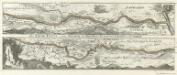
Der Lech-Fluss von Füessen im Algöw an Bis zu seinen Auslauff in die Donaw.
1 : 180000 Mollova mapová sbírka Bodenehr, Gabriel Bodenehr, Gabriel
Monstrat mediam Partem Ducat: Bavariæ, Urbem Jmp: Augustam Vindelicorum, cum Parte Ducat Neoburg, et Episc. Frising
1 : 150000 Mollova mapová sbírka Buna, Wilhelm C. Broenner, Heinrich Ludwig
Describit Partem Regim: Monach: intra Lycum et Isaram versus Merid: sitam Secund: ej; Præf: Partic. Episc: Augustani, Comit: Werdenfels et Tirol
1 : 150000 Mollova mapová sbírka Buna, Wilhelm C. Broenner, Heinrich Ludwig
Neueste Karte von der Markgrafschaft Burgau zu den oesterreichischen Vorlanden in Schwaben gehörig
1 Karte : Kupferdruck ; 54 x 47 cm Probst; Sprengler Johann Michael Probst
Suevia Universa :
1 : 170000 Mollova mapová sbírka Michal, Jacques de Seutter, Matthäus Seutter, Matthäus
Novissima delineatio Marchionatus Burgoviae
1 : 150000 Mollova mapová sbírka Michal, Jacques de Seutter, Matthäus
Die Lande der Grafen Fugger
1 Karte : Kupferdruck ; 20 x 25 cm Reilly F. J. J. von Reilly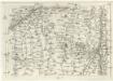
Geographica Provinciarum Sveviae Descriptio =
Mollova mapová sbírka Hurter, Johann Christoph Bodenehr, Johann Georg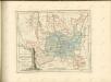

Bairische Landtafeln XXIIII. Darinnē das hochlöblich Furstenthumb Obern unnd Nidern Bayrn sambt der Obern Pflaz Erz unnd Stifft Salzburg Eichstet unnd andern mehrern anstossenden Herschafftē]
1 : 145000 Mollova mapová sbírka Apian, Philipp Amman, Jost Apian, Petrus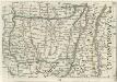
Geographica Provinciarum Sveviae Descriptio =
Mollova mapová sbírka Hurter, Johann Christoph Bodenehr, Gabriel
Bairische Landtafeln XXIIII. Darinnē das hochlöblich Furstenthumb Obern unnd Nidern Bayrn sambt der Obern Pflaz Erz unnd Stifft Salzburg Eichstet unnd andern mehrern anstossenden Herschafftē]
1 : 145000 Mollova mapová sbírka Apian, Philipp Amman, Jost Apian, Petrus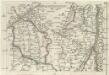
Geographica Provinciarum Sveviae Descriptio =
Mollova mapová sbírka Hurter, Johann Christoph Bodenehr, Gabriel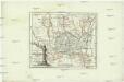
Die Lande der Grafen Fugger mit den Herrschaften Thannhausen, Schwabeck, und Mindelheim den Benachbarten Abteyen un der freyen Reichsstadt Kaufbeuren
1 : 245000 Švábsko (Německo)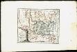
Lande der Grafen Fugger mit den Herrschaften Thannhausen, Schwabeck und Mindelheim, den Benachbarten Abteyen und der freyen Reichsstadt Kaufbeuren
Reilly, Franz Johann Joseph von
Geographica Provinciarum Sveviae Descriptio =
Mollova mapová sbírka Hurter, Johann Christoph Bodenehr, Johann Georg
Augspurg
1 Karte : Kupferdruck ; 27 x 34 cm Weigel Christoph Weigel
![Bobingen, Liechtenberg, Babern, Möhringen a okolí]](https://images-2.georeferencer.com/images/iiif/844114572318/full/,300/0/native.jpg)

