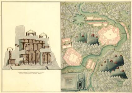
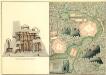
Maps of Márianosztra
Plan der Bergwerg fekete Patak und Berznye
Mollova mapová sbírka Geyer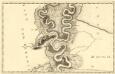
Sectio. IX Mohács - Vrangos
Mollova mapová sbírka Marsili, Luigi Ferdinando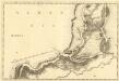
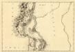
Erdsin - Feudwar
Mollova mapová sbírka Marsili, Luigi Ferdinando
III. vojenské mapování 4862/1
1 : 25000
[Gradkartenblatt]
1 : 25000 Maďarsko Vojenský zeměpisný ústav
[Gradkartenblatt]
1 : 25000 Maďarsko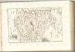

Mappa Comitatus Solthensis
1 : 170000 Mollova mapová sbírka Mikoviny, Sámuel Schmutzer, Andreas
C. Albensis
Ungarn Fejér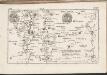
C. Pilisiensis ; C. Solthensis
Ungarn Komitat Pest-Pilis-Solt-Kiskun
Subotica
1 : 200000 Subotica (Srbsko) Kartografska radionica
Fejér válmegye
1 : 370000 Fejér (Maďarsko) Chiapó, Benjamin Benedicti, Hieronymus
Comitat Stuhlweissenburg
1 : 300000
Comitat Stuhlweissenburg
1 : 280000 Székesfehérvár (Maďarsko)
Baranya vármegye térképe
1 : 385000 Baranya (Maďarsko : župa) Kogutowicz, Manó Magyar Földrajzi Intézet
Mappa Comitatus Pilisiensis Methodo Astronomico-Geometrica concinnata.
1 : 162500 Mollova mapová sbírka Mikoviny, Sámuel Nicolaï, Georg David Christoph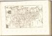

C. Tolnensis
Ungarn Komitat Tolna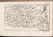
C. Baranyiensis
Ungarn Komitat Baranya
Comitat Baranya
1 : 290000 Baranya (Maďarsko : župa)
Comitat Baranya
1 : 288000 Baranya (Maďarsko : župa)
Fejér vármegye térképe
1 : 380000 Fejér (Maďarsko) Kogutowicz, Manó Magyar Földrajzi Intézet
Comitat Tolna
1 : 350000
Comitat Tolna
1 : 280000
Tolna vármegye térképe
1 : 355000 Kogutowicz, Manó Magyar Földrajzi Intézet
A Dunavölgy Átnézeti Térképe, Carte d ́ensemble del la Vallée du Danube XIX.

A Dunavölgy Átnézeti Térképe, Carte d ́ensemble del la Vallée du Danube XV.
St. Andre - Ertsin
Mollova mapová sbírka Marsili, Luigi Ferdinando
Duna
1 : 25000 Budapešť (Maďarsko : oblast) M. Kir. Állami Térképészet