Maps of Dalmatia
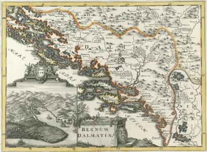
Regnum Dalmatiae
1 : 1200000 Mollova mapová sbírka Bruggen, Johann van der Brugge, Johannes van der
Regnum Dalmatiae
1 : 1200000 Mollova mapová sbírka Bruggen, Johann van der Brugge, Johannes van der
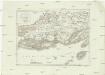
Strassen-Karte des Königreich's Dalmatien
1 : 410000 Dalmácie (Chorvatsko) Artaria
Karte des Königreiches Dalmatien
1 : 890000 Chorvatsko Bermann, Jeremias im Typographischen Landkarten-Verlage
Karte des Königreiches Dalmatien
1 : 890000 Dalmácie (Chorvatsko) Raffelsperger, Franz im Typographischen Landkarten-Verlage
Karte des Königreiches Dalmatien
1 : 890000 Chorvatsko Bermann, Jeremias im Typographischen Landkarten-Verlage
Karte des Königreiches Dalmatien
1 : 890000 Chorvatsko Raffelsperger, Franz Franz Raffelsperger
Strassen-Karte des Königreichs Dalmatien
1 : 430000 Chorvatsko
Übersichts-Blatt
Kroatien Dalmatien
Carte von Dalmatien und dem Gebieth von Ragusa
1 : 180000 Dalmácie (Chorvatsko) Traux, Maximilian de Artaria und Compagnie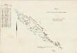
Carta indicante le tappe per le marchie militari
Dalmatien Marschroute, Militärkartografie Emilys
Dalmatien und Montenegro
Kroatien, Montenegro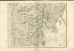

Dalmatien und Montenegro nach den ostreichishen Vermessungen mit Verbesserungen
1 : 750000 Dalmácie (Chorvatsko) Wilkinson, John Gardner Mayer, Gustav Gustav Mayer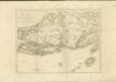

Königreich Dalmatien
1 : 1000000 Dalmácie (Chorvatsko)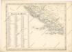
Strassen und Eisenbahnkarte des oesterreichischen Kaiserthumes

Sheet XVIII: Karte Des Oesterreichischen Kaiserstaates.
1 : 576000 Scheda, Josef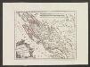
Der Noerdliche Theil Des Königreichs Dalmatien
1 : 1000000 Dalmatien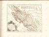

Vermehrte und Verbesserte Landkarten des Königreichs Ungarn :
1 : 500000 Mollova mapová sbírka Stier, Martin Böner, Johann-Alexander Endter, Martin
Iadera, Sicum et Aenona Vulgo Zara, Sibenico et Nona cum Insulis adjacentibus. in Parte Dalmatiae Boreali. [Karte], in: Novus atlas absolutissimus, Bd. 9, S. 314.
1 Karte aus Atlas Janssonius Offizin
Iadera, Sicum et Aenona Vulgo Zara, Sibenico et Nona cum Insulis adiacentibus. in Parte Dalmatiae Boreali. [Karte], in: Het vijfde Deel Des Grooten Atlas : Vervatende De Water-Weereld, S. 234.
1 Karte aus Atlas Jansson, Jan Jansson, Jan
Dalmatien und seine Hinterländer
1 : 1700000 Kroatien Dalmatien Bosnien Herzegowina
Eisenbahnkarte der k.u.k. oesterreichisch-ungarischen Monarchie
Westlicher Theil von Dalmatien
1 : 450000 Chorvatsko Santini, P. Engelman, J. W. F. A. Schraembl
Westlicher Theil von Dalmatien
1 : 445000 Chorvatsko Santini, P. Engelman, J. W. F. A. Schraembl
Skelet-Karte für Curs-Skizzen
Chorvatsko K. u. k. Kriegs-Marine
Střední Dalmacie
1 : 750000 Dalmácie střední (Chorvatsko) Machát, František c. a k. voj. zeměpisný ústav