Maps of Szentendrei járás
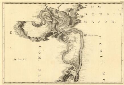
Sectio. IV, Barkan - Sz. André
Mollova mapová sbírka Marsili, Luigi Ferdinando
Pilis hegység
1 : 50000 M. Kir. Állami Térképeszet
[Gradkartenblatt]
1 : 25000 Maďarsko Vojenský zeměpisný ústav
Duna
1 : 25000 Budapešť (Maďarsko : oblast) M. Kir. Állami Térképészet
Nograd und Waitzen.
from Spezialkarte der osterreichisch-ungarischen Monarchie.
Obuda, (Budapest).
from Spezialkarte der osterreichisch-ungarischen Monarchie.
St. Andre - Ertsin
Mollova mapová sbírka Marsili, Luigi Ferdinando
Óbuda, (Budapest)
1 : 75000 Budapest-Óbuda Geripp: Offiz. Leitner, Assist. Scharre u. Fldw. Kostrba. Terrain: Vorst. Adler, Offiz. Leitner u. J. Fitz
Nógrád a Vácov
1 : 75000 Maďarsko Kartografické odd. při Mi. nár. obrany
III. vojenské mapování 4861/4
1 : 25000
C. Pilisiensis ; C. Solthensis
Ungarn Komitat Pest-Pilis-Solt-Kiskun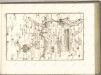

Komorn 148, uit: Special-Karte von Mittel-Europa / nach amtlichen Quellen bearbeitet von W. Liebenow
1 : 300000 titelvariant: W. Liebenow's Mittel-Europa; Annotatie: Titel boven de bladen: W. Liebenow's Mittel-Europa Johannes Wilhelm Liebenow 1822-1897 Frankfurt a. M. : Ludwig Ravenstein
Mappa Comitatus Pilisiensis Methodo Astronomico-Geometrica concinnata.
1 : 162500 Mollova mapová sbírka Mikoviny, Sámuel Nicolaï, Georg David Christoph
Haduan sampt derselben Revier wie solche von der königliche Würdin Ertzhertzog Maximiian u. auff den 16. Augusti belaegert beschossen und endtlich mit stürmender hand den 3. Septembris in disem 1596. Jar erobert worden
Fugger, Philipp Eduard Alexander Mair
Generální mapa ČSR

C. Hontensis
Slowakei Komitat Hont
2 Ofen-Pest
Budapest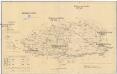
Komorner Comitat
1 : 290000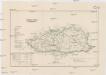
Komorner Comitat
1 : 288000 Komárno (Slovensko)
Mgy. Szolgyen und Gran.
from Spezialkarte der osterreichisch-ungarischen Monarchie.
Neszmely und Zsambek.
from Spezialkarte der osterreichisch-ungarischen Monarchie.
Hont vármegye
1 : 288000 Hont (Slovensko a Maďarsko) Biller, Bernhard Görög
III. vojenské mapování 4862
1 : 75000

Radvaň n. Dunajom
1 : 75000 Maďarsko Vojenský zeměpisný ústav
Zsámbék
1 : 75000 Maďarsko Vojenský zeměpisný ústav
Dunaradvány a Zsámbék
1 : 75000 Maďarsko Vojenský zeměpisný ústav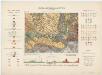
Zone 14, Kol. XIX, Umgebung von Magyarszölgyén und Párkány-Nána, uit: [Geologische Specialkarte der im Reichsrathe vertretenen Königreiche und Länder der österreichisch-ungarischen Monarchie] / geologische Aufnahmen der königl. ung. Geologischen Anstalt
1 : 75000 Annotatie: Verantwoordelijkheidsvermelding in 1909 veranderd in: Königliche Ungarische Geologische Reichsanstalt; Sommige bladen in het Frans; Annotatie geografische gegevens: Coördinaten gebaseerd op nulmeridiaan van Ferro (Hierro) Königliche Ungarische Geologische Reichsanstalt; Königliche Ungarische Geologische Anstalt Budapest : [Königliche Ungarische Geologische Anstalt]