Maps of Nagyigmánd
Raab - Neudorff
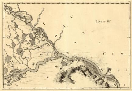
Mollova mapová sbírka Marsili, Luigi Ferdinando
III. vojenské mapování 4960
1 : 75000
Ács und Totis
1 : 75000 Ács (Ungarn), Tata (Ungarn) Geripp: Feldw. Watterich. Terrain: Wachtmst. Edl. v. Palitschek
Ács
1 : 75000 Maďarsko Vojenský zeměpisný ústav
Komárom (Újváros) és Tata
1 : 25000 Maďarsko M. Kir. Állami Térképszeti Intézet
III. vojenské mapování 4960/1
1 : 25000
Nagyigmánd
1 : 25000 Maďarsko M. Kir. Állami Térképszeti Intézet
III. vojenské mapování 4959/2
1 : 25000
Komárom vármegye térképe
1 : 360000 Kogutowicz, Manó Magyar Földrajzi Intézet
C. Comaromiensis
Ungarn Komitat Komorn (Ungarn)
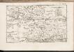
Acs und Totis.
from Spezialkarte der osterreichisch-ungarischen Monarchie.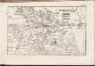
C. Jauriniensis
Ungarn Komitat Raab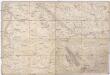
Special Karte von Ungarn
1 : 14400 Györ (Maďarsko : oblast) K.K. Militärisch-Geographisches Institut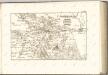

Györ vármegye
1 : 240000 Györ-oblast (Maďarsko) Király, Georg
Raab.
from Spezialkarte der osterreichisch-ungarischen Monarchie.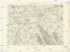
Klížska Nemá
1 : 75000 Maďarsko Vojenský zeměpisný ústav
Györ
1 : 75000 Györ (Maďarsko : oblast) Vojenský zeměpisný ústav
Einnahme von Raab am 28ten Juni 1849.
Györ-oblast (Maďarsko) Mortier, Pieter Jan Jiří
III. vojenské mapování 4959
1 : 75000
Schlacht bei Komorn am 11ten Juli 1849
1 : 61500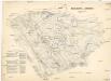
Schlacht bei Komorn am 11ten Juli 1849
1 : 61500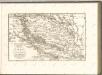

Komorn 148, uit: Special-Karte von Mittel-Europa / nach amtlichen Quellen bearbeitet von W. Liebenow
1 : 300000 titelvariant: W. Liebenow's Mittel-Europa; Annotatie: Titel boven de bladen: W. Liebenow's Mittel-Europa Johannes Wilhelm Liebenow 1822-1897 Frankfurt a. M. : Ludwig Ravenstein
Komárom Vármegye
1 : 340000 Slovensko jižní
Bez titulu: Západní Maďarsko
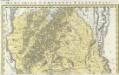
Comitatvs Posoniensis Germanis Presbvrg dicti Delineatio Geographica
1 : 150000 Mollova mapová sbírka Homann, Johann Baptist Alber, Johann Eberhard Homann, Johann Baptista - dědici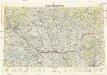
Neubertova generální automapa Republiky československé
1 : 200000 Bratislava (Slovensko : oblast) Soukup, Jan V. Neubert a synové