Maps of Kandel
Geographica Provinciarum Sveviae Descriptio :
Mollova mapová sbírka Hurter, Johann Christoph Küsel, Melchior Bodenehr, Johann Georg
Meßtischblatt 6915 : Wörth am Rhein, 1939
1 : 250000 Wörth am Rhein. - Aufn. 1909, bericht. 1938/39. - 1:25000. - Wiesbaden: Hauptvermessungsabteilung XI, 1939. - 1 Kt.
Meßtischblatt 50 : Daxlanden, Maxau, 1876
1 : 250000 Daxlanden, Maxau. - 1:25000. - Leipzig: Giesecke & Devrient, 1876. - 1 Kt
Carte über den Lauf des Rheins von Lauterburg bis unterhalb Sandhofen längs der Badisch - Bayerschen Grenze

Carte über den Lauf des Rheins von Lauterburg bis unterhalb Sandhofen längs der Badisch - Bayerschen Grenze

Les environs de Landau
1 Karte : Kupferdruck ; 23 x 33 cm Fer; Inselin Nicolas de Fer
Geographica Provinciarum Sveviae Descriptio =
Mollova mapová sbírka Hurter, Johann Christoph Bodenehr, Gabriel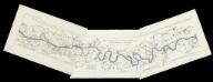
[Lauf des Rheins von Neuburg bis unterhalb Mannheim im Anfange des Jahres 1837] : Tab. 1: Hydrographische Charte vom Lauf des Rheins v. Neuburg bis Sondernheim die im Jahre 1817 angefangen Rectification desselben enthaltend. 2: Hydrographische Carte vom Lauf des Rheins von Sondernheim bis Otterstatt mit Rücksicht auf die Rectification desselben . 3: Hydrographische Carte vom Lauf des Rheins mit Rücksicht auf die Rectification desselben : Distrikte v. Waldsee bis an die Hessischen Grenze
1 : 80000 [S.l.] : Grosh. Bad. Landw. Wochenblatt
[Philipsbourg]
1 Blatt : 60 x 91 cm s.n.
Blatt 18. Lauterburg, uit: Topographische Karte des Rheinstromes und seiner beiderseitigen Ufer von Hueningen bis Lauterburg oder längs der Französich-Badischen Gränze, ... / ... reducirt und gezeichnet ... im Bureau der Grossherzoglich Badischen Rheingränz-Berichtigungs Commission
1 : 20000 titelvariant: Rheingränz-Carte; Annotatie: Voor aanwezige bladen zie overzichtsblad Grossherzogliche Badische Rheingränz-Berichtigungs Commission. Bureau Freiburg im Breisgau : im Herder'schen Künst-Institut
Meßtischblatt 6815 : Herxheim, 1943
1 : 250000 Herxheim. - Aufn. 1909, hrsg. 1912, letzte Nachtr. 1939. - 1:25000. - Wiesbaden: Hauptvermessungsabteilung XI, 1943. - 1 Kt.
Meßtischblatt 6914 : Schaidt, 1939
1 : 250000 Schaidt. - Aufn. 1909, hrsg. 1914, bericht. 1939, letzte Na. - 1:25000. - Wiesbaden: Hauptvermessungsabteilung XI, 1939. - 1 Kt.
Le cours du Rhin de Bâle à Hert près Philisbourg contenant l'Alsace et partie du Brisgau, 5
1 Blatt : 77 x 52 cm Le Rouge
Le Flambeau de la Guerre Allumee au Rhin
Mollova mapová sbírka Delisle, Guillaume Schenk, Peter II
Landau mitt umbliegenden dörfferen und Stätten
1 : 170000 Mollova mapová sbírka Person, Nikolaus Person, Nicolas

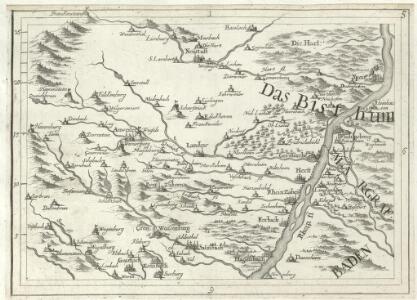
Der Pfinz und Enz Kreis im Grossherzogthum Baden
1 : 200000 Bádensko (Německo) Krauth Wolff, F. C.F. Müllerschen Buchhandlung
Accurate Special-Charte der Gegend des Rheins, von Ettlingen, Carls Ruhe, Philippsburg, Bruchsal, bis Mannheim, etc. Entworffen
Riecke, Gustav Friedrich; Ostertag, Heinrich Jonas; Cöntgen, Bartolomäus Anton Brönner
160. Landau, uit: Topographische Uebersichtskarte des Deutschen Reiches / herausgegeben v. d. Kartogr. Abt. d. Königl. Preuß. Landesaufnahme
1 : 200000 titelvariant: Topogr. Übersichtskarte des Deutschen Reiches; Annotatie: Titel boven bladen ook: Topogr. Übersichtskarte des Deutschen Reiches; Annotatie geografische gegevens: Op elk blad twee maatstokken: 10 Kilometer = 5,5 cm; 1 geogr. Meile = 3,6 cm; Legenda onder op elk blad Königlich Preußische Landesaufnahme. Kartographische Abtheilung [S.l : Königlich Preußische Landesaufnahme, Kartographische Abtheilung]
Alasatia superior et inferior III. tabulis delineata, 3
1 Blatt : 62 x 59 cm s.n.
Carte Particuliere de Pays qui sont situéz entre le Rhein, la Saare, la Moselle, et la Basse Alsace
1 : 150000 Mollova mapová sbírka Jaillot, Alexis-Hubert Jaillot, Alexis Hubert
Exact und Gantz accurater Plan
1 : 570000 Mollova mapová sbírka Geyer, Friedrich W. Berndt, Johann Christoph Geyer, Friedrich

Suevia Universa
1 : 170000 Mollova mapová sbírka Michal, Jacques de Seutter, Matthäus Seutter, Matthäus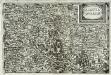
Alsatia inferior
1 Karte : Kupferdruck ; 14 x 22 cm Lambert Andreae
Partie du Cours du Rhein, ou se Trouvent les Villes de Spire Philipsbourg Landau Hagenau et le Fort Louis, Dessigne et Levee sur les Lieues
1 : 160000 Mollova mapová sbírka Baillieul, Gaspard Bailleul, Gaspard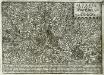
Alsatia inferior
1 Karte : Kupferdruck ; 17 x 27 cm Specklin; Quad Johannes Bussemacher
Carlsruhe - Stuttgart
1 : 200000 Herder, Benjamin
Carte Particuliere des Pays qui sont situéz entre le Rhein, la Saare, la Moselle, et la Basse Alsace
1 : 150000 Mollova mapová sbírka Mortier, Pieter Mortier, Pierre