Maps of King Frederik Vi Coast
Groenland Oriental. Amer. Sep. 20.
1 : 1641836 Vandermaelen, Philippe, 1795-1869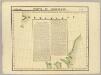
Partie de Groenland. Amer. Sep. 11.
1 : 1641836 Vandermaelen, Philippe, 1795-1869
Feuille 1 (A I), uit: Carte géologique internationale de l'Europe : la carte, votée au congrès géologique international de Bologne en 1881, est exécutée conformément aux décisions d'une commission internationale, avec le concours des gouvernements, sous le dir. de M.M. Beyrich et Hauchecorne
Annotatie: Blad 48 gamme des couleurs; blad 49: bladwijzer en titelblad Heinrich Ernst Beyrich 1815-1896; Wi. Hauchecorne Berlin : Reimer / (Berlin: Institut lithographique)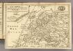
L'Europe.
1 : 26500000 Fer, Nicolas de, 1646-1720
Gletscherkarte
Atlas der Geologie Zittel, K.v. ; Berghaus, Hermann Justus Perthes
A General Chart ... Davis Straits & Baffin Islands Bay.
1 : 19000000 Melish, John
Pas-caerte van Groenlandt, Yslandt, Straet Davids en Ian Mayen Eylant
1 Karte : Kupferdruck ; 43 x 52 cm Doncker bÿ Hendrick Doncker boekverkoper en graadbooghmaker inde Nieubrughsteegh
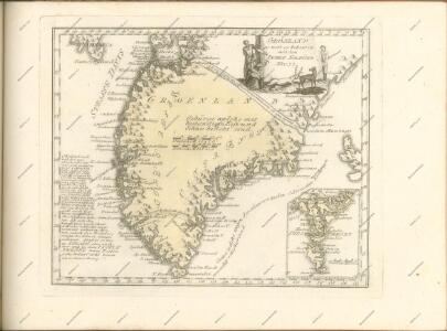
Groenland und die angraenzenden Laender nach den Charten und Berichten von Cranz, Egede, Gieseke, Graah, Olavsen, Parry, Ross, Scoresby, Thorhallesen u.a.
1 : 5000000 entworfen und gezeichnet von Theodor Gliemann Weimar : Verlag des Geograph. Instituts
Carte réduite des mers du Nord
1 Karte : Kupferdruck ; 31 x 42 cm Bellin Didot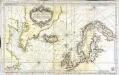
Carte réduite des mers du Nord
1 Karte : Kupferdruck ; 51 x 84 cm s.n.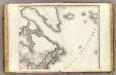
Amerique Septentrionale 2.
1 : 7500000 Brue, Adrien Hubert, 1786-1832
Canada - East. Pergamon World Atlas.
1 : 10000000 Polish Army Topography Service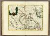
La Baja D'Hudson Terra di Labrador e Groenlandia.
1 : 9750000 Zatta, Antonio
North America...N.E. Sheet.
1 : 7500000 Tanner, Henry S.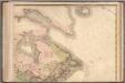
North America...N.E. Sheet.
1 : 7500000 Tanner, Henry S.
185-186. North Canada, Greenland. The World Atlas.
1 : 7500000 USSR (Union of Soviet Socialist Republics).
Gletscherkarte.
Berghaus, Hermann
Carte marine, de la B. de Baffin, et une partie d'Hudson, d'Island et Groenland
1 Karte : Kupferdruck ; 42 x 48 cm Königliche Akademie der Wissenschaften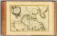
L'Amerique Septentrionale 1.
1 : 10050000 Bonne, Rigobert, 1727-1794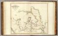
Arctic Regions.
1 : 19000000 Thomson, John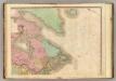
North America, N.E.. Sheet.
1 : 7600000 Tanner, Henry S.
Septentrionalium regionum descriptio
1 : 28000000 1 Karte : Kupferdruck ; 8 x 11 cm Galle, Philippe [Christophe Plantin]
Septentrionalivm regionvm descrip
1 : 11050000 Evropa severozápadní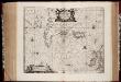
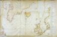
Typus Maritimus Groenlandiae, Islandiae, Freti Davidis, Insulae Iohannis Mayen, et Hitlandiae, Scotiae, et Hiberniae litora maritima Septentrionalia
1 : 7000000 Annotatie: Paskaart van de noordelijke Atlantische Oceaan met de kusten van met name het gebied tussen de Faeroër Eilanden, Groenland en Baffin Island; Origineel is Blad 149 in atlas factice; Kaart bevat diverse kompasrozen en is gedecoreerd met afbeeldingen van schepen en een walvis; Annotatie geografische gegevens: Met drie schaalstokken [Amstelodami] : [Apud Ioannem Ianßonium]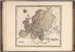
Europe.
1 : 11721600 Tanner, Henry S.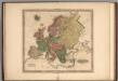
Europe.
1 : 11721600 Tanner, Henry S.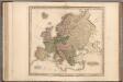
Europe.
1 : 11721600 Tanner, Henry S.
Europe.
1 : 11721600 Tanner, Henry S.