Maps of Crimea

Crimée
Nouvel atlas physique politique et historique de l'Empire ottoman et des états limitrophes en Europe, en Asie et en Afrique, en quarante feuilles Hellert, J.J. Bellizard, Dufour et Cie
Crimea.
1 : 665000 Mitchell, Samuel Augustus
Crimea.
1 : 665000 Mitchell, Samuel Augustus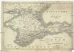
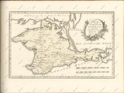
Karte der Krym oder des Taurischen Chersones
1 : 1070000 Krym (Ukrajina) J.J. Weber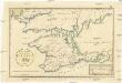
Post Karte von der Halbinsel Taurien oder Krim
1 : 1000000 Krym (Ukrajina) Benedicti, Hieronymus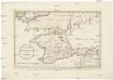
Post Karte von der Halbinsel Taurien oder Krim
1 : 1000000 Krym (Ukrajina) Benedicti, Hieronymus
Carte de la Crimée
1 : 1900000 1 Karte : Kupferdruck ; 17 x 21 cm Bellin, Jacques Nicolas [Bellin]
Post Karte von der Halbinsel Taurien oder Krim / H. Benedicti sc
1 : 1100000 1 Karte : Kupferdruck ; 27 x 41 cm Benedicti, Hieronymus
Die Krymm
1 : 1680000 Feodosija (Ukrajina) Flemming, Karl druck u. Verlag v. C. Flemming
Die Krymm
1 : 680000 Anapa (Rusko) Flemming, C. C. Flemming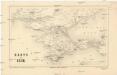
Karte der Krim
1 : 1484000 Krym (Ukrajina) Leopold Sommer
Caucausus & Crimea.
1 : 5000000 Fullarton, A. & Co.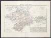
Crimea o penisola Taurica
1 : 600000 Marzolla, Benedetto [Verlag nicht ermittelbar]
Halbinsel Krymm
Grosser Hand-Atlas über alle Theile der Erde in 170 Karten Meyer, J. Verlag des Bibliographischen Instituts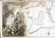
Carte de la mer noire et de la mer d'Asow, 1
1 Blatt : 57 x 86 cm s.n.
Verus chersonesi Tauricae seu Crimeae conspectus adjacentium item regionum / editus ex autographis C
1 : 970000 1 Karte : Kupferdruck ; 46 x 65 cm Frauendorff, Carl von apud R. & I. Ottens
Verus chersonesi Tauricae seu Crimeae conspectus adjacentium item regionum / editus ex autographis C
1 : 970000 1 Karte : Kupferdruck ; 46 x 65 cm Frauendorff, Carl von apud Joan Block
Special-Karte der Halbinsel Krymm [sic]
1 : 350000 Handtke, Friedrich C. Flemming
Krymm Halbinsel.
1 : 640000 Radefeld, Carl Christian Franz, 1788-1874
Specialkarte der Halbinsel Krymm
1 : 350000 entworfen und gezeichnet von F. Handtke Glogau : Flemming
Spec. karta Ukrainy
1 : 420000 Krym (Ukrajina) vidannja Kartografičnogo vyddilu golovnoji geodezyčnoji upravy
[Taurien oder Crim]
1 Karte : Kupferdruck ; 18 x 13 cm [Trattner]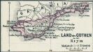
Land der Gothen in der Krym
1 : 2500000 Krim Goten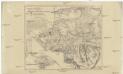
Karte vom südwestlichen Theile der Krim mit Sevastopol
1 : 170000 Krym (Ukrajina) Petermann, August Justus Perthes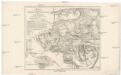
Karte von südwestlichen Theile der Krim mit Sebastopol
1 : 170000 Krym (Ukrajina) Petermann, August Justus Perthes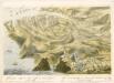
bez titulu: soubor panoramat – Krymská válka

Plan der Umgebung von Ssewasstopol mit Angabe der Stellungen und Belagerungs-Arbeiten der verbündeten Armeen
1 : 40000 Sewastopol (Region) Krimkrieg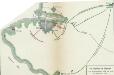
Die Belagerung von Sebastopol vom 14. September 1854 bis 11. September 1855
Sewastopol Sewastopol / Belagerung