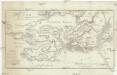
Maps of Region of Central Greece


Griechenland
1 : 2000000 Griechenland
Achaiae Nova & accurata Descriptio. [Karte], in: Novus atlas absolutissimus, Bd. 10, S. 102.
1 Karte aus Atlas Janssonius Offizin
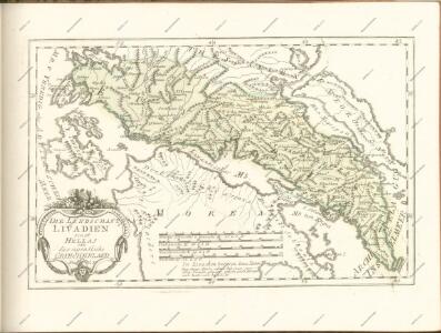
Epirus, Thessalia et Hellas
Griechenland, Thessalien
Graecia heroum tempore
Griechenland, Mittelmeerraum, Antike
[Griechenland]
1 : 2500000 Griechenland
Peloponesvs sive Morea
1 : 1100000 Peloponés (Řecko) Laurenberg, L.
Insular. Aliquot Aegaei Maris Antiqua Descrip.[:] Euboea, Insula.[Karte], in: Theatrum orbis terrarum, S. 517.
1 Karte aus Atlas Ortelius, Abraham Vrients, Jan Baptista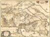
Attica, Mecarica, Corinthiaca, Boeotia, Phocis, Locri. [Karte], in: Novus atlas absolutissimus, Bd. 10, S. 131.
1 Karte aus Atlas Janssonius Offizin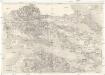
[Golfe de Corinthe]
Korintský záliv (Řecko : oblast) Koeppelin [sic]
Achaia vetvs et nova
1 : 400000 Achaia (Řecko) Homann, Johann Baptist Homann, Johann Christoph â Io. Bapt. Homanno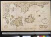
De zuijdelijkste zeekust van Morea als meede het eyland Zante en Cefalonia geleegen in de Middellandsche Zee
Greece Gerard van Keulen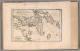
Attica, Megaris and part of the Island of Euboea. No. 9
1 : 66000 Barbie du Bocage, Jean Denis
Attica Megarica Corinthiaca Boeotia Phocis Locri
Atika, poloostrov (Řecko) Velius, Theodorus Hondius, Henricus sumptibus Henrici Hondii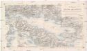
Der Meerbusen von Korinth oder Lepanto
1 : 200000 Korintský záliv (Řecko : oblast) Stanley, Owen Mannsell, A. L. Depot de la guerre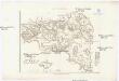
Karte von Attika
1 : 33000 Atika, poloostrov (Řecko) Müller, Karl Otfried Gleditsch
Elis und Triphylia
1 : 640000 Peloponés (Řecko) Barbié du Bocage, Jean Denis
Boeotien
1 : 291000 Řecko Müller, Karl Otfried Gleditsch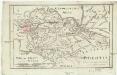
Boeotia
1 : 435000 Barbié du Bocage, Jean Denis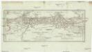
Corinth, Sicyon, Phliasia und Achaia
1 : 640000 Achaia (Řecko) Barbié du Bocage, Jean Denis
Candia cum Insulis aliquot circa Graeciam[:] [Zante] [Karte], in: Gerardi Mercatoris et I. Hondii Newer Atlas, oder, Grosses Weltbuch, Bd. 2, S. 336.
1 Karte aus Atlas Mercator, Gerhard und Hondius, Jodocus Jansson, Jan
Italien und Balkanhalbinsel. Nebenkarten II. 1. Athen und der Isthmus von Korinth
Attika
Arcadia
1 : 640000 Arkádie (Řecko) Barbié du Bocage, Jean Denis
Chartes Attikes
1 : 100000 Atika, poloostrov (Řecko) Eleutheroudakes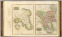
Attica, Turkey in Europe.
Thomson, John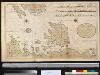
Het eijland St. Maura met alle dessels havenen geleegen aen de kust van Grecia in de Middelandse Zee aen de Oost sijde vant incomen van de Golf v. Venetia
Greece Gerard van Keulen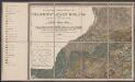
Candia cum Insulis aliquot circa Graeciam[:] [Zante] [Karte], in: Gerardi Mercatoris Atlas, sive, Cosmographicae meditationes de fabrica mundi et fabricati figura, S. 493.
1 Karte aus Atlas Mercator, Gerhard Montanus, Petrus
Phocis und Doris
1 : 435000 Barbié du Bocage, Jean Denis
Greece 1:100,000, Tripolis
Sheet K7 of the map series: Greece. (Albania) 1 : 100,000. M.D.R. 610. [G.S.G.S. 4439] [London] : War Office