Maps of Nord-Pas-de-Calais
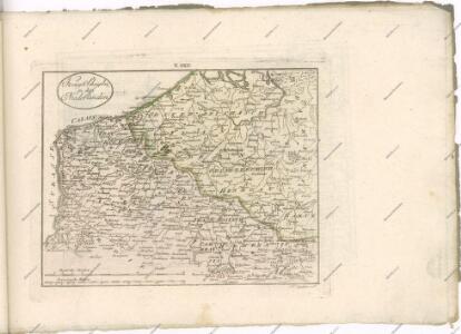
Les provinces des Pais Bas Autrichiens
Belgie Seutter, Matthäus par Matthieu Seutter
Carte des Pais Bas
1 : 202000 Bourbonsko (Francie) Le Rouge Le Rouge
[Kaart], uit: Nord de la France Belgique (Ouest)
1 : 250000 titelvariant: Carte routière; Annotatie: Gevouwen, in pochette (19 x 13,5 cm); Titel op pochette: Carte routière; Met bladwijzer op pochette; Annotatie geografische gegevens: Met schaalstok; Legenda Paris : Taride / (Paris : Gaillac-Monrocq et Cie)
Carte du département du Nord
1 Karte : Kupferdruck ; 22 x 32 cm, Bildgrösse 32 x 42 cm Brion de la Tour; Desnos Desnos rue St. Jacques au globe
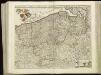
Flandria Et Zeelandia Comitatus. [Karte], in: Novus Atlas, das ist, Weltbeschreibung, Bd. 1, S. 354.
1 Karte aus Atlas Blaeu, Joan Blaeu, Willem Janszoon
Flandria Et Zeelandia Comitatus. [Karte], in: Theatrum orbis terrarum, sive, Atlas novus, Bd. 1, S. 365.
1 Karte aus Atlas Blaeu, Joan Blaeu, Willem Janszoon
Flandria Et Zeelandia Comitatus. [Karte], in: Le théâtre du monde, ou, Nouvel atlas contenant les chartes et descriptions de tous les païs de la terre, Bd. 1, S. 383.
1 Karte aus Atlas Blaeu, Willem Janszoon und Blaeu, Joan Blaeu, Willem Janszoon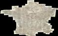
Composite: Carte de France.
1 : 86400 Cassini family; Cassini, Cesar-Francois, 1714-1784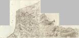
Composite 1: Carte de France.
1 : 86400 Cassini family; Cassini, Cesar-Francois, 1714-1784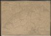
Comitatus Flandriae Nova Tabula. [Karte], in: Gerardi Mercatoris et I. Hondii Newer Atlas, oder, Grosses Weltbuch, Bd. 1, S. 416.
1 Karte aus Atlas Mercator, Gerhard und Hondius, Jodocus Jansson, Jan
Flandriae Comitatus Descriptio. [Karte] [Walcheren. Borsele. Suitbeverlandt.] [Nebenkarte], in: Theatrum orbis terrarum, S. 186.
1 Karte aus Atlas Ortelius, Abraham Vrients, Jan Baptista
Comitatus Flandriae Nova Tabula. [Karte], in: Novus atlas absolutissimus, Bd. 3, S. 106.
1 Karte aus Atlas Janssonius Offizin
Le Gouvernement General De Picardie, ou sont Le Pays Reconquis, Le Boulenois, Le Ponthieu [...] [Karte], in: Atlas nouveau, contenant toutes les parties du monde [...], Bd. 1, S. 112.
1 Karte aus Atlas Sanson, Nicolas Jaillot, Alexis Hubert und Mortier, Pieter
Carte routiere du théatre de la guerre, contenant la Flandre, partie du Brabant et du Comte de Namur : dressée d'après la grande carte de Ferraris ...
1 : 250000 Annotatie: Het impressum vermeldt als jaar van uitgave: l'an 2eme de la République Française Paris : Basset
Flandriae comitatus
1 : 300000 Flandry Visscher, Nicolaes Jansz. Gouwen, Giliam van der apud Petrum Schenk junior
Flandria. [Karte], in: Theatrum orbis terrarum, S. 48.
1 Karte aus Atlas Ortelius, Abraham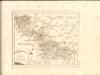

Flandriae Comitatus Accuratissima Descriptio [Karte], in: Novus atlas absolutissimus, Bd. 3, S. 109.
1 Karte aus Atlas Janssonius Offizin

[105][108] Comitatus Flandriae tabula, uit: Atlas sive Descriptio terrarum orbis
Annotatie: Gedigitaliseerde versie. Amsterdam. Heiloo : Picturae (vervaardiger), 2015. tiff-bestand. Gedigitaliseerd: 07-01-2015; Origineel: Universiteitsbibliotheek Vrije Universiteit (XL.05127.-) ; Netherlands; Titelpagina ontbreekt Wit, Frederik de Amsterdam : Frederick de Wit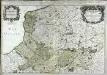
Le gouvernement general de Picardie
1 Karte auf 2 Blättern : Kupferdruck ; 52 x 78 cm Jaillot chez H. Iaillot joignant les grands Augustins aux 2. globes
Gouvernement général de Picardie et Artois
1 Karte : Kupferdruck ; 46 x 57 cm Robert de Vaugondy G. et D. Robert de Vaugondy
Flandria maximus et pulcherrimus Europae comitatus
1 : 310000 Flandry Seutter, Matthäus
Gouvernement de Flandre
1 Karte : Kupferdruck ; 31 x 42 cm Mentelle; Tardieu; Dubuisson Mentelle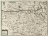
Flandria et Zeelandia Comitatvs
1 : 310000 Mollova mapová sbírka Blaeu, Willem Janszoon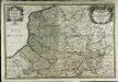
Le gouvernement general de Picardie
1 Karte auf 2 Blättern : Kupferdruck ; 52 x 78 cm Jaillot; Sanson chez H. Iaillot joignant les grands Augustins aux 2. globes
Picardie, Artois, Boulenois, Flandre françoise, Haynaut et Cambrésis
1 Karte : Kupferdruck ; 51 x 64 cm Robert de Vaugondy; Fortin; Arrivet; Dussy chés Fortin ing.r mécanicien du roy rue de la Harpe