Maps of Luxembourg


Partie du Duché de Luxembourg et de l'Electorat de Treves
1 : 120000 Mollova mapová sbírka Baillieul, Gaspard Baillieul, Gaspard
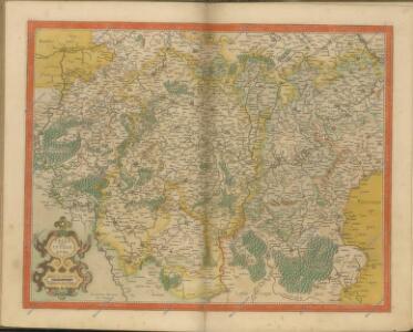
Luxenbvrgicvs ducatus
Mollova mapová sbírka Mercator, Gerhard Mercator, Gerard
Sheet 1, uit: Stanford's large scale map of the seat of war / Stanford's Geographical Estab[lishmen]t
1 : 300000 Stanford's Geographical Establishment, Londen London : Stanford
Ducatus Lutzenburgici tabula
1 : 320000 Lucembursko Wit, Frederick de per Fredericum de Wit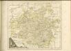

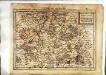
Le Duché de Luxembourg
1 : 330000 Mollova mapová sbírka Fer, Nicolas de Starckman, P. Fer, Nicolas de
Le duché de Luxembourg
1 : 370000 Lucembursko Fer, Nicolas de Starckman, P. N. de Fer
Delineatio Topographica Altissimae Atque Adeò Verae Scaturiginis Danubii Fl: Ubi monendum, tenuissimos illos ramusculos aquae à rusticis, pro irrigandis pratis ita esse excavatos; et, si hoc non foret, aquam, sine dubio, alveolo uno, aut saltem paucioribus defluxuram fuisse
1 : 6000 Mollova mapová sbírka Marsili, Luigi Ferdinando
[25], uit: Hydro-Oro und Chorographische General Karte des Koenigreichs der Niederlande und der angrenzenden Länder bis Paris : mit der Angabe der Kunst und Heer-Strassen und der Entfernung der Poststationen / ... zusammengetragen und reducirt von ... Wilhelm Müller
1 : 400000 titelvariant: Generalkarte des Koenigreichs Hannover; Annotatie: 1e supplement bij: Generalkarte des Koenigreichs Hannover (1818) Müller, Wilhelm (fl. 1818) [Hannover : Wilhelm Müller]
Partie Occidentale Du Temporel De L'Archevesché et Eslectorat, De Treves. [Karte], in: Atlas nouveau, contenant toutes les parties du monde [...], Bd. 1, S. 196.
1 Karte aus Atlas Sanson, Nicolas Jaillot, Alexis Hubert und Mortier, Pieter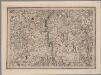
[22], uit: Hydro-Oro und Chorographische General Karte des Koenigreichs der Niederlande und der angrenzenden Länder bis Paris : mit der Angabe der Kunst und Heer-Strassen und der Entfernung der Poststationen / ... zusammengetragen und reducirt von ... Wilhelm Müller
1 : 400000 titelvariant: Generalkarte des Koenigreichs Hannover; Annotatie: 1e supplement bij: Generalkarte des Koenigreichs Hannover (1818) Müller, Wilhelm (fl. 1818) [Hannover : Wilhelm Müller]
148. Mettendorf, uit: Topographische Uebersichtskarte des Deutschen Reiches / herausgegeben v. d. Kartogr. Abt. d. Königl. Preuß. Landesaufnahme
1 : 200000 titelvariant: Topogr. Übersichtskarte des Deutschen Reiches; Annotatie: Titel boven bladen ook: Topogr. Übersichtskarte des Deutschen Reiches; Annotatie geografische gegevens: Op elk blad twee maatstokken: 10 Kilometer = 5,5 cm; 1 geogr. Meile = 3,6 cm; Legenda onder op elk blad Königlich Preußische Landesaufnahme. Kartographische Abtheilung [S.l : Königlich Preußische Landesaufnahme, Kartographische Abtheilung]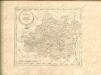

Le Duché de Luxembourg
1 : 316000 Mollova mapová sbírka Sanson, Guillaume Jaillot, Alexis Hubert
Lotharingia septentrionalis
1 Karte : Kupferdruck ; 36 x 47 cm Janssonius Joannes Janssonius
Partie Occidentale Du Temporel De L'Archevesché et Eslectorat, De Treves
1 : 210000 Mollova mapová sbírka Sanson, Guillaume Jaillot, Alexis Hubert
Lotharingia septentrionalis
1 Karte : Kupferdruck ; 17 x 24 cm Mercator; Keere Cloppenburgh
[Atlas départemental : La France et ses colonies] No. 56 Moselle
1 : 670000 publ. par Michel fils ainé [dressé par A. Lorrain, et gravé par H. Dandeleux] Versailles [etc.] : Barreswil et Andrieux
Dept. De La Moselle.
1 : 455000 Levasseur, Victor.
Mediomatrici
1 Karte : Kupferdruck ; 41 x 48 cm Sanson; Mariette chez P. Mariette
Partie Occidentale Du Temporel De L'Archevesché et Eslectorat De Treves
1 : 210000 Mollova mapová sbírka Sanson, Guillaume Jaillot, Alexis Hubert
Mediomatrici
1 Karte : Kupferdruck ; 41 x 48 cm Sanson; Robert de Vaugondy ches le Sr. Robert geog. du roi quai de l'horloge
Le Duché de Luxembourg divisé en Quartier Walon et Allemand
1 : 140000 Mollova mapová sbírka Jaillot, Alexis-Hubert Jaillot, Alexis Hubert
Prüm 98, uit: [W. Liebenow's Special-Karte von Mittel-Europa]
1 : 300000 titelvariant: W. Liebenow's Mittel-Europa; Annotatie: Titel boven de bladen: W. Liebenow's Mittel-Europa Johannes Wilhelm Liebenow 1822-1897 Hannover : Hermann Oppermann
Trier 112, uit: Special-Karte von Mittel-Europa / nach amtlichen Quellen bearbeitet von W. Liebenow
1 : 300000 titelvariant: W. Liebenow's Mittel-Europa; Annotatie: Titel boven de bladen: W. Liebenow's Mittel-Europa Johannes Wilhelm Liebenow 1822-1897 Frankfurt a. M. : Ludwig Ravenstein
Theatre De La Guerre Dans Les Pays Qui Sont Situéz Entre le Rhin, la Saare, la Moselle et la Basse Alsace. [Karte], in: Atlas nouveau, contenant toutes les parties du monde [...], Bd. 1, S. 235.
1 Karte aus Atlas Sanson, Nicolas Jaillot, Alexis Hubert und Mortier, Pieter
Prüm 98, uit: Special-Karte von Mittel-Europa / nach amtlichen Quellen bearbeitet von W. Liebenow
1 : 300000 titelvariant: W. Liebenow's Mittel-Europa; Annotatie: Titel boven de bladen: W. Liebenow's Mittel-Europa Johannes Wilhelm Liebenow 1822-1897 Frankfurt a. M. : Ludwig Ravenstein