Maps of Turkey
[Balkán a Malá Asie]
1 : 2850000 Balkánský poloostrov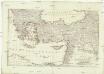
[Balkán a Malá Asie]
1 : 2850000 Balkánský poloostrov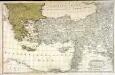
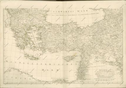
Dritter Theil der Karte von Europa welcher das südliche Russland Polen und Ungarn die europæische, und beinahe die ganze asiatische Türkei enthælt, 2
1 Blatt : 54 x 84 cm F.A. Schrämbl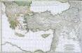
Troisième partie de la carte d'Europe contenant le midi de la Russie, la Pologne et la Hongrie, la Turquie y compris celle d'Asie presqu'entière, 2
1 Blatt : 53 x 84 cm chez l'auteur
Colonia romana, Tabula geographica provinciarum et urbium.
1 : 5000000 L'Isle, Guillaume de, 1675-1726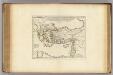
Colonia Romana, Tabula Geographica Provinciarum et Urbium.
1 : 5000000 L'Isle, Guillaume de, 1675-1726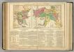
Turkey.
1 : 7800000 Lavoisne, M.
Latein. Kaisertum in Constantinopel und die christlichen Reiche im Orient 1204
Lateinisches Kaiserreich
Das lateinische Kaiserthum in Constantinopel und die christlichen Reiche im Orient 1204
Lateinisches Kaiserreich , Kreuzfahrerstaaten
Tabula geographica ad acta aposto
Středozemní moře-oblast východní Berka, Jan
Tabula Nova Asie Minoris [Karte], in: Claudii Ptolemei viri Alexandrini mathematice discipline philosophi doctissimi geographie opus [...], S. 269.
1 Karte aus Atlas Waldseemüller, Martin [und Ptolemaeus, Claudius] Übelin, Georg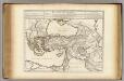
Retraite des Dix Mille Tabula.
1 : 5000000 L'Isle, Guillaume de, 1675-1726
Peregrinationis divi Paulitypus Corographicus
Der vordere Orient
1 : 2750000 Blízký východ List & von Bressensdorf
Retraite des dix mille
1 Karte : Kupferdruck ; 37 x 55 cm, Bildgrösse 45 x 57 cm L'Isle; Buache apud auctorem in ripâ vulgo dictâ la rue des Noyers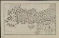
Schul-Atlas für die alte Erdbeschreibung : zur allgemeinen Schul-encyclopädie gehörig
J. H. Campe Zusammensetzung und Zeichnung von [...] Dufour, unter Leitung von Heusinger ; gestochen von Frentzel. Braunschweig : Schulbuchhandlung
E. Mediterranean.
1 : 5000000 Philip, George
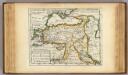
[Klein-Asien & Syrien, Nebst den Westlichen Theilen von Armenien, Kurdistan & Mesopotamien]
Handatlas über alle Theile der Erde und über das Weltgebäude Stieler, Adolf Justus Perthes
Tabula Prima Asie [Karte], in: Claudii Ptolemei viri Alexandrini mathematice discipline philosophi doctissimi geographie opus [...], S. 193.
1 Karte aus Atlas Waldseemüller, Martin [und Ptolemaeus, Claudius] Übelin, Georg
Klein-Asien & Syrien nebst den westlichen Theilen von Armenien, Kurdistan & Mesopotamien
Hand-Atlas über alle Theile der Erde und über das Weltgebäude Stieler, Adolf Justus Perthes
Tabula geographica Cyri et Xenophontis expeditionem illustrans
1 : 8000000 Annotatie: Historische kaart van de tocht van Xenophon en de "Tienduizend" door het Perzische Rijk (401 v.Chr.) Leiden : Brill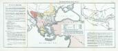
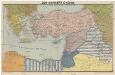
Nr. 15. Der russisch-türkische Krieg 1877/78
Balkanhalbinsel Russisch-Russisch-Türkischer Krieg <1877-1878>
Karte des Küstenlandes von Aegypten, Syrien und Kleinasien
1 : 4750000 Egypt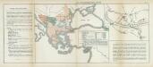
Nr. 11. Der russisch-türkische Krieg 1877/78
Balkanhalbinsel Russisch-Russisch-Türkischer Krieg <1877-1878>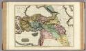
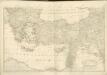
Turkey in Asia.
1 : 3300000 Pinkerton, John, 1758-1826
Natoliae Sive Asia Minor [Karte], in: Gerardi Mercatoris Atlas, sive, Cosmographicae meditationes de fabrica mundi et fabricati figura, S. 520.
1 Karte aus Atlas Mercator, Gerhard Montanus, Petrus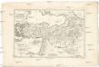
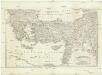
Turquie d'Asie
1 : 7590000 Turecko Bonne, Rigobert André
ASIA MINOR, SYRIA, ARMENIA, MESOPOTAMIA, ASSYRIA, Palestina
1 : 7000000 Arménie Renner Kleinknecht Bibliographisches Institut