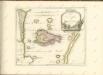
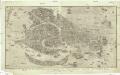
Maps of Treviso


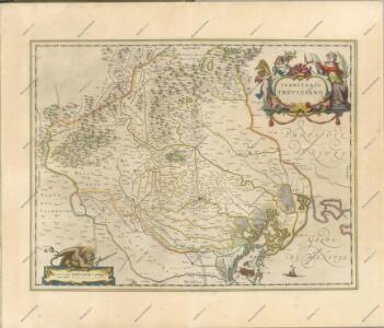
Territorio Trevigiano [Karte], in: Theatrum orbis terrarum, sive, Atlas novus, Bd. 3, S. 119.
1 Karte aus Atlas Blaeu, Joan Blaeu, Willem Janszoon
Territorio Trevigiano [Karte], in: Novus Atlas, das ist, Weltbeschreibung, Bd. 3, S. 139.
1 Karte aus Atlas Blaeu, Joan Blaeu, Willem Janszoon
TERRITORIO | TREVIGIANO.
[Amsterdam : Joan Blaeu]
Territorio Trevigiano [Karte], in: Le théâtre du monde, ou, Nouvel atlas contenant les chartes et descriptions de tous les païs de la terre, Bd. 3, S. 141.
1 Karte aus Atlas Blaeu, Willem Janszoon und Blaeu, Joan Blaeu, Willem Janszoon
Territorio Trevigiano [Karte], in: Novus atlas absolutissimus, Bd. 5, S. 56.
1 Karte aus Atlas Janssonius Offizin
Tarvisini Agri Typus [Karte], in: Theatrum orbis terrarum, S. 306.
1 Karte aus Atlas Ortelius, Abraham Vrients, Jan Baptista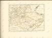

Tarvisini Agri Typus [Karte], in: Theatrum orbis terrarum, S. 211.
1 Karte aus Atlas Ortelius, Abraham
Il Trevisiano diviso ne suoi territori e distretti di nuova projezione
1 : 228000 Treviso (Itálie) Pitteri, Marco Alvise Antonio Zatta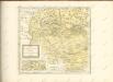

Territorio Trevigiano
Mollova mapová sbírka Magini, Giovanni Antonio Magini, Fabio
Diocesi Padovana con tutta la sua Estensione ne Vicini Territori
1 : 150000 Mollova mapová sbírka Clarici, Paolo Bartolommeo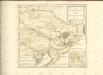

Carta del dipartimento del Bacchiglione
1 : 156000 Biasioli, A.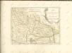

Diocesi Padovana con tutta la sua Estensione ne Vicini Territori
1 : 150000 Mollova mapová sbírka Clarici, Paolo Bartolommeo
Tyrolis sub Felici Regimine Mariae Theresiae Rom. Imper. Avg. Chorographice Delineata ...
1 : 104000 Mollova mapová sbírka Mansfeld, Johann Ernst Mansfeld, Johann Ernest
[Fontana-Fredda, Pordenone e dintorni]
1 : 8100 Itálie severní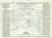
Piano topografico dell'isolario di Venezia
1 : 75500 Benátky-oblast (Itálie) Berlan, F. Bernardo Combatti
Nono congresso carta topografica della laguna di Venezia e del territorio conterminante fino a 37 chilometri di distanza dalla cittá con cenni descrittivi del gran ponte sulla laguna
Benátky-oblast (Itálie) Garlato, G. B. G. Kier
Belluno und Feltre.
from Spezialkarte der osterreichisch-ungarischen Monarchie.
Tyrolis sub Felici Regimine Mariae Theresiae Rom. Imper. Avg. Chorographice Delineata ...
1 : 104000 Mollova mapová sbírka Mansfeld, Johann Ernst Mansfeld, Johann Ernest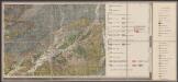
Geologische Übersichtskarte des tirolisch-venetianischen Hochlandes zwischen Etsch und Piave
1 : 75000 Südost-Blatt Mojsisovics, Edmund von Hölder
[Feltre]
1 : 61538 Feltre (Itálie)
Cismon
1 : 25000 Benátsko (Itálie) Istituto geografico militare
Tomba Nordhälfte
1 : 25000 Benátsko (Itálie) 6. A.K.
Tomba Südhälfte
1 : 25000 Benátsko (Itálie) Kriegsvermessung 13.