Maps of Racibórz County
Carte ethnographique de la région de Ratiboř
Ratiboř (Polsko : oblast) Service cartographique de l'Armée Tchécoslovaque

Sbírka map a diagramů použitých na mírových konferencích v Paříži v letech 1919 - 1920
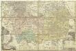
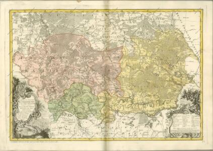
Principatus Silesiae Rattiboriensis
1 : 111000 Ratiboř-oblast (Polsko) Wieland, Johann Wolfgang Heredibus Homannianis
147. Beuthen, uit: Topographische Uebersichtskarte des Deutschen Reiches / herausgegeben v. d. Kartogr. Abt. d. Königl. Preuß. Landesaufnahme
1 : 200000 titelvariant: Topogr. Übersichtskarte des Deutschen Reiches; Annotatie: Titel boven bladen ook: Topogr. Übersichtskarte des Deutschen Reiches; Annotatie geografische gegevens: Op elk blad twee maatstokken: 10 Kilometer = 5,5 cm; 1 geogr. Meile = 3,6 cm; Legenda onder op elk blad Königlich Preußische Landesaufnahme. Kartographische Abtheilung [S.l : Königlich Preußische Landesaufnahme, Kartographische Abtheilung]
Theil von Schlesien.
Slezsko (Polsko) Weiland, Karl Ferdinand Bürck, A. im Verlage des Geograph. Instituts
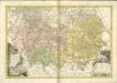
Das Fürstenthum Ratibor in Ober Schlesien
Mollova mapová sbírka Schleuen, Johann David Schleuen, Johann David
Myslowitz und Oswiecim.
from Spezialkarte der osterreichisch-ungarischen Monarchie.
Das Fürstenthum Ratibor in Ober Schlesien
1 : 200000 Horní Slezsko Schleuen, Johann David I.D. Schleuen
Ratibor
1 : 75000 Ratiboř-oblast (Polsko) Ministerstvo národní obrany
III. vojenské mapování 3960
1 : 75000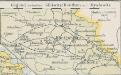
Gegend zwischen Gleiwitz-Beuthen und Myslowitz
1 : 400000 Oberschlesien
Carte ethnographique de la partie de la Haute-Silésie cedée a l'etat Tchécoslovaque par le traité de Versailles
1 : 125000 Horní Slezsko Kapras, Jan Hocke, Jan Unie
Myslowitz und Oświecim
1 : 75000 Bloschitz, R. K. u. k. militär-geographisches Institut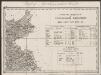
Umgebungen von Jägerndorf und die statistische Uebersicht
1 : 144000 K.K. Militärisches Geographisches Institut
Podrobná mapa Markrabství moravského a Vévodství slezkého
1 : 100000 Krnov (Česko : oblast) Srp, Jan Jos. R. Vilímek
Cosel
1 : 75000 Ministerstvo národní obrany
Gleiwitz
1 : 75000 Gliwice-oblast (Polsko) Ministerstvo národní obrany
Opava a okolí
1 : 75000 Opava (Česko : oblast) Vojenský zeměpisný ústav

[Kartenblatt]
1 : 25000 Kietrz (Polsko) Reichsamt für Landesaufnahme
III. vojenské mapování 4061/1
1 : 25000
[Kartenblatt]
1 : 25000 Morava (Česko) Reichsamt für Landesaufnahme
[Kartenblatt]
1 : 25000 Kravaře (Opava, Česko) Reichsamt für Landesaufnahme
III. vojenské mapování 4060/1
1 : 25000
[Kartenblatt]
1 : 25000 Chuchelná (Česko) Reichsamt für Landesaufnahme
Gradkartenblatt
1 : 25000 Bohumín-oblast (Česko) Mayer, Johann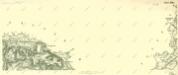
III. vojenské mapování 4060/2
1 : 25000