Maps of Arabian Peninsula


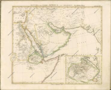
[Mittel- und Nord-Africa und Arabien, Oestliches Blatt]
Hand-Atlas über alle Theile der Erde nach dem neuesten Zustande und über das Weltgebäude Stieler, Adolf bei Justus Perthes
Mittel- und Nord-Africa und Arabien. Östliches Blatt
Stieler's Hand-Atlas Stieler, Adolf bei Justus Perthes
Sexta Asie Tabula [Karte], in: [Clavdii Ptholomei Cosmographi ...], S. 317.
1 Karte aus Atlas Nicolaus Germanus [und Ptolemaeus, Claudius]
[Mittel- und Nord-Africa, Oestl. Theil und Arabien]
Hand-Atlas über alle Theile der Erde und über das Weltgebäude Stieler, Adolf Justus Perthes
Sexta Asie Tabula [Karte], in: Claudii Ptolemei viri Alexandrini mathematice discipline philosophi doctissimi geographie opus [...], S. 208.
1 Karte aus Atlas Waldseemüller, Martin [und Ptolemaeus, Claudius] Übelin, Georg
Tabula Asiae VI. [Karte], in: Geographia universalis vetus et nova complectens Claudii Ptolemaei Alexandrini enarrationis libros VIII, S. 281.
1 Karte aus Atlas Münster, Sebastian [und Ptolemaeus, Claudius]
Tabula Asiae VI. [Karte], in: Claud. Ptolemaeus. Geographia lat. cum mappis [...], S. 311.
1 Karte aus Atlas Münster, Sebastian [und Ptolemaeus, Claudius]
Nordost-Afrika und Arabien
Handatlas über alle Theile der Erde und über das Weltgebäude Stieler, Adolf Justus Perthes
Nordost-Afrika Und Arabien.
1 : 12500000 Petermann, A.
Asie 1.
1 : 7150000 Anville, Jean Baptiste Bourguignon d, 1697-1782
Carte de la coste d'Arabie, Mer Rouge et Golfe de Perse : tirée de la Carte de l'Océan Oriental publiée en 1740 par Ordre de Mgr le Comte de Maurepas augmentée sur des remarques particulières et dressée sur des observations astronomiques = Kaart van de Kust van Arabië, de Roode-Zee en de Gulf van Persië Gemaakt na de Fransse-Kaart van den Ooster-Ocean uitgegeven A. 1740 op Bevel van den Hre Grave de Maurepas Vermeederd op byzondere Aanmerkingen, en geschikt volgens Sterrekundige-Waarnemi
1 : 14000000 Schley, Jacobus van der, 1715-1779 Pierre de Hondt
Carte des trois Arabies : tirée en partie de l'Arabe de Nubie, en partie de diuers autres autheurs
1 : 7500000 Sanson, Nicolas, 1600-1667 Chez Pierre Mariette
Karte von der asiatischen Türkey oder Levande, Persien und Ostindien
Asie jižní Reilly, Franz Johann Josef von von F.I.I. von Reilly
Turkey, Saudi Arabia, Afghanistan, and Iran.
1 : 14630000 Johnson, A.J.
Arabian Sea.
1 : 10000000 Philip, George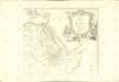

Alexandri Magni Macedonis expeditio
Asie jihozápadní
Uebersichts-Karte der ethnographischen Verhältnisse von Asien und von den angrenzenden Theilen Europa'sbearbeitet und herausgegeben mit Unterstützung der kaiserlichen Akademie der Wissenschaften in Wien von Vinzenz v. Haardt
Hartenthurn, Vincenz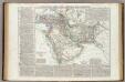
Turchia Asiatica, Arabia, Persia, Afghanistan, Herat, Belutchistan.
1 : 11000000 Marzolla, Benedetto
Carte Particuliere De La Mer Rouge &c. Levée Par Ordre Expres des Roys de Portugal sous qui on en a Fait la Decouverte. [Karte], in: Atlas nouveau, contenant toutes les parties du monde [...], Bd. 2, S. 228.
1 Karte aus Atlas Sanson, Nicolas Jaillot, Alexis Hubert und Mortier, Pieter
Vorder-Asien und Nil-Land
Schul-Atlas über alle Theile der Erde nach dem neuesten Zustande, und über das Weltgebäude Stieler, Adolf Justus Perthes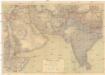
Südwest-Asien
1 : 5000000 Asie jihozápadní Justus Perthes
Erster Theil der Karte von Asien
1 : 7250000 Arabský poloostrov Anville, Jean-Baptiste Bourguinon d' Adam, Jakob F.A. Schraembl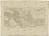
[Erster Theil der Karte von Asien]
Arabský poloostrov Anville, Jean-Baptiste Bourguinon d' Adam, Jakob F.A. Schraembl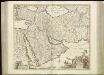
[76][76] Nova Persiae Armeniae Natoliae et Arabiae descriptio, uit: Atlas sive Descriptio terrarum orbis
Annotatie: Gedigitaliseerde versie. Amsterdam. Heiloo : Picturae (vervaardiger), 2015. tiff-bestand. Gedigitaliseerd: 07-01-2015; Origineel: Universiteitsbibliotheek Vrije Universiteit (XL.05127.-) ; Netherlands; Titelpagina ontbreekt Wit, Frederik de Amsterdam : Frederick de Wit
Asie Occidentale.
1 : 14000000 Garnier, F. A., 1803-1863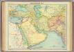
South-western Asia.
1 : 10000000 John Bartholomew and Son
Vorder-Asien und das Land des Nil
E. von Sydow's Schul-Atlas in sechs und dreissig Karten Sydow, Emil von bei Justus Perthes