Maps of Sweden


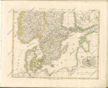
[Schweden und Norwegen auch Dänemark, Südliches Blatt]
Hand-Atlas über alle Theile der Erde nach dem neuesten Zustande und über das Weltgebäude Stieler, Adolf bei Justus Perthes
Schweden und Norwegen auch Daenemark
Stieler's Hand-Atlas Stieler, Adolf bei Justus Perthes
Schweden, Norwegen 2.
1 : 4500000 Flemming, Carl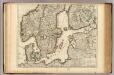
Courones du Nord (sud)
1 : 2600000 L'Isle, Guillaume de, 1675-1726
Denmark Sweden and Russia on the Baltic.
1 : 3380000 Sharpe, J.
Scandanavie Flle. S.
1 : 2500000 Vivien St Martin, L.
55-56. Scandanavia, South. The World Atlas.
1 : 2500000 USSR (Union of Soviet Socialist Republics).
Ice Chart, Baltic Sea, March.
U.S. Navy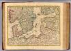
Courones du nord 2.
1 : 2500000 Covens et Mortier
Ice Chart, Baltic Sea, October.
U.S. Navy
Ice Chart, Baltic Sea, June.
U.S. Navy
Ice Chart, Baltic Sea, February.
U.S. Navy
Ice Chart, Baltic Sea, April.
U.S. Navy
Uebersichtskarte von der Ost - See und den anliegenden Ländern

Ice Chart, Baltic Sea, November.
U.S. Navy
Ice Chart, Baltic Sea, December.
U.S. Navy
Ice Chart, Baltic Sea, January.
U.S. Navy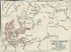
Nord- und Ostseeherrschaft II: Reich Waldemars II.
1 : 10000000 Ostseeraum Valdemar II., Danmark, Konge
Ice Chart, Baltic Sea, May.
U.S. Navy
Die Ostsee
Grosser Hand-Atlas über alle Theile der Erde in 170 Karten Meyer, J. Verlag des Bibliographischen Instituts
Ostsee.
1 : 2150000 Radefeld, Carl Christian Franz, 1788-1874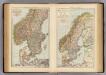
S. Scandinavia, Norway, Sweden.
1 : 4000000 Andree, Richard; Times (London, England)
[VIII], uit: Geognostische Karte des Oesterreichischen Kaiserstaates mit einem grossen Theile Deutschland's u. Italien / hauptsachlich nach ... Haidinger's geognostischer Karte dieses Staates bearb. von Josef Scheda
1 : 3000000 titelvariant: General-Karte von Europa in 25 Blättern; Annotatie: Bijlage bij: General-Karte von Europa in 25 Blättern. - 1:2.592.000. - 1845-1847 Scheda, Joseph Wien : K.K. Militär. Geografisch. Institut
Die Ost See
1 : 500000 Baltské moře-oblast Flemming, Carl C. Flemming
Die Ost See
1 : 5000000 Baltské moře-oblast Flemming, Carl C. Flemming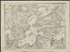
Kriegscarte zwischen Schweden und Rusland
nach den besten Carten gezeichnet von I.C. Iaeger Frankf. a/m : im Verlag der Jägerishen Landcarten Handlung
Nord- und Ostseeherrschaft IV
1 : 7000000 Ostseeraum, Polen-Litauen, Deutscher Orden
[Dänemark und Süd-Schweden]
Neuer Handatlas über alle Theile der Erde Kiepert, Heinrich Verlag von Dietrich Reimer