Maps of Verona

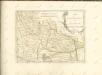
Carte nouvelle du Territoire de Verone : levée par ordre exprès à l'usage des armées en Italie, où sont exactement marqués les grands chemins, les routes des imperiaux &c
1 : 200000 par le Sr. Sanson, Geograph. du Roy A Amsterdam : chez Pierre Mortier
Verona e dintorni
1 : 100000 Verona (Itálie : oblast) Instituto geografico militare
Carta del dipartimento del Bacchiglione
1 : 156000 Biasioli, A.
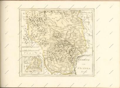
La Territoire de Vicenza Ou sont marquées toutes les Vallees Cols, Passages et Mines d'Argent. Qui sont dans les Montagnes qui separent ce Pays de Léveché de Trente
1 : 370000 Mollova mapová sbírka Nolin, Jean-Baptiste Nolin, Jean Baptiste
Veronae Vicentiae et Patavii ditiones
1 Karte : Kupferdruck ; 35 x 47 cm Mercator s.n.
Veronae Vicentiae et Patavii ditiones
1 Karte : Kupferdruck ; 35 x 48 cm Mercator s.n.

Territorio di Vicenza
1 : 330000 Mollova mapová sbírka Magini, Fabio Magini, Fabio
Avio und Valdagno.
from Spezialkarte der osterreichisch-ungarischen Monarchie.
Il Vicentino Diviso ne suoi Vicariati
[Rivereto, Vicenza und Umgebung]
1 : 75000 K. u. k. Militärgeographisches Institut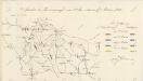

Carte d'une Partie du Mantouan, du Veronois, et des Campanems de l'Armée Imperiale
Mollova mapová sbírka Rebein, J. D.
Plan der Gegend am obern Mincio
1 : 20000 Gardské jezero-oblast (Itálie)
Gegend zwischen Verona, Peschiera, und Mantova
1 : 43200 Mantova (Itálie)
Italy: reserve division training area
1 : 50000 Italy: reserve division training area. From a collection of maps of the theatre of war in Italy, 1917-18. War Office
Plan des Schlachtfeldes von Custozza am 24. Juni 1866
1 : 20000 Blatt 2 [k.k. Generalstabs-Bureau für Kriegsgeschichte]
Plan des Schlachtfeldes von Custozza am 24. Juni 1866
1 : 20000 Blatt 1 [k.k. Generalstabs-Bureau für Kriegsgeschichte]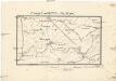
Umgebung von Vallegio
Valeggio sul Mincio (Itálie) Stanich, Eugen Simonyi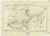
Gegend bei Monzambano
Monzambano (Itálie) Mathievich, Alexander

Landesstrich zwischen der Chiese und der Etsch 1837
1 : 21600 Blatt 3 [s.n.]

Landesstrich zwischen der Chiese und der Etsch 1837
1 : 21600 Blatt 4 [s.n.]
Verona
1 : 21600 Gerlach, C.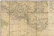
Gegend zwischen Volta, Guidizzolo, Solferino, Cavriana und Monzambano zum Behuf der Manoeuvrir-Rayons der Division des F.M.L. Baron Paumgarten im Jahre 1834
1 : 31500 Cavriana (Itálie)
Colli Eugenei, Italy: G.H.Q. Training Area
1 : 25000 Colli Eugenei, Italy: G.H.Q. Training Area. From a collection of maps of the theatre of war in Italy, 1917-18. War Office