Maps of Côtes-d'Armor
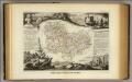
Dept. De Cotes du Nord.
1 : 571000 Levasseur, Victor.
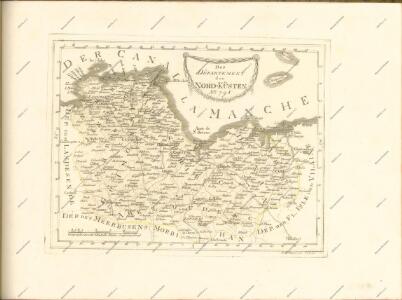
Département des Côtes du Nord
1 Karte : Kupferdruck ; 48 x 49 cm Houdan; Dumez chez Dumez directeur de l'atlas national rue de la Harpe n.o 26, et au dépôt de cet atlas placé au cabinet bibliographique rue de la Monnoye n.o 5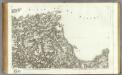
156 Treguier.
1 : 86400 Cassini family; Cassini, Cesar-Francois, 1714-1784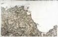
[Tréguier]
1 Blatt : 60 x 92 cm s.n.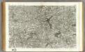
157 Uzel.
1 : 86400 Cassini family; Cassini, Cesar-Francois, 1714-1784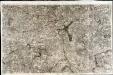
[Uzel]
1 Blatt : 61 x 91 cm s.n.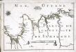
[Partie de la côte de la Bretagne]
1 Karte : 22 x 33 cm de Fer
[Partie de la côte de la Bretagne]
1 Karte : 22 x 33 cm de Fer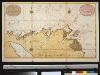
Een gedeelte van de Kanaal aen de kust van Vrankrijk van Pt. de Port de Pomne tot Tregastel
France Gerard van Keulen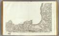
127 St.-Malo, Granville.
1 : 86400 Cassini family; Cassini, Cesar-Francois, 1714-1784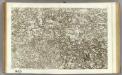
128 Dinan.
1 : 86400 Cassini family; Cassini, Cesar-Francois, 1714-1784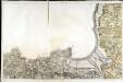
[Saint-Malo - Granville]
1 Blatt : 61 x 92 cm s.n.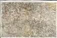
[Dinan]
1 Blatt : 61 x 92 cm s.n.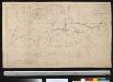
Nieuwe afteekening van het inkoomen en reede van St. Malo naer de laeste Frane afteekeningh
France Johannes van Keulen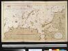
De haven van St. Malo ent incoomen vande rivier Dinan int Canaal aen de kust van Bretagne
France Gerard van Keulen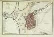
Plan de St. Malo
1 Plan : Kupferdruck ; 31 x 48 cm Le Rouge chez le Rouge rue des Augustins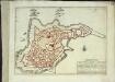
St. Malo
1 Plan : Kupferdruck ; 21 x 29 cm Fer s.n.
Duche de Bretaigne
1 : 791000 Bretaň (Francie) Hardy chez Henry Hondius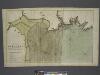
The coast of BRETAGNE from GRANVILLE to CAPEFREHEL
from The sea-atlas : containing an hydrographical description of most of the sea-coasts of the known parts of the world.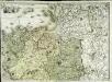
Carte géométrique de la province de Bretagne, 3
1 Blatt : chés l'auteur
L'evesché de Vannes
1 Karte : Kupferdruck ; 43 x 56 cm Jaillot chez le Sr. Jaillot geographe du roy joignant les grands Augustins aux deux globes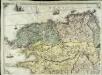
Carte géométrique de la province de Bretagne, 1
1 Blatt : chés l'auteur
Carte reduite des isles de Jersey, Grenesey et d'Aurigny
1 Karte : Kupferdruck ; 54 x 40 cm Bellin s.n.
14) IV.S.E. ''Rennes'', uit: Carte géologique de France
1 : 500000 Annotatie: Voor aanwezige bladen zie bladoverzicht [S.l : s.n.]
Département de l'Isle et Vilaine
1 Karte : Kupferdruck ; 41 x 35 cm Capitaine s.n.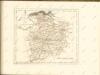

Jersey, Guernsey.
1 : 364000 Faden, William, 1750?-1836