Maps of Loir-et-Cher
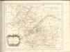

Tableau géographique et statistique du département de Loir-et-Cher
1 : 620000 gravé par Le Gagneur Paris : Baudouin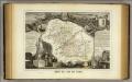
Dept. De Loir et Cher.
1 : 590000 Levasseur, Victor.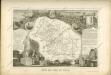

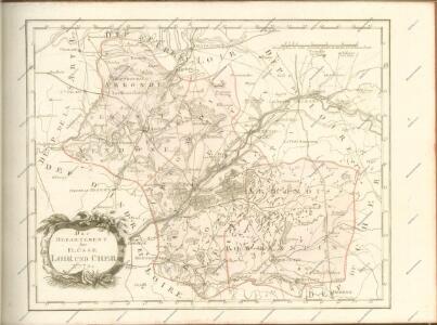
Département du Loir et du Cher
1 Karte : Kupferdruck ; 49 x 48 cm Houdan au bureau de l'atlas national de France rue Serpente n.o 15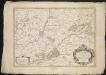
L'Evesché de Blois, divisé en Archidiaconéz et Doyennéz
1 : 266000
L'Evesché de Blois, divisé en Archidiaconéz et Doyennéz
1 : 211000
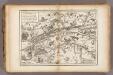
Description du Blaisois anno 1630
1 Karte : Kupferdruck ; 36 x 48 cm Mercator; Hondius Henricus Hondius
Partie septentrionale de l'evesché de Chartres
1 Karte : Kupferdruck ; 45 x 60 cm Sanson; Jaillot H. Iaillot
Description du Blaisois
1 Karte : Kupferdruck ; 35 x 47 cm Valck; Schenk typographia Gerardi Valk et Petri Schenk
Carnutes, eveché de Blois
1 Karte : Kupferdruck ; 40 x 54 cm Sanson; Robert de Vaugondy; Chauveau chés le Sr. Robert geog. ord. du roi quai de l'Horloge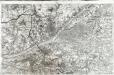
[Blois]
1 Blatt : 60 x 91 cm s.n.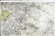
[Vendôme]
1 Blatt : 60 x 91 cm s.n.
Govverneme[n]t d'Amboise
1 Karte : Kupferdruck ; 11 x 15 cm Sebastian Cramoisy
Govverneme[n]t d'Orleans
1 Karte : Kupferdruck ; 11 x 15 cm Sebastian Cramoisy
Govvernement de Tours
1 Karte : Kupferdruck ; 11 x 15 cm Sebastian Cramoisy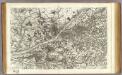
29 Blois.
1 : 86400 Cassini family; Cassini, Cesar-Francois, 1714-1784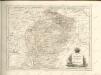
La Loire, l'Indre.
1 : 180000 Vincent
Gowernement de Gallardon
1 Karte : Kupferdruck ; 11 x 15 cm Sebastian Cramoisy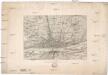
Orléans
1 : 20000 Orléans (Francie)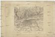
Tours
1 : 20000 Tours (Francie)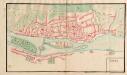
A colored plan of Tours
A colored manuscript plan of Tours in France; drawn about 1680, on a scale of 70 toises to an inch.
Orleans
1 Plan : Kupferdruck ; 11 x 15 cm Sebastian Cramoisy
Plan de la ville d'Orleans
1 Plan : Kupferdruck ; 39 x 47 cm Perdoux chéz Perdoux libraire place du Martroy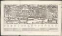
Plan et profil au naturel de la ville d'Orleans
1 : 1
Plan g.al du parc de Chambord
1 : 30300
Plan zur Schlacht bei Orléans am 3. December
1 : 40000 Buchh. des Großherzogl. Staatsverl. [u.a.]
Comitatus Blesensis, [...] Blaisois. [Karte], in: Le théâtre du monde, ou, Nouvel atlas contenant les chartes et descriptions de tous les païs de la terre, Bd. 2, S. 105.
1 Karte aus Atlas Blaeu, Willem Janszoon und Blaeu, Joan Blaeu, Willem Janszoon