Maps of Toledo
Ciudad-Real
Ed. Alberto Martín; F. Galceran

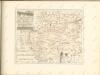
Mapa de la provincia de Toledo
1 Karte : Kupferdruck ; 37 x 40 cm López s.n.
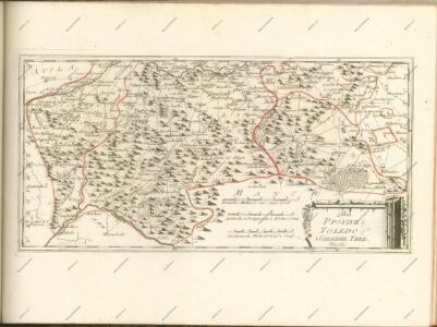
Provincia de la Mancha donde se comprehenden los partidos de Ciudad-Real, Infantes, y Alcaràz
1 Karte : Kupferdruck ; 36 x 37 cm López s.n.
Provincia de la Mancha donde se comprehenden los partidos de Ciudad-Real, Infantes, y Alcaràz
1 : 500000 compuesta sobre las mejores memorias impresas y manuscritas, y sujeta à las observaciones astronomicas por D. Thomàs Lopez, pensionista de S. M. Madrid : [Thomas Lopez]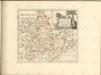
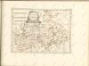

Mapa geografico de las sierras de Guadalupe
1 Karte : Kupferdruck ; 33 x 37 cm López s.n.
Carpetaniae Partis Descr. 1584. [Karte], in: Theatrum orbis terrarum, S. 107.
1 Karte aus Atlas Ortelius, Abraham Vrients, Jan Baptista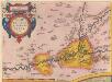
Carpetaniae Partis Descr. 1584. [Karte], in: Theatrum orbis terrarum, S. 60.
1 Karte aus Atlas Ortelius, Abraham
Toledo e dintorni: lavori difensivi eseguiti dal nemico [C.T.V. Corpo Truppe Volontarie. Comando Artiglieria (Itàlia)]
1 : 25000 1 Mapa imprès amb anotacions manuscrites. Carpeta: Guerra Civil. Datació aproximada. [C.T.V. Corpo Truppe Volontarie. Comando Artiglieria (Itàlia)]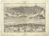
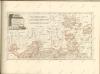
Toletum
Toledo (Španělsko) Braun, Georg Hogenberg, Franz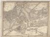
Topografia del real sitio de Aranjuez
Aranjuez (Španělsko) Aguirre, Domingo de
[Carte d'Espagne et de Portugal en neuf feuilles, 5]
1 Blatt : 31 x 41 cm P.G. Chanlaire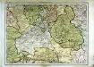
Espagne et Portugal, 5
1 Blatt : 31 x 42 cm Mentelle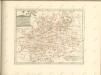

Castiliæ novæ pars occidentalis provincias Madrit, Toledo et Mancha comprehendens
1 Karte : Kupferdruck ; 48 x 46 cm Güssefeld; López apud Homannianos Heredes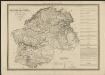
Cataluña con las nuevas divisiones
1 : 600000 formada por A. H. Dufour Paris : Bulla
Castiliæ novæ pars orientalis provincias Cuenca et Guadalaxara comprehendens
1 Karte : Kupferdruck ; 51 x 43 cm Güssefeld; López apud Homannianos Heredes
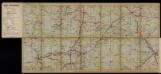
Guías-mapas de carreteras de España y Portugal. No 1 [Zona Ciudad Real, Córdoba, Jaén, Murcia]
Autopista
Invictissimo principi Phillipo V. Hispaniarum regi la Castille vieille et nouvelle avec l'Estremadure divisé en Estremadure de Castille et de Leon
1 : 1090000 Extremadura (Španělsko) Nolin, Jean-Baptiste Mendes Silva, Rodrigo I.B. Nolin
Castiliae novae pars orientalis
1 : 540000 Kastilie (Španělsko) Güssefeld, Franz L. López, Tomás apud Hommanianos Heredes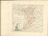

Madrid
1 : 200000 Coello, Francisco [Verlag nicht ermittelbar]
Segoviæ et Avilæ provinciarum charta geographica
1 Karte : Kupferdruck ; 43 x 55 cm López; Güssefeld; Vogel in lucem edita per Hom. Hered