Maps of Xinjiang
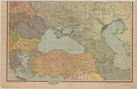
Evropské Rusko a Turecko
Kuchař, Karel
France, Spain, Portugal.
1 : 5200000 Mitchell, Samuel Augustus
France, Spain, Portugal.
1 : 5200000 Mitchell, Samuel Augustus
Map Of France, Spain, And Portugal.
1 : 6500000 Mitchell, Samuel Augustus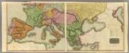
Europe S.
1 : 4050000 Thomson, John
Composite: Europe.
1 : 4050000 Thomson, John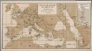
[Europa], uit: Routekaart van Nederland naar Ned. Indië en terug
1 : 8000000 Annotatie: Samengest. op uitnoodiging der Stoomvaart Maatschappij Nederland Groustra, J. Amsterdam : Seyffardt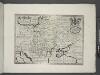
Hungary, Transylvania, Poland, &c.
from A new sett of maps both of antient and present geography : wherein not only the latitude and longitude of many places are corrected according to the latest observations, but also the most remarkable differences of antient and present geography may be quickly discern'd by a bare inspection or comparing of correspondent maps, which seems to be the most natural and easy method to lead young students (for whose use the work is principally intended) unto a competent knowledge of the geographical science : together with a geographical treatise particularly adapted to the use and design of these maps / by Edward Wells, M.A. and student of Christ-Church, Oxon.
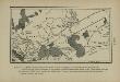
Marche approximative des Huns, d’Asie en Europe, aux premiers siècles de notre ère
Europa Hunnen Völkerwanderung Völkerwanderungszeit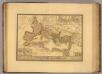
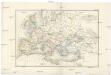
Empire Romain sous Theodose.
1 : 11300000 Picquet, C.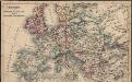
Europa seit Friedrich dem Grossen bis zur französ. Revolution
Europa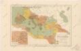
Říše římská ve své největší rozsáhlosti

Di-gyiu Du, Ng Da-tsiu Di-du[地舆图、五大洲地图]
Di-gyiu Du, Ng Da-tsiu Di-du[地舆图、五大洲地图] 1853年,Martin, W. A. P. (William Alexander Parsons) 美国长老会传教士丁韪良用罗马拼音标注宁波方言编写的世界地理著作,对地球和各大洲进行介绍。内有东西半球图、亚洲图、欧洲图、非洲图、北美洲图、南美洲图、地中海附近图、清内地十八省图、浙江省图、宁波附近图等。 10图,墨刻本,罗马拼音标注宁波方言,图幅不一,约39 x 49.5 cm Harvard-Yenching | Rare Book | TA 2370 92,Hollis Number:008156153
Russland beim Tode Iwans II. 1584
Russland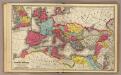
Roman Empire.
1 : 13600000 Mitchell, Samuel Augustus
Incursions of barbarians.
1 : 23500000 Mitchell, Samuel Augustus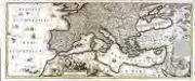
Mare Mediterraneum
1 Karte auf 2 Blättern : Kupferdruck ; 42 x 103 cm by Iohannes Cóvens en Cornelis Mortier
Europa im Jahr 1812
Europa
Composite: Imperii Romani.
1 : 9850000 Vivien de St Martin, L.
[Das Mittellaendische und Schwarze Meer. Auch als General Karte des Osmanischen Reichs]
Hand-Atlas über alle Theile der Erde nach dem neuesten Zustande und über das Weltgebäude Stieler, Adolf bei Justus Perthes
Gemaelde des Roemischen Reichs in seiner grösten Ausdehnung
Historisch-genealogisch-geographischer Atlas von Le Sage Las Cases, Emmanuel Auguste Dieudonné Marius Joseph de Johann Velten, Kunsthändler
TABLEAU DE L'EMPIRE ROMIN
Afrika severní Las Cases, Emmanuel-Auguste-Dieudonné Didot, Pierre Jules Didot Ainé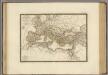
Empire Romain sous Constantin.
1 : 11300000 Brue, Adrien Hubert, 1786-1832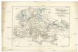
Uebersichts-Karte für die Zeit nach dem zweiten pariser Frieden
Evropa Loewenberg, Julius Herder, B.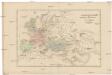
Uebersichts-Karte für die Geschichte von der Völkerwanderung bis auf Carl den Grossen
Evropa Loewenberg, Julius Herder, B.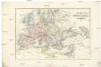
Uebersichts-Karte für das Zeitalter Napoleon's
Evropa Loewenberg, Julius Herder, B.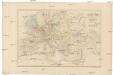
Uebersichts-Karte für die Geschichte von der Reformation bis zum westphälischen Frieden
Evropa Loewenberg, Julius Herder, B.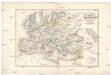
Uebersichts-Karte für der Carls des Grossen bis zum Ende der Kreuzzüge
Evropa Loewenberg, Julius Herder, B.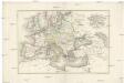
Uebersichts-Karte für die Zeit vom westphälischen Frieden bis zur französischen Revolution 1789
Evropa Loewenberg, Julius Herder, B.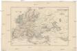
Uebersichts-Karte für die Geschichte vom Ende der Kreuzzüge bis zur Reformation
Evropa Loewenberg, Julius Herder, B.