Maps of Holešovice
Praha : orientační plán
1 : 15000
Praha : orientační plán - střed města
Praha : orientační plán středu města
1 : 15000
Plan de la ville & du siege de Prague
1 : 46000 Praha (Česko) Trijsz, A.
Plan von Prag und den Vororten
Praha (Česko) vom Deutschen Verein
Praha : plán kulturních památek
1 : 10000
Plán král. hlav. města Prahy a obcí sousedících
Praha (Česko) Šádek, Jindřich Beck, Heinrich Jos. R. Vilímek
Monumentální plán královského hlavního města Prahy
1 : 5000 Praha (Česko) Brož, Josef Lhoták ze Lhoty, Jan nákladem Jos. R. Vilímka
[Praha]
1 : 10000 Praha (Česko)
Nejnovější a nejúplnější plán královského hlav. města Prahy, Karlína, Žižkova, Královských Vinohradů, Vršovic, Nuslí, Smíchova a nejbližšího okolí
1 : 12000
Nejnovější plán Prahy s okolím

Monumentální plán královského hlavního města Prahy : Karlína, Král.Vinohradů, Žižkova, Bubenče, Nuslí a Smíchova i s nejnovější VII. částí Holešovicemi a Bubny
1 : 5000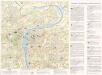
Praha : plán středu města
1 : 15000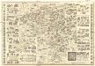
Názorný plán Prahy
1 : 7700 Praha (Česko) Lauda, Ladislav Státní ústav pro učebné pomůcky škol průmyslových a odborných
Plán Prahy
1 : 11520 Praha (Česko) Grefnetter, Josef Bohemie
Plan von Prag und Umgebung

Nejnovější plán Prahy
Praha (Česko)
Plan d. Königl. Haupstadt Prag und der Vororten
1 : 20000
Nejnovější a nejúplnější plán královského hlav. města Prahy, Karlína, Žižkova, Královských Vinohradů, Vršovic, Nuslí, Smíchova a nejbližšího okolí
1 : 12000 Karlín (Praha, Česko) Brož, Josef A. Storch syn
Neuester Grundriss von Prag und seiner Umgebung

Plán Prahy s okolím
1 : 10000
Prag Orientierungsplan

Plán král. hlav. města Prahy a obcí sousedních
Libeň (Praha, Česko) Jos. R. Vilímek
Neuester Plan der königl. Landes-Hauptstadt Prag und der Vororte

Kriegs-Expeditions-Karte in Böhmen I. Blat, in welchem die Haubtstadt Prag mit der französsischen und saechsischen Belageru[n]g und Eroberung, so den 26. Novembre 1741. geschehen, vorgestellet wird
1 : 20700 Praha (Česko) Meyer Sinsart von Homaen[n] Erben
Kriegs-Expeditions-Karte in Böhmen I. Blat, in welchem die Haubtstadt Prag mit der französsischen und saechsischen Belageru[n]g und Eroberung, so den 26. Novembre 1741. geschehen, vorgestellet wird
1 : 20700 Praha (Česko) Meyer Sinsart von Homaen[n] Erben
Plán král. Hlav. Města Prahy

Neuester Plan von Prag mit seiner Umgebungen
1 : 18000 Praha (Česko) bei Gottl. Haase Söhne
Plán Prahy s okolím
1 : 10000