Maps of XI Región Aysén del General Carlos Ibáñez del Campo
Afteekening van een gedeelte van de kust van Chili in de Zuijd Zee van El Laguia tot C. de la Victoria
Chile Gerard van Keulen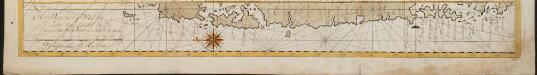
Het Vervolg van de Kust van Chili van de Straat van Magalanus tot 't Eyland La Mocha
Chile Gerard van Keulen
(Mapa de la Republica de Chile 11)
1 : 11000000 Pissis, Aime, 1812-1889
Mapa de la region patagonica entre los grados 47 y 52 sur
1 : 500000 Argentine. Oficina de Límites Internacionales [Buenos Aires ?] :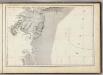
(Mapa de la Republica de Chile 10)
1 : 11000000 Pissis, Aime, 1812-1889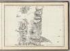
(Mapa de la Republica de Chile 9)
1 : 11000000 Pissis, Aime, 1812-1889
Mapa de la region patagonica entre los grados 41 y 47 sur
1 : 500000 Argentine. Oficina de Límites Internacionales [Buenos Aires ?] :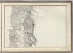
(Mapa de la Republica de Chile 8)
1 : 11000000 Pissis, Aime, 1812-1889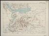
Magallanes [50°-51° S]
1 : 250000 Comisión Chilena de Límites [Santiago du Chili] : Comision chilena de limites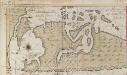
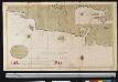
Een haven aen de kust van Chili
Chile Gerard van Keulen
The channels between Port de Ancud and Port Montt by the Officers of H.M.S. Beagle, 1835
[The channels between Port de Ancud and Port Montt ... by the Officers of H.M.S. Beagle, 1835, etc. (Port Abtao. Port Montt. Entrance of the River Maulin)]
Acworth, Sullivan County.
1 : 39000 D.H. Hurd & Co.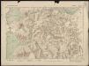
Llanquihue [41°-42° S]
1 : 250000 Comisión Chilena de Límites [Santiago du Chili] : Comision chilena de limites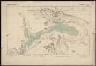
Llanquihue [46°-47° S]
1 : 250000 Comisión Chilena de Límites [Santiago du Chili] : Comision chilena de limites
Patagonia ... South Orkney ... Falkland Islands ... South Georgia Island.
1 : 8236800 Colton, G.W.
Composite: (Mapa de la Republica de Chile 9-15)
1 : 11000000 Pissis, Aime, 1812-1889
Partie, la Patagonie. Amer. Merid. 40.
1 : 1641836 Vandermaelen, Philippe, 1795-1869
Partie, la Patagonie. Amer. Merid. 38.
1 : 1641836 Vandermaelen, Philippe, 1795-1869
Exquisita & magno aliquot mensium periculo lustrata et iam retecta Freti Magellanici Facies. [...] [Karte], in: Gerardi Mercatoris Atlas, sive, Cosmographicae meditationes de fabrica mundi et fabricati figura, S. 562.
1 Karte aus Atlas Mercator, Gerhard Montanus, Petrus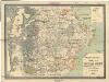
Plano parcial del territorio de Santa Cruz
1 : 681000 Argentina Cobos, Norberto B. Greiner, Ulrich G. Siniscalchi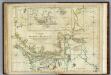
Chart Of The Straits Of Magellan.
1 : 880000 Jefferys, Thomas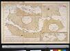
Carte du Detroit de Magellan dressée sur les memoires de Mr. de la Morliere Doct.r de Sorbonne dediée à Monseigneur l'évêque de Viviers
Chile Gerard van Keulen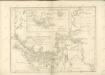
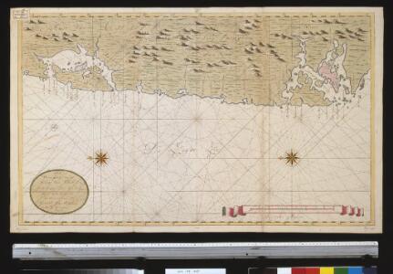
Een gedeelte van de kust van Chili in de Zuijd Zee van Po. IJtata tot El Laguia of van 36 tot 41 graden Breete
Chile Gerard van Keulen
Demarcacion de limites con Chile. Plano general de la sub-comision n°4
1 : 500000 Argentine. Oficina de Límites Internacionales [Buenos Aires ?] :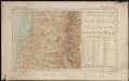
Republica de Chile [39°-41° S]
1 : 500000 (Chili) Oficina de Mensura de Tierras Santiago du Chili : Oficina de Mensura de Tierras
Patagonia. South Orkney or Powell's Group. Falkland Islands. South Georgia Island.
1 : 7600000 Colton, G.W.
Esquisse de la Patagonie (République Argentine)
1 : 6000000 Paris : Erhard et fils
Patagonie, Terre de Feu, Malouines.
1 : 3750000 Martin de Moussy, V. (Victor), 1810-1869