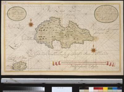
Maps of Islas Juan Fernandez
Nieuwe afteekening van de eijlanden van Ferdinand of Ilhas de Juan Fernando geleegen in de Zuijt Zee op de breete van 34 graden 15 minuten op de kust van Chili 80 Duijtsche mijlen van de wal
Chile Gerard van Keulen
Chili, cote.
1 : 2500000 Spain. Marina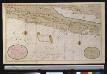
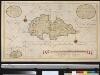
Nieuwe afteekeningh van Chili geeleegen in de Groodt Zuijt Zee
Chile Gerard van Keulen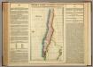
Map Of Chili.
1 : 9757440 Lea, I.
Geographisch-statistische und historische Charte von Chile
1 : 3500000 Weimar : Verlag des Geographischen Instituts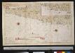
De kusten van Chili
Chile Gerard van Keulen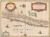
Chili [Karte], in: Novus Atlas, das ist, Weltbeschreibung, Bd. 2, S. 352.
1 Karte aus Atlas Blaeu, Joan Blaeu, Willem Janszoon
Chili. [Karte], in: Novus atlas absolutissimus, Bd. 6, S. 249.
1 Karte aus Atlas Janssonius Offizin
South America 5.
1 : 2800000 Arrowsmith, Aaron
Chili.
1 : 3200000 Pinkerton, John, 1758-1826
Chili.
1 : 8400000 Arrowsmith, Aaron; Lewis, Samuel
Chili.
1 : 4752000 Lucas, Fielding Jr.
South America 5.
1 : 6969600 Letts, Son & Co.
La Plata, Chile.
1 : 6700000 Society for the Diffusion of Useful Knowledge (Great Britain)
Chile
1 : 6630000 Chile im Verlage des Geographischen Instituts
Chili.
1 : 8950000 Lucas, Fielding Jr.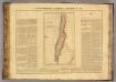
Chili.
1 : 6600000 Buchon, J. A. C.; Carey, H. C.; Lea, I.
Chili [Karte], in: Le théâtre du monde, ou, Nouvel atlas contenant les chartes et descriptions de tous les païs de la terre, Bd. 2, S. 347.
1 Karte aus Atlas Blaeu, Willem Janszoon und Blaeu, Joan Blaeu, Willem Janszoon
Patagonia. South Orkney or Powell's Group. Falkland Islands. South Georgia Island.
Colton, G.W.
Le Chili
1 : 6400000
Chili. [Karte], in: Gerardi Mercatoris et I. Hondii Newer Atlas, oder, Grosses Weltbuch, Bd. 2, S. 416.
1 Karte aus Atlas Mercator, Gerhard und Hondius, Jodocus Jansson, Jan
Chili and part of the Viceroyalty of La Plata.
from Carey's general atlas, improved and enlarged : being a collection of maps of the world and quarters, their principal empires, kingdoms, &c.
Paskaarte van't zuÿdelÿckste deel van America
1 Karte : Kupferdruck ; 43 x 53 cm Doncker bÿ Hendrick Doncker boeckverkoper en graad-boog-maker inde Nieuwe-brug-steeg
Tractus australior Americæ meridionalis a Rio de la Plata per fretum Magellanicum ad Toraltum
1 Karte : Kupferdruck ; 48 x 54 cm Renard Louis Renard
[Süd-Amerika in 6 Blättern, Blatt 5]
Adolf Stieler's Handatlas über alle Theile der Erde und über das Weltgebäude Stieler, Adolf Justus Perthes
Missioni Salesiane della Patagonia settentrionale
1 : 2000000 Falklandy Salesianische Buchdruckerei
Patagonie, Detroit de Magellan, Terres Australes.
1 : 6000000 Garnier, F. A., 1803-1863
Chili, La Plata, Bolivia.
1 : 6800000 Hall, S. (Sidney)
Republica Argentina - Superficie, poblacion, ferrocarriles, cultivos y ganados
1 : 7400000 Argentine. Ministerio de agricultura [Buenos Aires] : Direccion de economia rural y estadistica