Maps of Mate Asher Regional Council
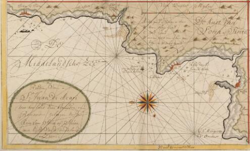
De reeden van St. Juan de Acari met het land daer bezuijden en benoorden geleegen aen de kust van Soria of Sirien
Israel Gerard van Keulen
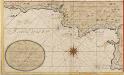
De reede van St. Jan de Acari en Kaijfa met t Land van Sidon of Saita
Israel Gerard van Keulen
Levés en Galilée faisant suit à la Carte du Liban de l'Etat-Major Français : exécutés en 1870 / par M.M. Mieulet et Derrien
1 : 100000 titelvariant: Levés en Galilée; Annotatie: Met verklaring van Arabische termen H. Mieulet; Isidore-Antoine-Michel Derrien 1839-1904 [S.l. : Lemercier]
Nazareth, Palestine (1946)
Survey of Palestine. Nazareth. Scale 1 : 5,000. [Jaffa] : [Survey of Palestine]
Sheet II. Palestine Exploration Map.
1 : 63360 Kitchener, H.R. (Horatio Herbert)
47 Tyre, Sidon.
1 : 100000 Jacotin, Pierre, 1765-1827
Composite: Sheets 1-47
1 : 100000 Jacotin, Pierre, 1765-1827
Palestina: gráfico de la vida de Jesús y año litúrgico
1 Mapa. La data és la que figura en el Nihil Obstat del censor. Datació aproximada Font, Lamberto
Palaestina za času P. Ježíše
Izrael
Palestine or Canaan
1 : 1
Ancient Palestine.
1 : 990000 Hughes, William

Palestina seu Terra Sancta. (1826)
1 : 1090000 Tanner, Henry S.
Palestine, Jerusalem.
1 : 970000 Mitchell, Samuel Augustus
Palestine, Jerusalem.
1 : 970000 Mitchell, Samuel Augustus
Palestine, Jerusalem.
1 : 970000 Mitchell, Samuel Augustus Jr.
Palestine, Jerusalem.
1 : 970000 Mitchell, Samuel Augustus
Palestine.
1 : 960000 Mitchell, Samuel Augustus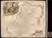
Iudaea sive Terra Sancta quae Israelitarum
1 : 690000 1 Karte : Kupferdruck ; 49 x 56 cm Danckerts, Theodorus [Danckerts]
Palestine.
1 : 1000000 Colton, G.W.
Palestine.
1 : 1130000 Tanner, Henry S.
Wegekarte von Palästina
1 : 800000 Palestina Preußische Landesaufnahme
Palestine.
1 : 1000000 Finley, Anthony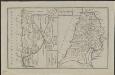
Schul-Atlas für die alte Erdbeschreibung : zur allgemeinen Schul-encyclopädie gehörig
J. H. Campe Zusammensetzung und Zeichnung von [...] Dufour, unter Leitung von Heusinger ; gestochen von Frentzel. Braunschweig : Schulbuchhandlung
Cesta Israelitů z Egypta a cesty sv. Pavla

Das Heilige Land aus der Vogelschau
Palestina J. Weber
Terra Sancta sive Palaestina exhibens non solum regna vetera Iuda et Israel in suas XII. tribus distincta, sed etiam eorundem diversarum aetatum conditionem et facta in Sacris Paginis indicata
1 : 704800 Kanaán Lotter, Tobias Conrad Lotter, Matthäus Albrecht studio Tobiae Conradi Lotter
Karte vom Heil. Lande
1 : 1400000 Izrael
Palestina čili Kanaan
Palestina Fried, Franz Luther, Th. nákladem Spolku Komenského