Maps of Jämtlands län
Trigonometrisk grunnlag, vedlegg 63a: Karta öfver Norra Sverige
1 : 500000 August Hahr Schlachter & Seedorff, Stockholm
Partie, Suede, Norwege. Europe 4.
1 : 1641836 Vandermaelen, Philippe, 1795-1869
NORDLANDIÆ | et quibies | GESTRICIA | et | HELSINGICÆ | REGIONES
Auct. Andrea Buræo Sueco. [Amsterdam : Joan Blaeu]
Nordlandiae et quibies Gestricia et Helsingicae regiones
1 : 1285000 auctore Andrea Buraeo Sueco [Amsterdam] : J. Blaeu
Island
Island Milbauer, Emanuel Vlastimil Walch, Johann
Karta öfver Swearike och norra delen af Swerige
1 : 720000 författad af C.P. Hällström S. Anderson sc. [Stockholm] : Geografiska Inrättningen
Norgesavdelingen 38c nord: Græntse-Carte imellom Norge og Swerrige
1 : 800000 Jens Christian Spidberg
Norge 10: Kart over Trondhjems Len samt Dele af Jemteland og Herjedalen
1 : 400000
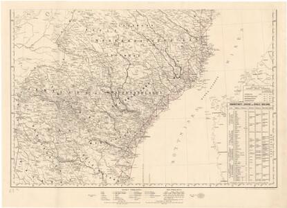
Schema raīona operacīi grafa Kamenskago
Finnland Kamenskij, Nikolaj Michajlowic Russisch-Schwedischer Krieg <1808-1809>
Norgesavdelingen 227-4: Vægkart over Norge - sydlige blad
1 : 600000 P. Dybdahl | J. Sejersted A. Bruns Forlag
Norgesavdelingen 209-4: Kart over det sydlige Norge
1 : 600000 Lars Østlin | Per Nissen | O. H. Paulsen H. Aschehoug og Co
Norge 55-2: Accurat landcaart over Norges Rige anden Part
1 : 300000 G. Bordin
Norge 55-3: Accurat landcaart over Norges Rige anden Part
1 : 300000 G. Bordin
Ostsee
1 : 200000 Baltské moře Reichs-Marine-Amt
Norge 55-7: Accurat landcaart over Norges Rige anden Part
1 : 300000 G. Bordin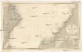
Ostsee
1 : 200000 Baltské moře Reichs-Marine-Amt
Skogkart paa grunnlag av det Hydrografiske kart, blad 4
1 : 500000 Kaptein K. Gleditsch
XVIII
1 : 400000 N. Franck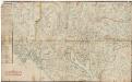
Kartblad 7 Carte over det 1. Trondhiemsche Regiment tillige med de 3 Nordenfi: Skieløber Compagniers Situation.
Isach Jørgen Coldevin
Spesielle kart nr 71: Oversigtskart udarbeidet som bilag til Lappekommissionens Indberetning
1 : 400000
XV
1 : 400000 R. Haavin
XV
1 : 400000 R. Haavin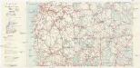
Finnland Straßenkarte
1 : 400000 Finsko Gen St d H Abt f Kr Kart u Verm W IV Mil Geo
XII
1 : 400000 N. Franck
XII
1 : 400000 N. Franck
Det nordöstlige blad
1 : 600000 Norsko severní H. Aschehoug
Le royaume Norvége
1 : 2400000 Norsko
XVIII
1 : 400000 N. Franck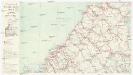
Finnland Straßenkarte
1 : 400000 Finsko Gen St d H Abt f Kr Kart u Verm W IV Mil Geo