Maps of Scandinavia

Statistikk 26-5c: Heste. Middeltal pr Gaard
1 : 2400000
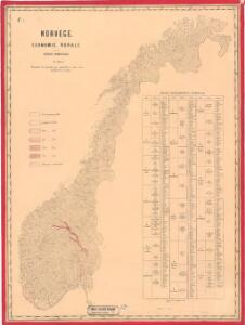
Statistikk 28- Le royaume de Norvège
1 : 2400000
Statistikk 26-4b: Avling reduceret til Bygværdi.
1 : 2400000
Statistikk kart 14: Norvège. Division médicale
1 : 2400000
Statistikk kart 3: Folkemængdekart over Norge
1 : 1600000
Spesielle kart 72a: Kart over Valgmands- og Stortingsvalgene
1 : 2400000 K. Petersen Olaf Norli's forlag; Kristiania
Statistikk 26-8b: Avling af Korn
1 : 2400000
Statistikk 26-5b: Udsæd af korn i tønder, reduceret til bygværdi pr. 1000 maal
1 : 2400000
Statistikk 26-6b: Udsæd af Korn
1 : 2400000
Statistikk 26-9c: Husdyrene reduceret til Hornkvæg for hver Gaard
1 : 2400000
Statistikk kart 15a: Norvège. Division militaire
1 : 2400000
Spesielle kart 66-3: Kart udvisende de med bidrag af Statskassen understøttende Dampskibsrouter
1 : 2400000
Spesielle kart 5-3: Telegraf Kart over Norge
1 : 2000000
Statistikk 26-3c: Faar. Antal Dyr pr 1000 Maal høstet Areal
1 : 2400000
Spesielle kart 66-1: Kart udvisende de med bidrag af Statskassen understøttende Dampskibsrouter
1 : 2400000
Jordbunnskart
1 : 2000000 Juel Låg Norges Landbrukshøgskole | Norges geografiske oppmåling
Statistikk 26-1b: Hovedsæden i hvert Herred
1 : 2400000
Statistikk kart 19-4: Fremstilling af Norges Agerbrug. Engdyrkning. Eng beregnet i procent af dyrket areal
1 : 2400000
Statistikk 26-2c: Hornkvæg. Antal Dyr pr 1000 Maal høstet Areal
1 : 2400000
Spesielle kart 5-2: Telegraf Kart over Norge
1 : 2000000
Spesielle kart nr 74: Strandfladen langs Norges kyst
1 : 2400000 Dr. Hans Reusch
Statistikk 26-10b: Eng i Procent af den dyrkede Jord, fogderivis
1 : 2400000
Statistikk 26-6c: Hornkvæg. Middeltal pr Gaard
1 : 2400000
Statistikk kart 11- Norvége
1 : 2400000
Statistikk kart 12-b: Norvège. Division administrative
1 : 2400000
Spesielle kart 66-2: Kart udvisende de med bidrag af Statskassen understøttende Dampskibsrouter
1 : 2400000
Statistikk kart 20-4: Fremstilling af den norske Fædrift. Faaret. Dyrenes antal pr 1000 maal afhøstet areal
1 : 2400000
[Ost-Europa, Blatt 1]
Adolf Stieler's Handatlas über alle Theile der Erde und über das Weltgebäude Stieler, Adolf Justus Perthes
[Ost-Europa in 6 Blättern, Enthaltend: Norwegen, Schweden, Russland, Kaukasien und die Türkei, Blatt 1]
Hand-Atlas über alle Theile der Erde und über das Weltgebäude Stieler, Adolf Justus Perthes