Maps of Mediterranean Sea
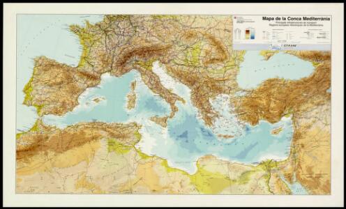
Mapa de la Conca Mediterrània: principals infrastructures de transport : regions europees riberenques de la Mediterrània
1 : 3500000 1 Mapa. Institut Cartogràfic de Catalunya ICC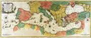
Carte geographique representant la mer Mediterranée ou la seconde partie du théatre de la guerre entre les Russes et les Turcs
1 Karte auf 3 Blättern : Kupferdruck ; 53 x 130 cm Lotter Tobias Konrad Lotter
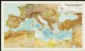
L'Europe au Temps des Croisades.
Andriveau-Goujon, J.
Gemaelde des Roemischen Reichs in seiner grösten Ausdehnung
Historisch-genealogisch-geographischer Atlas von Le Sage Las Cases, Emmanuel Auguste Dieudonné Marius Joseph de Johann Velten, Kunsthändler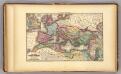
Roman Empire.
1 : 9000000 Young, James H.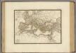
Empire Romain sous Constantin.
1 : 11300000 Brue, Adrien Hubert, 1786-1832
TABLEAU DE L'EMPIRE ROMIN
Afrika severní Las Cases, Emmanuel-Auguste-Dieudonné Didot, Pierre Jules Didot Ainé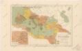
Říše římská ve své největší rozsáhlosti
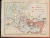
L'Empire Grec au temps de Justinien (VI.e siècle)
Byzantinisches Reich Justinian I.
Empire Romain.
Andriveau-Goujon, J.
Die nach der Völkerwanderung entstandenen neuen Reiche. Anfang des 6ten Jahrh
Europa Völkerwanderung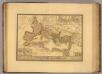
Empire Romain sous Theodose.
1 : 11300000 Picquet, C.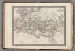
Empire Romain.
1 : 14400000 Monin, C.V.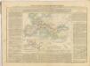
Das Römische Reich
Malá Asie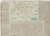
TABLEAU DE LA TRANSMIGRATION DES BARBARES
Evropa Las Cases, Emmanuel-Auguste-Dieudonné Didot, Pierre Jules Didot Ainé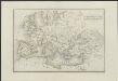
[Historisch-geographischer Atlas zu den allgemeinen Geschichtswerken von C. v. Rotteck, Pölitz u. Becker] : Uebersichts-Karte der nach der Völkerwanderung entstandenen neuen Reiche
von Julius Loewenberg Lithographie von B. Herder in Freiburg im Breisg. [Freiburg im Breisgau] : [Herder]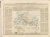
[Historisch-geographischer Atlas zu den allgemeinen Geschichtswerken von C. v. Rotteck, Pölitz u. Becker] : Uebersichts-Karte von der Zeit Carls des Grossen bis zum Ende der Kreuzzüge
von J. Loewenberg Lithographie von B. Herder in Freiburg im Breisgau [Freiburg im Breisgau] : [Herder]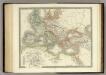
Ancient Roman Empire.
1 : 12400000 Teesdale, Henry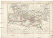
Das Römische Reich unter Traianus
starověký Řím
Europa 1812
Europa Kunz, Andreas ; Moeschl, Joachim Robert
Imperium Romanum Antiquum
Römisches Reich
Europa zur Zeit der Kreuzzüge
Europa, Byzantinisches Reich, Kreuzzüge
[Das Mittellaendische und Schwarze Meer. Auch als General Karte des Osmanischen Reichs]
Hand-Atlas über alle Theile der Erde nach dem neuesten Zustande und über das Weltgebäude Stieler, Adolf bei Justus Perthes
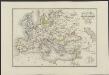
Europa 1839
Europa Kunz, Andreas ; Röss, Wolf ; Moeschl, Joachim Robert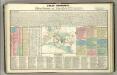
Tableau historique de Rome ancienne.
1 : 23700000 Duval, Henri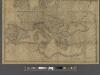
A new map of Europe exhibiting its natural and political divisions drawn from the most recent materials
From Whole