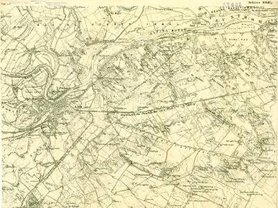
Maps of Győrújfalu
III. vojenské mapování 4959/2
1 : 25000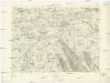
Klížska Nemá
1 : 75000 Maďarsko Vojenský zeměpisný ústav
Györ
1 : 75000 Györ (Maďarsko : oblast) Vojenský zeměpisný ústav
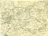
III. vojenské mapování 4959
1 : 75000
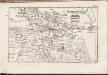
Einnahme von Raab am 28ten Juni 1849.
Györ-oblast (Maďarsko) Mortier, Pieter Jan Jiří
Raab.
from Spezialkarte der osterreichisch-ungarischen Monarchie.
Györ vármegye
1 : 240000 Györ-oblast (Maďarsko) Király, Georg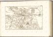
C. Jauriniensis
Ungarn Komitat Raab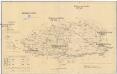
Komorner Comitat
1 : 290000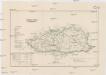
Komorner Comitat
1 : 288000 Komárno (Slovensko)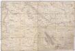
Special Karte von Ungarn
1 : 14400 Györ (Maďarsko : oblast) K.K. Militärisch-Geographisches Institut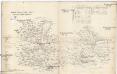
Oedenburger und Raaber Comitat
1 : 280000 Györ (Maďarsko : oblast)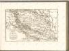

Komorn 148, uit: Special-Karte von Mittel-Europa / nach amtlichen Quellen bearbeitet von W. Liebenow
1 : 300000 titelvariant: W. Liebenow's Mittel-Europa; Annotatie: Titel boven de bladen: W. Liebenow's Mittel-Europa Johannes Wilhelm Liebenow 1822-1897 Frankfurt a. M. : Ludwig Ravenstein
Uibersichts Karte der projectirten Tracen, der Wien-Raaber Eisenbahn sammt Nebenzweigen
1 : 430000 Győr (Maďarsko) M. Schönerer
Wien 147, uit: Special-Karte von Mittel-Europa / nach amtlichen Quellen bearbeitet von W. Liebenow
1 : 300000 titelvariant: W. Liebenow's Mittel-Europa; Annotatie: Titel boven de bladen: W. Liebenow's Mittel-Europa Johannes Wilhelm Liebenow 1822-1897 Frankfurt a. M. : Ludwig Ravenstein
Mappa Comitatvs Posoniensis
1 : 250000 Mollova mapová sbírka Bel, Matej Nicolaï, Georg David Christoph Bel, Matej
Komárom Vármegye
1 : 340000 Slovensko jižní
Übersichtskarte zu den Operationen vor u. nach der Schlacht bei Raab

Bez titulu: Západní Maďarsko
Siedlungsgebiet der Deutschen nach dem Nachbarschaftsindex für Westungarn 1941
Ungarn, Transdanubien, Deutsche, Siedlung Bottlik, Zsolt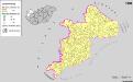
Siedlungsgebiet der Deutschen nach dem Nachbarschaftsindex für Westungarn 1980
Ungarn, Transdanubien, Deutsche, Siedlung Bottlik, Zsolt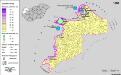
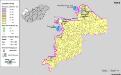
Siedlungsgebiet der Deutschen nach dem Nachbarschaftsindex für Westungarn 1880
Ungarn, Transdanubien, Deutsche, Siedlung Bottlik, Zsolt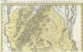
Comitatvs Posoniensis Germanis Presbvrg dicti Delineatio Geographica
1 : 150000 Mollova mapová sbírka Homann, Johann Baptist Alber, Johann Eberhard Homann, Johann Baptista - dědici
Kroaten in West-Ungarn 1941
Transdanubien Kroaten, Siedlung Bottlik, Zsolt
Kroaten in West-Ungarn 1880
Transdanubien Kroaten, Siedlung Bottlik, Zsolt
A horvátok aránya és száma Nyugat-Magyarországon 1980-ban
Transdanubien Kroaten, Siedlung Bottlik, Zsolt
Kroaten in West-Ungarn 1980
Transdanubien Kroaten, Siedlung Bottlik, Zsolt