Maps of Šrobárová

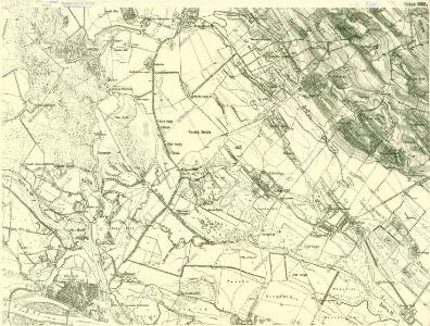
III. vojenské mapování 4860/4
1 : 25000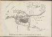
Komárom összes mellék-erőditéseinek s környékének vázlata 1849-ik évi állapotban
Ungarn Komorn
Neuhäusel und Komorn
1 : 75000 Komorn (Slowakei), Neuhäusel Geripp u. Terrain: J. Schulenburg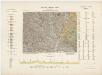
14 Zóna, XVIII Rovat, Érsekujvár és Komárom Vidéke, uit: [Geologische Specialkarte der im Reichsrathe vertretenen Königreiche und Länder der österreichisch-ungarischen Monarchie] / geologische Aufnahmen der königl. ung. Geologischen Anstalt
1 : 75000 Annotatie: Verantwoordelijkheidsvermelding in 1909 veranderd in: Königliche Ungarische Geologische Reichsanstalt; Sommige bladen in het Frans; Annotatie geografische gegevens: Coördinaten gebaseerd op nulmeridiaan van Ferro (Hierro) Königliche Ungarische Geologische Reichsanstalt; Königliche Ungarische Geologische Anstalt Budapest : [Königliche Ungarische Geologische Anstalt]
Neuhausel und Komorn.; Spezialkarte der osterreichisch-ungarischen Monarchie.
from Spezialkarte der osterreichisch-ungarischen Monarchie. Austro-Hungarian Monarchy. Militärgeographisches Institut.,
III. vojenské mapování 4860
1 : 75000
III. vojenské mapování 4860/3
1 : 25000
Komárno
1 : 75000 Slovensko Vojenský zeměpisný ústav
Komárno a Nové Zámky
1 : 75000 Slovensko Vojenský zeměpisný ústav
Komárno a Nové Zámky
1 : 75000 Slovensko Vojenský zeměpisný ústav
Schlacht bei Komorn am 11ten Juli 1849
1 : 61500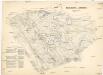
Schlacht bei Komorn am 11ten Juli 1849
1 : 61500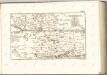
C. Comaromiensis
Ungarn Komitat Komorn (Ungarn)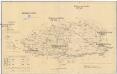
Komorner Comitat
1 : 290000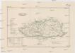
Komorner Comitat
1 : 288000 Komárno (Slovensko)
Komárom vármegye térképe
1 : 360000 Kogutowicz, Manó Magyar Földrajzi Intézet
Generální mapa ČSR

Barser und Honther Comitat
1 : 290000 Levice (Slovensko : oblast)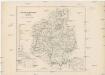
Barser und Honther Comitat
1 : 288000 Levice-oblast (Slovensko)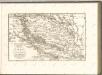

Komorn 148, uit: Special-Karte von Mittel-Europa / nach amtlichen Quellen bearbeitet von W. Liebenow
1 : 300000 titelvariant: W. Liebenow's Mittel-Europa; Annotatie: Titel boven de bladen: W. Liebenow's Mittel-Europa Johannes Wilhelm Liebenow 1822-1897 Frankfurt a. M. : Ludwig Ravenstein
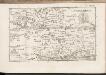
C. Strigontensis
Ungarn Komitat Gran (Ungarn)
Komárom Vármegye
1 : 340000 Slovensko jižní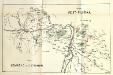
Stolice Pešť-Pilišská. Stolice Komárno a Ostřihom
Komitat Komárom-Esztergom, Komitat Pest-Pilis-Solt-Kiskun, ethnische Gruppe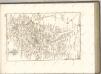

Generalkarte von Zentraleuropa
Comitatvs Posoniensis Germanis Presbvrg dicti Delineatio Geographica
1 : 150000 Mollova mapová sbírka Homann, Johann Baptist Alber, Johann Eberhard Homann, Johann Baptista - dědici
Bez titulu: mapy slovenských krajů