Maps of Tatabányai járás

III. vojenské mapování 4961
1 : 75000
Radvaň n. Dunajom
1 : 75000 Maďarsko Vojenský zeměpisný ústav
Zsámbék
1 : 75000 Maďarsko Vojenský zeměpisný ústav
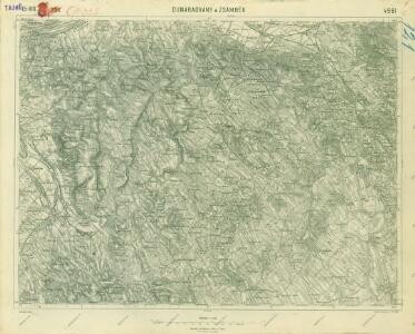
Dunaradvány a Zsámbék
1 : 75000 Maďarsko Vojenský zeměpisný ústav
Neszmély
1 : 25000 Maďarsko M. Kir. Állami Térképszeti Intézet
Neszmely und Zsambek.
from Spezialkarte der osterreichisch-ungarischen Monarchie.
Generální mapa ČSR

Komorn 148, uit: Special-Karte von Mittel-Europa / nach amtlichen Quellen bearbeitet von W. Liebenow
1 : 300000 titelvariant: W. Liebenow's Mittel-Europa; Annotatie: Titel boven de bladen: W. Liebenow's Mittel-Europa Johannes Wilhelm Liebenow 1822-1897 Frankfurt a. M. : Ludwig Ravenstein

C. Strigontensis
Ungarn Komitat Gran (Ungarn)
Komárom Vármegye
1 : 340000 Slovensko jižní
Stolice Pešť-Pilišská. Stolice Komárno a Ostřihom
Komitat Komárom-Esztergom, Komitat Pest-Pilis-Solt-Kiskun, ethnische Gruppe
C. Comaromiensis
Ungarn Komitat Komorn (Ungarn)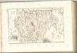

C. Albensis
Ungarn Fejér
Fejér válmegye
1 : 370000 Fejér (Maďarsko) Chiapó, Benjamin Benedicti, Hieronymus
Komárom vármegye térképe
1 : 360000 Kogutowicz, Manó Magyar Földrajzi Intézet
Comitat Stuhlweissenburg
1 : 300000
Comitat Stuhlweissenburg
1 : 280000 Székesfehérvár (Maďarsko)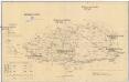
Komorner Comitat
1 : 290000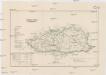
Komorner Comitat
1 : 288000 Komárno (Slovensko)
C. Pilisiensis ; C. Solthensis
Ungarn Komitat Pest-Pilis-Solt-Kiskun
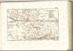
Mgy. Szolgyen und Gran.
from Spezialkarte der osterreichisch-ungarischen Monarchie.
Bicske und Martonvasar.
from Spezialkarte der osterreichisch-ungarischen Monarchie.
2 Ofen-Pest
Budapest
St. Andre - Ertsin
Mollova mapová sbírka Marsili, Luigi Ferdinando
Pilis hegység
1 : 50000 M. Kir. Állami Térképeszet
Acs und Totis.
from Spezialkarte der osterreichisch-ungarischen Monarchie.