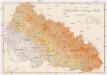
Maps of Yasinia

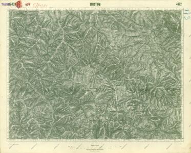
III. vojenské mapování 4672
1 : 75000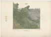
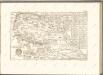
Zone 11, 12, Kol. XXX, Brusztura, uit: [Geologische Specialkarte der im Reichsrathe vertretenen Königreiche und Länder der österreichisch-ungarischen Monarchie] / geologische Aufnahmen der königl. ung. Geologischen Anstalt
1 : 75000 Annotatie: Verantwoordelijkheidsvermelding in 1909 veranderd in: Königliche Ungarische Geologische Reichsanstalt; Sommige bladen in het Frans; Annotatie geografische gegevens: Coördinaten gebaseerd op nulmeridiaan van Ferro (Hierro) Königliche Ungarische Geologische Reichsanstalt; Königliche Ungarische Geologische Anstalt Budapest : [Königliche Ungarische Geologische Anstalt]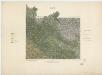
A Bruszturai m. kir. erdögondnokság "A" és "B" gazdasági osztályának átnézeti térképe
1 : 30000 Klösz György és fia
A Királymezöi m. kir. felsö erdögondnokság "A" és "B" gazdasági osztályainak átnézeti térképe
1 : 30000 Klösz György a syn
A Németmokrai m. kir. erdögondnokság "A B" és "C" gazdasági osztályainak átnézeti térképe
1 : 30000 Klösz György és fia
Brusztura.
from Spezialkarte der osterreichisch-ungarischen Monarchie.
Brustury
1 : 75000 Ukrajina Vojenský zeměpisný ústav
A Kalocsai m. kir. erdögondnokság A és B üzemosztályának átnézeti térképe
1 : 23000 Klösz Gy. és fia

Generalkarte von Zentraleuropa

Máramaros vármegye térképe
1 : 500000 Maramureş (Rumunsko) Kogutowicz, Manó Magyar Földrajzi Intézet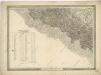
General-Karte des Königreiches Galizien und des Herzogthumes Bukovina
C. Marmarus
Rumänien Komitat Marmarosch
Řiditelství [sic] státních lesů Rachovo
1 : 75000 Voj. zeměpisný ústav
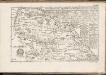
Horinčovo
1 : 75000 Ukrajina Vojenský zeměpisný ústav
Porohy.
from Spezialkarte der osterreichisch-ungarischen Monarchie.
Korosmezo und Mikuliczyn.
from Spezialkarte der osterreichisch-ungarischen Monarchie.
Mapa turistických cest značkovaných odb. K.Č.S.T. Rachov
1 : 200000 Československo Odbor klubu čsl. turistů
Körösmezö und Mikuliczyn
1 : 75000 Jasinja-oblast (Ukrajina) Jonak, Edl. Freyenwald von K. u. k. Militärgeographisches Institut
Berezna und Szinever.
from Spezialkarte der osterreichisch-ungarischen Monarchie.
Porohy
1 : 75000 Ukrajina Vojenský zeměpisný ústav
Rachov
1 : 75000 Ukrajina Vojenský zeměpisný ústav
Dubovo-Krasnišursky komposes. les

Comitat Marmaros
1 : 288000 Maramureş (Rumunsko)
Comitat Marmaros
1 : 280000 Marmarošská Sihoť (Rumunsko : oblast)
Generalkarte von Zentraleuropa

Ukrainae pars quae Pokutia vulgo dicitur / per Guil. le Vasseur de Beauplan S. R. M. Poloniae archit
1 : 310000 1 Karte : Kupferdruck ; 42 x 51 cm Beauplan, Guillaume le Vasseur de [Verlag nicht ermittelbar]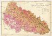
Podkarpatská Rus
1 : 225000 Podkarpatská Rus (Ukrajina) Gregor, František Novotný a Bartošek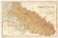
Podkarpatská Rus
1 : 225000 Podkarpatská Rus (Ukrajina) Gregor, František Novotný a Bartošek