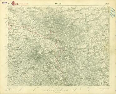
Maps of Moravskoslezský

III. vojenské mapování 4061
1 : 75000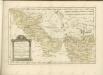

Mapa země Moravské. S částmi pohraničnými Slezska, Čech, Rakous i Uher
Přehledná mapa katastrálních území ve Slezsku

Slezská silniční mapa

Mapa Górnego Śląska
1 : 600000 Horní Slezsko Gregor, Józef K. Miarka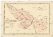
Mapa dekanátů, poutních míst a klášterů vévodství slezského
Slezsko (Česko)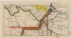
Sbírka map a diagramů použitých na mírových konferencích v Paříži v letech 1919 - 1920
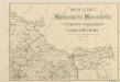
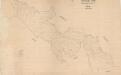
Mapa silnic Markrabství Moravského s enklávou Osoblažskou ve Vejvodství Slezském
Die Markgrafschaft Maehren mit dem Herzogthume Schlesien

Severomoravský kraj
Sbírka map a diagramů použitých na mírových konferencích v Paříži v letech 1919 - 1920
[Die Burgen Nordmährens und Schlesiens]
1 : 200000 Morava severní (Česko) Kubica, Franz Vojenský zeměpisný ústav
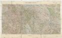
Kartographische Darstellung der Abstimmungs-Ergebnisse von Oberschlesien
1 : 100000 [im Auftrag des Auswärtigen Amtes bearb. in der Plankammer des Preußisch-Statistischen Landesamtes vom Gerke] ; mit Genehmigung der Landesaufnahme, Berlin Berlin : Berliner Lithographisches Institut
Kraj Ostravský

Kraj Ostravský

Kraj ostravský

Troppauer Kreis

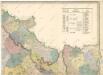
Přehledná hydrografická mapa povodí Odry na Moravě a ve Slezsku
1 : 750000 Odra-povodí Čs. státní ústav hydrologický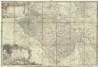
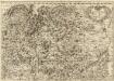
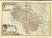
Principatvs Silesiae Oppaviensis novissima tabula geographica
1 : 150000 Opava-oblast (Česko) Wieland, Johann Wolfgang Schubarth, Matthäus Homannianos Heredes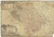
Principatvs Silesiae Oppaviensis novissima tabula geographica
1 : 150000 Opava-oblast (Česko) Wieland, Johann Wolfgang Schubarth, Matthäus Homannianos Heredes
Reisekarte durch die Mähr.-Schles.-Sudeten
1 : 200000 Jeseníky (Česko : pohoří) A. Blažek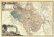
Principatvs Silesiae Oppaviensis novissima Tabula geographica.
1 : 150000 Mollova mapová sbírka Wieland, Johann Wolfgang Homann, Johann Baptista - dědici
[Die Markgraftschaft Mähren]
1 : 200000 Opava-oblast (Česko) Schenkl, Conrad Philipp Carl Winiker
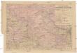
Der Troppauer Kreis
1 : 200000 Jeseníky (Česko) Schenkl, Conrad Philipp Carl Winiker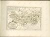
Das deutsche Sprachgebiet Nord-Mährens u. Schlesiens auf Grand der Volkszählung v. 31. Dec. 1880
1 : 300000 Morava severní (Česko) Held, Franz Wolfschütz Historisch-statistische Section der k. k. mährisch-schlesische Ackerbaugesellschaft
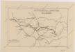
Granica Polski na Śląsku górnym
1 : 600000 Polsko Instytut kartograficzny Atlas