Maps of Mediterranean Sea

Carte nouvelle de la mer Mediterranée : divisée en mer de Levant et de Ponant, subdivisés en leurs principales parties ou mers : avec les observations des Mrs. de l'Académie
1 : 4375000 Sanson, Nicolas, 1600-1667 chez Pierre Mortier
Karte der Länder des Mittelmeeres
1 : 5000000 Středozemní moře-oblast Freytag & Berndt
101. Mediterranean Sea. The World Atlas.
1 : 10000000 USSR (Union of Soviet Socialist Republics).
Mare internum cum populis adiacentibus a Pompeii ex Asia reditu usque ad bellum Actiacum.
1 : 12000000 Menke, Th.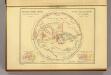
Geographie des Grecs Primitive.
Malte-Brun, Conrad, 1775-1826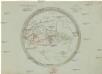
Aelteste Geographie der Griechen, nach dem Homer und Hesiodus
Afrika severní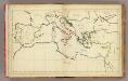
(Mediterranean Region)
1 : 10900000 Bowen, Frances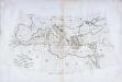
Carte des pays qu'occupe maintenant la mer Mediterranée
1 Karte : Kupferdruck ; 32 x 66 cm La Borde s.n.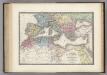
Nord de l'Afrique, Mediterranee.
1 : 9200000 Levasseur, E.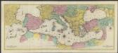
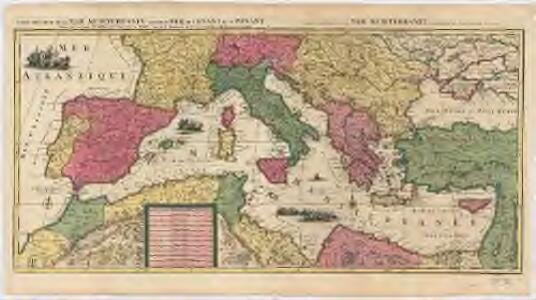
Carte géographique representant la Mer Méditerranée ou la seconde partie du Théatre de la guerre entre les russes et les turcs : c'est a dire les roiaumes, les étâts, les provinces et les diverses isles situées dans la dite Mer, avec la Mer Noire ou Pont Euxine et une partie de la province Georgie en Asia
1 : 4400000 par Tobie Conrad Lotter Augsbourg : Lotter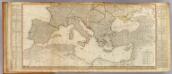
Europe (south)
1 : 4800000 Anville, Jean Baptiste Bourguignon d, 1697-1782; Kitchin, Thomas; Robert Laurie & James Whittle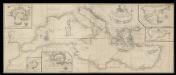
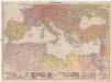
A correct chart of the Mediterranean sea from the coast of Portugal to the Levant
6 Carta nàutica. Conté: A plan of the city and Port of Civita-Vechia; The bay of Scanderoon; The bay of Tunis; A plan of the port of Neptune or Nation. Datació aproximada. Mount & Page William Mount & Thomas Page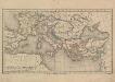
Europa und das oström. Reich zur Zeit der Kreuzzüge
Europa, Byzantinisches Reich, Kreuzzüge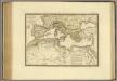
Nord de l'Afrique, Mer Mediterranee, Europe Meridionale.
1 : 9300000 Brue, Adrien Hubert, 1786-1832
Mittelländisches Meer
1 : 8250000 Středozemní moře-oblast Elfert, P. Geogr. Anstalt von Wagner & Debes
[Historisch-geographischer Atlas zu den allgemeinen Geschichtswerken von C. v. Rotteck, Pölitz u. Becker] : Die Küsten des Mittelländischen Meeres zur Uebersicht der ältesten Kolonisationen
von Julius Loewenberg [Freiburg im Breisgau] : [Herder]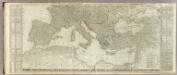
(Europe divided into its empires, kingdoms, states, republics, &c. Southern States)
1 : 4800000 Kitchin, Thomas
Mittelmeerländer
1 : 4000000 Afrika severní Georg Westermann
Mittelmeerländer
1 : 4000000 Afrika severní Georg Westermann
Mediterranean Basin.
1 : 6800000 Johnston, W. & A.K.
Carte geographique representant la Mer Mediterranée ou la seconde partie du théatre de la guerre entre les Russes et les Turcs
1 : 1000000 Evropa jižní Lotter, Tobias Conrad Tobie Conrad Lotter
L'Hellénisme dans l'Antiquité [I]
Makedonien Hellenismus Altertum Kümmerly & Frey
Overland Route To India.
1 : 24000000 Tallis, J. & F.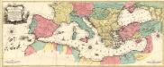
Carte Geographique representant la Mer Mediterranée ou la seconde Partie du Theatre de la Guerre entre les Russes et les Turcs
1 : 4400000 Mollova mapová sbírka Lotter, Tobias Conrad Lotter, Johann Jakob II.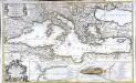
La mer Mediterranée
1 Karte auf 2 Blättern : Kupferdruck ; 53 x 87 cm Sanson; Denis; Basset; Basset chès Basset rue St. Jacques au coin de celle des Mathurins à l'Image S.e Genevieve
Europa Temporibus Expeditionum Sacrarum
Europa Kreuzzüge
Europa Aetate Napoleontis I
Europa Napoleon I., Frankreich, Kaiser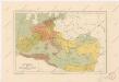
Evropa za stěhování národů