Maps of Westminster
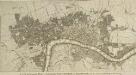
Urbium Londini et West-Monasterii nec non suburbii Southwark accurata ichnographia : in qua viae publicae omnes et singulae, plateae majores et minores, vici, angiporti, porticulae etc. una cum accessionibus aedificiorum, quibus urbs usque ad a. 1736, novissime locupletata est, reprasentantur : ad norman prototypi Londinensis edita curris Hommannianorum Heredum C.P.S.C.M
1 : 5280 Homann Erben (Firm) Homaennischen Erben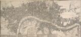
The LONDON GUIDE, or A POCKET PLAN of the CITIES OF LONDON & WESTMINSTER and BOROUGH of SOUTHWARK with the BEW BUILDINGS, &C to the present year
This map of Georgian London was published in John Entick's 1766'A New and Accurate History and Survey of London, Westminster and Southwark.' The title of the map appears in a panel below the plan along with the rates of hackney coaches and water ferries. It extends eastward to include Limehouse, then one of the main centres for shipbuilding in the capital. Bowles, Carington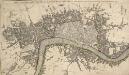
THE CITY GUIDE OR POCKET PLAN OF LONDON, WESTMINSTER And SOUTHWARK with the New Buildings to this Present Year 1764
This pocket map of London based on Rocque's map of 1748.Thetitle appears along the top, with the built-up area in the City of London described by stippling, and other built-up areas by crosshatching. The city boundaries are outlined in colour. The map shows the proposed new bridge at Blackfriars, but not the approaches. Designed by Robert Mylne, this third bridge to span the Thames was built between 1760 and 69. The nine semi-elliptical Portland-stone arches were replaced from 1860 to 69 by Cubitt and Carr’s present structure of five wrought-iron arches faced with cast iron and a granite pier.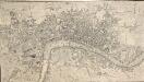
A NEW and Correct PLAN OF THE CITIES AND SUBURBS OF LONDON & WESTMINSTER & BOROUGH OF SOUTHWARK with the COUNTRY adjacent, the NEW BUILDINGS, ROADS &c. to the Year 1766
The title of this map runs along the top of the plan, which shows the new bridge at Blackfriars as "Pitt's Bridge". Designed by Robert Mylne, this third bridge spanning the Thames was built between 1760 and 69. The nine semi-elliptical Portland stone arches were replaced in a hundred years later by the present structure of five wrought-iron arches faced with cast-iron, and a granite pier designed by Cubitt and Carr. Gibson, John
A PLAN of the CITIES of LONDON AND WESTMINSTER and BOROUGH of SOUTHWARK 1771
The reference key of this map extends along the right margin and bottom of the map, with the title is in a cartouche. This map shows proposed lines of approach towards Blackfriars Bridge, later abandoned. Andrews, J.
A NEW and Correct PLAN of LONDON WESTMINSTER and SOUTHWARK with the New Buildings to the Year 1770
This map was published in 'A new and complete history and survey of the cities of London and Westminster... revised by Henry Chamberlain.' Only one edition was published and some copies omit the name of the engraver, J. Flyn. The Chelsea Waterworks are shown in Hyde Park. This was the first water-plant to use slow sand filtration to purify the water it supplied. Flyn, J.
THE CITY GUIDE OR POCKET PLAN OF LONDON, WESTMINSTER And SOUTHWARK With the New Buildings to the Year 1765 125
The title of this pocket map runs along the top, with the publisher's imprint below the plan. Built-up areas in the City of London are represented by stippling, and by crosshatching outside the city. The map is a later edition Bowles' 1761 plan, with the addition of Queen Anne's Square and Portman Square in Marylebone and the new bridge and approaches at Blackfriars. Designed by Robert Mylne, this third bridge spanning the Thames was built between 1760 and 69. The nine semi-elliptical Portland-stone arches were replaced from 1860 to 69 by the present structure of five wrought-iron arches, each faced with cast iron, and a granite pier designed by Carr and Cubbitt. Bayly, J.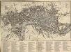
An IMPROVED PLAN of the CITIES of LONDON and WESTMINSTER and BOROUGH of SOUTHWARK, including the NEW BUILDINGS, ROADS &C. to the Present Year 1765.
The title of this pocket map appears along the top, with built-up areas represented by stippling in the City of London, and crosshatching elsewhere. A table of reference appears in a panel below the plan. The map, a later edition of Kitching and Parker's 1765 plan, shows the new bridge and the approaches at Blackfriars. Designed by Robert Mylne, this third bridge spanning the Thames was built between 1760 and 69. The nine semi-elliptical Portland stone arches were replaced from 1860 to 69 by the present structure of five wrought-iron arches each faced with cast iron, and a granite pier designed by Cubitt and Carr. Kitching, Thomas and Parker, Henry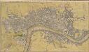
THE CITY GUIDE OR POCKET PLAN OF LONDON, WESTMINSTER And SOUTHWARK With the New Buildings to the Year 1765 121
The title of this map of London runs along the top, with built-up areas represented by stippling within the city boundaries, and hatched elsewhere. Fields and open spaces are shown in green. This first edition of the map does not show the new bridge at Blackfriars, added to the later editions. Bowles, John & Thomas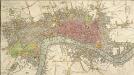
An IMPROVED PLAN of the CITIES of LONDON and WESTMINSTER and BOROUGH of SOUTHWARK, including the NEW BUILDINGS, ROADS &C.
This coloured map shows the built-up area of the City of London as a stippled pattern, with other built-up areas crosshatched. This map is a later edition of Kitching and Parker's 1765 plan, updated to include the new bridge and the approaches at Blackfriars as finally laid out. Designed by Robert Mylne, this third bridge spanning the Thames was built between 1760 and 69. The nine semi-elliptical Portland stone arches were replaced from 1860 to 69 by the present structure of five wrought-iron arches each faced with cast iron, and a granite pier designed by Cubitt and Carr. Kitching, Thomas and Parker, Henry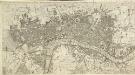
The LONDON DIRECTORY, or a New & Improved PLAN of LONDON, WESTMINSTER & SOUTHWARK; with the adjacent Country
The title of this folding map appears along the top. The plan shows Blackfriars Bridge, which was under construction between 1760 and 1769. There is uncertainty about the date of this map. It is very similar to the 1765 map by Robert Sayer and was probably produced from the same plate. Laurie& Whittle took over Sayer's stock in 1792, making an earlier publication date very unlikely. Laurie, Robert, and Whittle, James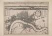
A New Map of the Cities of London and Westminster and Ye Borough of Southwarke with the Suburbs
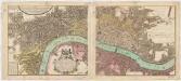
Large map of London with prospect view of the City from Bankside in a strip above the main plan. Entitled "Prospect of London as it was flourishing before the destruction by fire", the view is based on Hollar's celebrated view of London from Bankside of 1647 and shows London from Worcester House (just west of the Savoy) on the west to Wapping and St Catherine's Docks to the east. The view shows London before the fire being composed almost exclusively of Gothic buildings, Inigo Jones’s Banqueting Hall at Whitehall and the classical restoration of St. Paul’s cathedral being the only examples of Renaissance architecture. The map, with title in cartouche, reference tables at top right and top left and scale bar at bottom centre, is a very minute bird's eye view of the cities of London and Westminster, the borough of Southwark and the suburbs showing London after the fire growing in area faster than ever before. Stepney Church, for example, marks a new point of growth east of the city. Hollar, Wenceslaus
A Plan of the Cities of London and Westminster, the Borough of Southwark, and the contiguous Buildings..
This map of London in eight sheets is enclosed by a decorative border and features title along the top, with scale bars, reference table and advertisement along the bottom. The advertisement states that the map is bases on Rocque's map of 1747, with the addition of all the new buildings, Westminster Bridge and the approach roads to the bridge. Rocque, John
BOWLES'S Reduced NEW POCKET PLAN of the CITIES of LONDON and WESTMINSTER, with the BOROUGH of SOUTHWARK, exhibiting the NEW BUILDINGS to the YEAR 1783.
Carrington Bowles (1724-93) came from a family of publishers and map sellers who published a considerable body of work during a century of trading. This is the fifth edition of an original 1777map. It includes a table of references to churches and principal buildings. The built-up areas of the City of London are stippled, with the city and county boundaries delineated by coloured lines. The scale is given in miles or furlongs in the bottom right-hand corner. Carrington Bowles
The LONDON DIRECTORY, or a New & Improved PLAN of LONDON, WESTMINSTER, & SOUTHWARK;
This is a reissue of a map first published in 1771 by John Bowles. Bowles' name has been removed, with the imprint of there issuer, Robert Wilkinson, appearing instead. This map highlights the London Wall in red, showing with arrows the direction of water-flow in the Thames. Bowles, John
The ICHNOGRAPHY of the Cities of LONDON and WESTMINSTER and the Borough of SOUTHWARK 115
"Ichnography" means ground-plan. This small map was published in 'The Natural History of England' by the scientist and instrument-maker Benjamin Martin. This was part of the complete work 'General Magazine of Arts and Science' issued between 1756 and 1761. The map's title appears in a square table at top right. Built-up areas are stippled within the boundaries of the City of London, and crosshatched elsewhere. Owen, William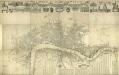
London & c., accurately Surveyed, an accurate Plan of the Cities of London and Westminster and the Borough of Southwark, 1732
This is a later edition of the map of London first issued by Morden and Lea in 1681-82. Printed in 12 sheets, the map features title in banner along the top, portraits of King William and Queen Mary below the title, with the Royal and City arms. Reference tables, compass rose and scale bar at lower right. Along the top of the map are views of Westminster Abbey, the Banqueting Hall, Somerset House, the Mercers' Chapel, the Royal Exchange, Guild Hall and St Paul's Cathedral, with equestrian statues of Charles I and Charles II at top left and right respectively. The map shows Wigmore Street, Grosvenor Square and the Church of St Anne, Limehouse which did not feature in earlier editions of the map. Morden, Robert and Lea, Philip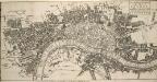
The ICHNOGRAPHY of the Cities of LONDON and WESTMINSTER and the Borough of SOUTHWARK 115x
This small map was published in 'The Natural History of England' by the scientist and instrument-maker Benjamin Martin. It comprised part of the complete 'General Magazine of Arts and Science' issued between 1756 and 1761. The map's title features in a square table at top right, and represents the built-up area within the city boundaries with stippling, and other built-up areas with crosshatching. "Ichnography" means ground-plan. Owen, William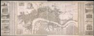
A New & Exact Plan of the Cities of London, & c.
Map of London with title along the top, arms of the 12 principal livery companies at top left with City arms and emblems of the arts. Lists of wards and parishes are reported in a table at bottom left and a descriptive note near bottom centre, with fares of coaches and ferries at bottom right. Down both sides of the map are views of prominent buildings: St Paul's Cathedral, the Banqueting House, the Royal Exchange, Custom House, the Admirably Office, the Royal Palace at St James', Westminster Abbey, Guildhall, the Bank of England, the Tower of London, the Treasury and South Sea House. Foster, George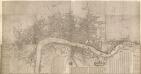
London &c., accurately surveyed by Wm Morgan, His Majesty Cosmographer
This is a later edition of the map of London and the built up area around it first issued by Morgan in 1681-82. The title of the map is missing. Also missing are the views of the equestrian statues of Charles I and II, prominent buildings and prospect of the City that accompanied the map. The map features scale bar and compass rose near bottom centre and reference tables with key to buildings in London, Westminster and Southwark along the bottom. Down the left is a list of officers of State and dignitaries and down the right is a list of City companies, Irish nobility and the clergy. Morgan, William
The LONDON DIRECTORY, or a New & Improved PLAN of LONDON, WESTMINSTER, & SOUTHWARK; 152
Robert Laurie was a fine mezzotint engraver and regular exhibitor at the Society of Artists in the 1770s. He acquired the stock of surveyor John Sayer’s in 1794 and, in partnership with James Whittle, founded the map publishing firm Laurie & Whittle. This map is very similar to the 1765 map by Robert Sayer and is probably from the same plate. Blackfriars Bridge is shown along with its proposed approaches. Laurie, Robert, and Whittle, James.
The LONDON DIRECTORY, or a New & Improved PLAN of LONDON, WESTMINSTER, & SOUTHWARK; 157
This is the eighth edition of the an original 1765Sayer map. Bennett’s name was added to the imprint of the third edition of the map, published in 1776. The two men were in partnership between 1770 and 1787.Their business was taken over by Laurie and Whittle in 1792. R. Sayer & J. Bennett
The LONDON DIRECTORY, or a New & Improved PLAN of LONDON, WESTMINSTER, & SOUTHWARK; 182
This map is a reissue of a map published in 1771 by John Bowles. Bowles's name has been replaced by that of Robert Wilkinson, the reissuer. A table of references to churches and public buildings appears below the map. The built-up area of the city is stippled, with other built-up areas done in crosshatching. Coloured lines delineate individual city wards. Bowles, John
The LONDON DIRECTORY, or a New & Improved PLAN of LONDON, WESTMINSTER & SOUTHWARK;
The title of this map appears along the top, with a key in panel below the plan and letters along the borders for reference. Sayer's maps of London, largely derivative, were issued with few alterations throughout the middle years of the 18th Century. This is a later edition of a map he first published in 1765, updated to include the approaches to Blackfriars Bridge, which did not feature in the first edition. Sayer, Robert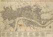
BOWLES'S Reduced NEW POCKET PLAN of the CITIES of LONDON & WESTMINSTER; WITH THE BOROUGH OF SOUTHWARK, exhibiting the New Buildings to the YEAR 1780
The Bowles family were successful map publishers and sellers whose considerable output spanned a century. This map is the second edition of an original 1777plan. It includes a table of references to churches and principal buildings. The built-up areas of the City of London are stippled. The scale is given in miles or furlongs. Bowles, Carington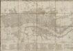
BOWLES'S Reduced NEW POCKET PLAN of the CITIES of LONDON and WESTMINSTER, with the BOROUGH of SOUTHWARK, exhibiting the NEW BUILDINGS to the YEAR 1787.
This is the sixth edition of Bowles's Reduced New Pocket Plan. The map was reissued 11 times between1777 and 1799. It includes a table of references to churches and principal buildings. The built-up areas of the City of London are represented by stippling; with the city boundaries delineated it red. The scale is given in miles and furlongs. Bowles, Carington
The LONDON DIRECTORY, or a New & Improved PLAN of LONDON,
Robert Sayer, the surveyor, traded as a map publisher and print seller in Fleet Street in the latter half of the 18th Century. Between 1751 and 1770and againfrom1784to 1794, he published maps under his own name or under the imprint of Sayer and Bennett. This is the 11th edition of a map published 14 times over a period of 27 years. During this time Robert Sayer became joined in partnership with John Bennett, with their joint imprint appearing on the third to eighth editions. The area of the city is highlighted in pink. A table of references for churches and public buildings appears below the map. In 1794 Sayers stock was acquired by Robert Laurie who founded the map publishing firm of Laurie & Whittle, with his friend James Whittle. Sayer, Robert
The LONDON DIRECTORY, or a New & Improved PLAN of LONDON, WESTMINSTER, & SOUTHWARK
This is the fifth edition of a map originally published in 1771 by John Bowles. His name has been replaced by the imprint of Robert Wilkinson, the reissuer. This map highlights the London Wall in red, and colours the city in pink. It uses arrows to show the direction of water-flow in the Thames. There are some additions to the map near Foundling Hospital. Bowles, John
Plan of London, Westminster & Southwark