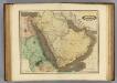
Maps of Arabian Peninsula
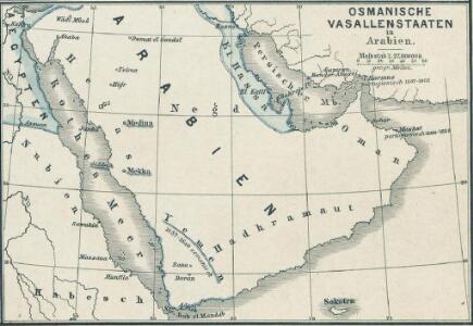
Osmanische Vasallenstaaten in Arabien
1 : 27000000 Osmanisches Reich, Arabien, Protektorat
Arabie, mer Rouge, et Golfe Persique
1 : 11350000 Arabský poloostrov Bonne, Rigobert André
Arabien
1 : 6000000 Omán Kiepert, Heinrich Nöedeke, Th. D. Reimer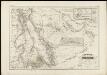
Arabia und das Nil-land
1 : 400000 den Manen Karsten Niebuhr's und den hochverdienten Forschern L.G. Ehrenberg u. E. Rüppell zugeeignet vom Verfasser [Heinrich Karl Wilhelm Berghaus] gestochen von Adolph Maedel in Weimar Gotha : bei Justus Perthes
Arabia et Arabicus sinus
1 : 5700000 Arabský poloostrov Reichard, Christian Gottlieb Campius, D. a D. Campio
152-153. Arabian Peninsula. Bahrein (Bahrain) Islands. The World Atlas.
1 : 5000000 USSR (Union of Soviet Socialist Republics).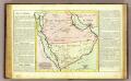
L'Arabie.
1 : 7000000 Clouet, J. B. L. (Jean-Baptiste Louis), b. 1730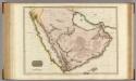
Arabia.
1 : 4500000 Pinkerton, John, 1758-1826
Arabia.
1 : 13800000 Darton, William
Arabien.
1 : 5500000 Weiland, C. F. (Carl Ferdinand), d. 1847
Arabien.
1 : 9400000 Radefeld, Carl Christian Franz, 1788-1874
Arabie
Nouvel atlas physique politique et historique de l'Empire ottoman et des états limitrophes en Europe, en Asie et en Afrique, en quarante feuilles Hellert, J.J. Bellizard, Dufour et Cie
ARABIA.
[Amsterdam : Joan Blaeu]
Arabiae Felicis, Petraeae et Desertae nova et accurata delineatio. [Karte], in: Novus atlas absolutissimus, Bd. 6, S. 102.
1 Karte aus Atlas Janssonius Offizin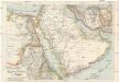
G. Freytags Kriegskarte von Ägypten, Palästina und Arabien
1 : 5000000 Egypt Freytag, Gustav Kartogr. Anstalt G. Freytag & Berndt
Arabien
1 : 23188000 Arabský poloostrov Schlieben Gleditsch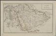
Schul-Atlas für die alte Erdbeschreibung : zur allgemeinen Schul-encyclopädie gehörig
J. H. Campe Zusammensetzung und Zeichnung von [...] Dufour, unter Leitung von Heusinger ; gestochen von Frentzel. Braunschweig : Schulbuchhandlung
Arabien, Ägypten, Nubien und Habesch
Schul-Atlas in 36 Karten Völter, Daniel Verlag der J.M. Dannheimer'schen Buchhandlung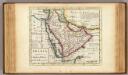
Arabia.
1 : 16000000 Moll, Herman, d. 1732
Arabien
1 : 5700000 entworfen und gezeichnet von C.F. Weiland Weimar : Verlag des Geograph. Instituts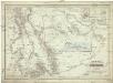
Arabia und das Nil-Land
1 : 4000000 Arabský poloostrov Berghaus, Heinrich Karl Wilhelm Ehrenberg, L. G. Justus Perthes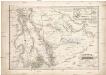
Arabia und das Nil-Land
1 : 4000000 Arabský poloostrov Berghaus, Heinrich Karl Wilhelm Ehrenberg, L. G. Justus Perthes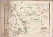
Arabia und das Nil-Land
1 : 4000000 Arabský poloostrov Berghaus, Heinrich Karl Wilhelm Ehrenberg, L. G. Justus Perthes
Neueste Karte von Arabien
Grosser Hand-Atlas über alle Theile der Erde in 170 Karten Meyer, J. Verlag des Bibliographischen Instituts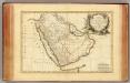
Arabie.
1 : 9300000 Bonne, Rigobert, 1727-1794
Arabia, Egypt, Nubia, Abyssinia.
1 : 8870400 Letts, Son & Co.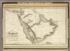
Arabia.
1 : 9250000 Playfair, Principal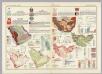
States of the Arabian Peninsula. Iran, Afghanistan. Pergamon World Atlas.
Polish Army Topography Service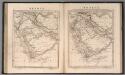
Arabia
1 : 11000000 Arrowsmith, Aaron Jr.