Maps of Greater Antilles
[Karibik]
1 : 45000000 Karibik
Carte des Isles Antilles dans l'Amérique septentrionale, avec la majeure partie des isles Lucayes faisant partie du théâtre de la guerre entre les anglais et les américains
1 : 3700000 Brion de La Tour, Louis, géographe 1756-1803 Paris : chés Esnauts et Rapilly
Island of Haiti. Lesser Antilles. Puerto Rico. Cuba.
1 : 3095000 Hammond, C.S.
Cuba mit den benachbarten Inseln und Gebieten
1 : 6000000 Atlantský oceán Carl Flemming
A map of the English, French, Spanish, Dutch, & Danish Islands, in the West Indies, taken from an improved map of the geographer to the King of France, with the tract of the last West India Fleet, through the Windward Passage
1 : 4942000
Cuba, Jamaica and Puerto Rico.
1 : 2950000 Colton, G.W.
West Indies.
1 : 6500000 Rand McNally and Company
Insularaum Hispaniolae et Cubae Cum Insulis circum jacentibus accurata delinatio. [Karte], in: Novus atlas absolutissimus, Bd. 9, S. 65.
1 Karte aus Atlas Janssonius Offizin
Cuba Insula ; Hispaniola Insula
1 : 1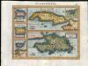
Zeilan Insula
1 : 1
Cuba Insula [Karte], in: Gerardi Mercatoris Atlas, sive, Cosmographicae meditationes de fabrica mundi et fabricati figura, S. 556.
1 Karte aus Atlas Mercator, Gerhard Montanus, Petrus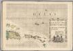
A Map of the British Empire in America. (Sheet 15).
1 : 2000000 Popple, Henry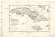
Isles de Cuba et de Jamaique
1 : 3280000 Jamajka Bonne, Rigobert André
A new chart of the seas surrounding the island of Cuba, with the soundings, currents, ships, courses &c. and a map of the island itself lately made by an officer in the Navy
1 : 4400000
West Indies.
1 : 3453120 Rogers, Henry Darwin
Cuba en Iamaica : soo als die door Kolumbus ontdekt, en by de Kastilianen bevolkt sijn = les de Cuba et de la Jamaique : ainsi qu'elles ont été prémierement découvertes par Christ. Colombe, ensuite peuplées par les Castillans ...
1 : 6500000
Cuba, Jamaica and Puerto Rico.
1 : 3000000 Colton, G.W.
Cuba, Jamaica and Puerto Rico.
1 : 3000000 Colton, G.W.
Cuba, Jamaica and Puerto Rico.
1 : 3000000 Colton, G.W.
Cuba Jamaica And Porto Rico.
1 : 2977920 Johnson, A.J.
Cuba, Jamaica And Porto Rico.
1 : 3041280 Colton, G.W.
West Indies, Cuba, Jamaica and Porto Rico.
1 : 3000000 Colton, G.W.
The West Indies, Cuba, Jamaica and Puerto Rico.
1 : 3000000 Colton, G.W.
Isla de Cuba, hoja 1
1 : 1000000 1 Mapa en dos fulls, col. Dins: Atlas de España y sus posesiones de ultramar Coello, Francisco ; Madoz, Pascual [Imprenta del Atlas de España]
Cuba.
1 : 2851200 Lucas, Fielding Jr.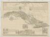
[Posesiones de America, Isla de Cuba]
1 : 1000000 Coello, Francisco [Verlag nicht ermittelbar]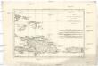
L'isle de St. Domingue, et celle de Porto-Rico
1 : 2930000 Hispaniola (ostrov) Bonne, Rigobert André
Mapa de la Isla de Cuba
Karibská oblast Torre, José Maria D., de la Pego, Andres
![[Karibik]](https://images-2.georeferencer.com/images/iiif/137544061313/full/,300/0/native.jpg)

