Maps of Hungary
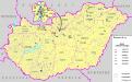
A szlovákok száma és aránya Magyarország mai területén 1910-ben
Ungarn Slowaken Bottlik, Zsolt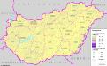
A románok száma és aránya Magyarország mai területén 1910-ben
Ungarn Rumänen Bottlik, Zsolt
A románok száma és aránya Magyarország területén 1990-ben
Ungarn Rumänen Bottlik, Zsolt
A szlovákok száma és aránya Magyarország területén 1990-ben
Ungarn Slowaken Bottlik, Zsolt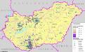
A németek száma és aránya Magyarország területén (2001) és kisebbségi önkormányzataik (2004)
Ungarn Deutsche, Selbstverwaltung Bottlik, Zsolt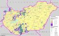
A németek száma és aránya Magyarország mai területén 1910-ben
Ungarn Deutsche Bottlik, Zsolt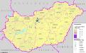
A szerbek száma és aránya Magyarország területén (2001) és kisebbségi önkormányzataik (2004)
Ungarn Serben, Selbstverwaltung Bottlik, Zsolt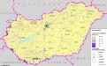
A horvátok száma és aránya Magyarország területén (2001) és kisebbségi önkormányzataik (2004)
Ungarn Kroaten, Selbstverwaltung Bottlik, Zsolt
A románok száma és aránya Magyarország területén (2001) és kisebbségi önkormányzataik (2004)
Ungarn Rumänen, Selbstverwaltung Bottlik, Zsolt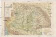
Carte physique de la Hongrie
1 : 2400000 Maďarsko Cholnoky, Béla J. Kogutowicz, Károly Inst. Géogr. Hongr. Soc. Anonyme
A szerbek száma és aránya Magyarország mai területén 1910-ben
Ungarn Serben Bottlik, Zsolt
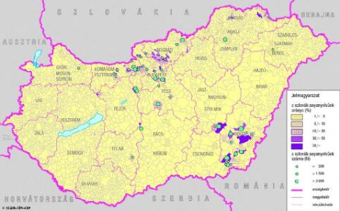
A szlovákok száma és aránya Magyarország területén (2001) és kisebbségi önkormányzataik (2004)
Ungarn Slowaken, Selbstverwaltung Bottlik, Zsolt
A németek száma és aránya Magyarország területén 1990-ben
Ungarn, Deutsche Bottlik, Zsolt
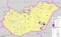
A horvátok száma és aránya Magyarország területén 1990-ben
Ungarn Kroaten Bottlik, Zsolt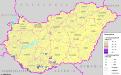
A horvátok száma és aránya Magyarország mai területén 1910-ben
Ungarn Kroaten Bottlik, Zsolt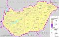
A szlovén száma és aránya Magyarország területén (2001) és kisebbségi önkormányzataik (2004)
Ungarn Slowenen, Selbstverwaltung Bottlik, Zsolt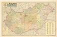
A Magyar népköztársaság kozigazgatási térképe
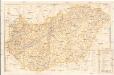
Magyar autotérkép
1 : 500000 Maďarsko Aczél testvérek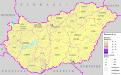
Serben auf dem Gebiet des heutigen Ungarn 1910
Ungarn Serben Bottlik, Zsolt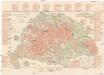
Terkép az 1905-évi országgy. képviselöválasztások eredményéröl
Maďarsko Freytag G. és Berndt
Deutsche in Ungarn 1990
Ungarn, Deutsche Bottlik, Zsolt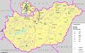
Az egyéb bevett nemzetiségek kisebbségi önkormányzatai (2004) Magyarországon
Ungarn Minderheiten, Selbstverwaltung Bottlik, Zsolt
Slowaken in Ungarn 1990
Ungarn Slowaken Bottlik, Zsolt
92. Hungary. The World Atlas.
1 : 1250000 USSR (Union of Soviet Socialist Republics).
Slowenen in Ungarn (2001) und ihre Selbstverwaltung (2004)
Ungarn Slowenen, Selbstverwaltung Bottlik, Zsolt
Rumänen in Ungarn 1990
Ungarn Rumänen Bottlik, Zsolt
Rumänen auf dem Gebiet des heutigen Ungarn 1910
Ungarn Rumänen Bottlik, Zsolt
Serben in Ungarn (2001) und ihre Selbstverwaltung (2004)
Ungarn Serben, Selbstverwaltung Bottlik, Zsolt
Deutsche in Ungarn (2001) und ihre Selbstverwaltung (2004)
Ungarn Deutsche, Selbstverwaltung Bottlik, Zsolt