Maps of Arad

Lippa
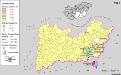
1 : 75000 Lipova, Arad (Judeţ)
Lambert-Cholesky sheet 1963 (Cuvin)
1 : 20000 Romanian military topographic map sheet under Lambert-Cholensky projection Institutul Geografic Militar geo-spatial.org Institutul Geografic Militar
Lambert-Cholesky sheet 1962 (Lipova)
1 : 20000 Romanian military topographic map sheet under Lambert-Cholensky projection Institutul Geografic Militar geo-spatial.org Institutul Geografic Militar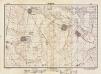
Lambert-Cholesky sheet 1862 (Frumuşeni)
1 : 20000 Romanian military topographic map sheet under Lambert-Cholensky projection Direcția Topografică Militară geo-spatial.org Direcția Topografică Militară
Lambert-Cholesky sheet 1863 (Mikalaka)
1 : 20000 Romanian military topographic map sheet under Lambert-Cholensky projection Serviciul Geografic al Armatei geo-spatial.org Serviciul Geografic al Armatei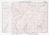
Lambert-Cholesky sheet 2063 (Vrf. Highiş)
1 : 20000 Romanian military topographic map sheet under Lambert-Cholensky projection Institutul Geografic Militar geo-spatial.org Institutul Geografic Militar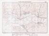
Lambert-Cholesky sheet 2062 (Odvoş)
1 : 20000 Romanian military topographic map sheet under Lambert-Cholensky projection Institutul Geografic Militar geo-spatial.org Institutul Geografic Militar
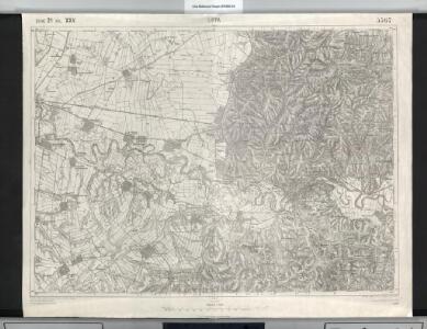
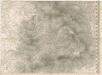
Lippa.
from Spezialkarte der osterreichisch-ungarischen Monarchie.
Lambert-Cholesky sheet 1961 (Buchberg)
1 : 20000 Romanian military topographic map sheet under Lambert-Cholensky projection Serviciul Geografic al Armatei geo-spatial.org Serviciul Geografic al Armatei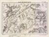
Lambert-Cholesky sheet 1861 (Fibis)
1 : 20000 Romanian military topographic map sheet under Lambert-Cholensky projection Direcția Topografică Militară geo-spatial.org Direcția Topografică Militară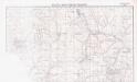
Lambert-Cholesky sheet 2061 (Şiştarovăţ)
1 : 20000 Romanian military topographic map sheet under Lambert-Cholensky projection Neprecizat geo-spatial.org Neprecizat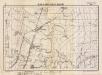
Lambert-Cholesky sheet 1864 (Simand Ujfalu)
1 : 20000 Romanian military topographic map sheet under Lambert-Cholensky projection Serviciul Geografic al Armatei geo-spatial.org Serviciul Geografic al Armatei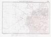
Lambert-Cholesky sheet 1964 (Şiria)
1 : 20000 Romanian military topographic map sheet under Lambert-Cholensky projection Institutul Geografic Militar geo-spatial.org Institutul Geografic Militar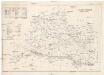
Arader Comitat
1 : 290000
Arader Comitat
1 : 288000 Arad (Rumunsko)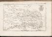
C. Aradiensis
Rumänien Komitat Arad (Rumänien)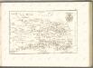

Tekintetes Temes vármegye térképe
Temešvár (Rumunsko) Györy, Lajos Beichel, J.
Apatelek und Simano.
from Spezialkarte der osterreichisch-ungarischen Monarchie.
Nada und Soborsin.
from Spezialkarte der osterreichisch-ungarischen Monarchie.
Lambert-Cholesky sheet 2064 (Agriş)
1 : 20000 Romanian military topographic map sheet under Lambert-Cholensky projection Institutul Geografic al Armatei geo-spatial.org Institutul Geografic al Armatei
Generalkarte von Zentraleuropa
Das Oesterreichische-Kaiserthum

Plan von Bergwerg Laposneck
Mollova mapová sbírka Geyer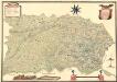
Mappa Der Grenz Scheidung Des Banat Temeswar Von Anno 1749 Mit Den Türken Geschlosen Von Herren General Feldmarschaů Lieutinont Freiheren Frantz Von Engelshofen A. 1749
Mollova mapová sbírka Geyer
Plan des Bergwergs zu Lupkovo
Mollova mapová sbírka Geyer
Siedlungsgebiet der Slowaken nach dem Nachbarschaftsindex für die Südliche Tiefebene 1880
Ungarn (Süd) Slowaken, Siedlung Bottlik, Zsolt
Théatre de la Guerre dans le Bannat de Temeswar
1 : 510000 Mollova mapová sbírka Briffaut, Etienne Briffaut, Etienne
Das Temeschwarer Bannat
1 : 389000 Banát Güssefeld, Franz L. Liesganig, Joseph von den Homann. Erben