Maps of Pontic Steppe
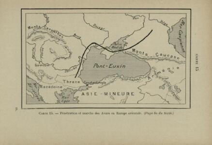
Pénétration et marche des Avars en Europe orientale
Osteuropa Avaren Völkerwanderungszeit
Le Theatre de la Guerre entre les deux puissans Empires de Russie et de Turquie, tant en Europe qu'en Asie :
1 : 2200000 Mollova mapová sbírka Jaeger, Johann Wilhelm Abraham Facius, Johann Gottlieb Jäger, Johann Wilhelm Abraham
Europe 4.
1 : 3850000 Brue, Adrien Hubert, 1786-1832
[Ethnographische Karte von Europa]
Zweiter Band, enthaltend in vier Abtheilungen die Vertheilung der Organismen: 5. Pflanzen-Geographie, 6. Thier-Geographie, 7. Anthropographie, 8. Ethnographie Humboldt, Alexander von Verlag von Justus Perthes
Nr. 5. Rußland und Konstantinopel
Schwarzmeer-Gebiet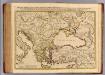
Imperii Orientalis et Circumjacentium Regionum.
1 : 4500000 L'Isle, Guillaume de, 1675-1726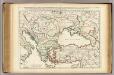
Imperii Orientalis et Circumjacentium Regionum.
1 : 4500000 L'Isle, Guillaume de, 1675-1726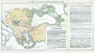
Nr. 12. Der Verfall der Türkei und die griechischen Freiheitskämpfe bis 1829
Osmanisches Reich Griechischer Unabhängigkeitskrieg
Oesterreichisch-russisch-türkischer Kriegsatlas
1 : 1500000 Evropa jižní Šimek, Maxmilian F. A. Schraembl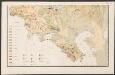
Carte des gîtes miniers de la Russie d'Europe
1 : 4200000 Süd-Blatt Möller, Valerian von Département des Mines de Russie
Balkánské státy a Turecko
1 : 3000000 Bospor (Turecko : průliv) Paulík, Ant. Klus, František Ústřední učitelské nakladatelství a knihkupectví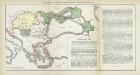
Nr. 8. Der Verfall der Türkei und die griechischen Freiheitskämpfe bis 1829
Osmanisches Reich Griechischer Unabhängigkeitskrieg
Partie orient.le de la mer Méditerranée
1 Karte : Kupferdruck ; 49 x 55 cm Robert de Vaugondy chés l'auteur quay de l'horloge du Palais près le pont neuf
Eastern part of the mediterranean sea with the coasts of Turky Anatolia Syria Egypt and Barbary
1 Blatt : 53 x 68 cm Sayer
Europa befolkningskarta

Russisch-türkischer Kriegsschauplatz, 1877
1 : 3700000 Petermann, August Perthes
Het oorlogsterrein aan de Zwarte Zee : (vogelperspectief)
Annotatie: Onder de kaart: De toeschouwer stelle zich geplaatst te zijn 300 k.m. boven den Hellespont met het gezicht naar het Noord-Oosten Arnhem : Van Egmond & Heuvelink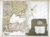
Karte von Europa, 4
4 Blätter : 52 x 70 cm Verlag der Königlich-Preussischen Academie-Kunst- und Buchhandlung
La mer Mediterranée vers l'orient
1 Karte : Kupferdruck ; 38 x 49 cm Duval P. Duval
Carte du teatre de la guerre dans la Pologne, Moscovie & Turquie
1 : 3250000 Evropa jihovýchodní Visscher, Nicolaus Schenk, Pieter apud Petrum Schenk
Grece. Caucase et Crimee.
1 : 2000000 Jouvet et Cie.
Russisch-türkischer Kriegsschauplatz, 1877
1 : 3700000 Balkánský poloostrov Petermann, A. Justus Perthes
Das Osmanische Reich nach seiner größten Ausdehnung im XVII. Jahrhundert.
osmanská říše Benecke Bormann, E. F. Tempsky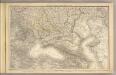
Das Russische Reich in Europa Sud.
1 : 4475000 Stein, Christ. Gottfr. Dan.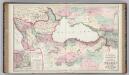
Vicinity of the Black Sea.
1 : 3787000 Gray, Ormando Willis
Empire Ottoman.
Andriveau-Goujon, J.
Europe 3.
1 : 2800000 Anville, Jean Baptiste Bourguignon d, 1697-1782
Das Osmanische Reich nach seiner grössten Ausdehnung im XVIIten Jahrhundert
1 : 12000000 Osmanisches Reich
Des europäischen Russlands südlicher Theil
Allgemeiner Atlas [Walch, Johannes] im Verlag bei Johannes Walch
Küstenländer des Schwarzen Meeres
1 : 8880000 Černé moře-oblast Renner Kleinknecht