Maps of powiat głubczycki
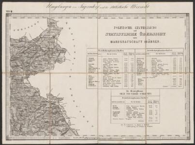
Umgebungen von Jägerndorf und die statistische Uebersicht
1 : 144000 K.K. Militärisches Geographisches Institut
146. Ratibor, uit: Topographische Uebersichtskarte des Deutschen Reiches / herausgegeben v. d. Kartogr. Abt. d. Königl. Preuß. Landesaufnahme
1 : 200000 titelvariant: Topogr. Übersichtskarte des Deutschen Reiches; Annotatie: Titel boven bladen ook: Topogr. Übersichtskarte des Deutschen Reiches; Annotatie geografische gegevens: Op elk blad twee maatstokken: 10 Kilometer = 5,5 cm; 1 geogr. Meile = 3,6 cm; Legenda onder op elk blad Königlich Preußische Landesaufnahme. Kartographische Abtheilung [S.l : Königlich Preußische Landesaufnahme, Kartographische Abtheilung]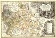
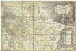
Principatvs Silesiae Karnoviensis nova et exactissima Tabula geographica, commonstrans insimul districtus ac Statvs Minores Frevdenthal Olbersdorf et Stevberndorf.
1 : 1125000 Mollova mapová sbírka Wieland, Johann Wolfgang Homann, Johann Baptista - dědici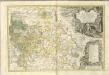
Principatvs Silesiae Karnoviensis nova et exactissima tabula geographica commonstrans insimul districtus ac statvs minores Frevdenthal, Olbersdorf et Stevberndorf
1 : 100000 Bruntál-oblast (Česko) Wieland, Johann Wolfgang Schubarth, Matthäus Homannianos Heredes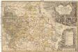
Principatvs Silesiae Karnoviensis nova et exactissima tabula geographica commonstrans insimul districtus ac statvs minores Frevdenthal Olbersdorf et Stevberndorf
1 : 100000 Bruntál-oblast (Česko) Wieland, Johann Wolfgang Schubarth, Matthäus ab Haeredibus Homannianis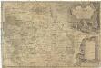
Principatvs Silesiae Karnoviensis nova et exactissima tabula geographica commonstrans insimul districtus ac Statvs minores Frevdenthal, Olbersdorf et Stevberndorf
1 : 100000 Bruntál-oblast (Česko) Wieland, Johann Wolfgang Schubarth, Matthäus Homannianos Heredes
Ratibor
1 : 75000 Ratiboř-oblast (Polsko) Ministerstvo národní obrany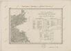
II. vojenské mapování 2
1 : 144000
III. vojenské mapování 3960
1 : 75000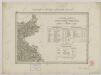
II. vojenské mapování 2
1 : 144000
Podrobná mapa Markrabství moravského a Vévodství slezkého
1 : 100000 Krnov (Česko : oblast) Srp, Jan Jos. R. Vilímek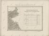
II. vojenské mapování 2
1 : 144000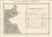
II. vojenské mapování 2
1 : 144000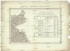
Umgebungen von Jägerndorf
Krnov-oblast (Česko) Enthoffer, J.

Karte des politischen Bezirkes Jägendorf

Jägerndorf
1 : 75000 Krnov (Česko : oblast) Schuberth K. u. k. Militärgeographisches Institut
III. vojenské mapování 3959
1 : 75000
III. vojenské mapování 3959/4
1 : 25000
[Kartenblatt]
1 : 25000 Głubczyce (Polsko : oblast) Reichsamt für Landesaufnahme
[Kartenblatt]
1 : 25000 Kietrz (Polsko) Reichsamt für Landesaufnahme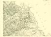
III. vojenské mapování 3959/4
1 : 25000
[Kartenblatt]
1 : 25000 Brumovice (Opava, Česko : oblast) Reichsamt für Landesaufnahme
[Kartenblatt]
1 : 25000 Morava (Česko) Reichsamt für Landesaufnahme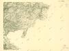
III. vojenské mapování 3959/2
1 : 25000
III. vojenské mapování 3959/2
1 : 25000
[Kartenblatt]
1 : 25000 Morava (Česko) Reichsamt für Landesaufnahme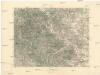
Krnov
1 : 75000 Krnov (Česko : oblast) Vojenský zeměpisný ústav