Maps of Freiburg im Breisgau

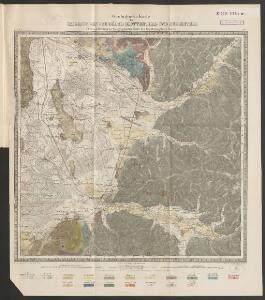
Geologische Karte der Umgebungen der Bäder Glotterthal und Suggenthal
1 : 50000 Schill, Julius Chr. Fr. Müller'sche Hofbuchhandlung
Meßtischblatt [7913] : Waldkirch, 1878
1 : 250000 Waldkirch. - 1:25000. - Leipzig: Giesecke & Devrient, 1878. - 1 Kt.
Meßtischblatt [7912] : Eichstetten, 1878
1 : 250000 Eichstetten. - 1:25000. - Leipzig: Giesecke & Devrient, 1878. - 1 Kt.
Meßtischblatt 117 : Freiburg, 1935
1 : 250000 Freiburg. - Berichtigt 1915, wichtigere Nachtr. 1928. - 1878 [erschienen ca. 1935]. - 1:25000. - Karlsruhe : Kunstdr. Künstlerbund, 1935. - 1 Kt.
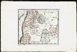
Friburg, in Brisgouw, aan den Treisamtusschen Brisack en het Swarte Wald
Fribourg (Švýcarsko) Schenk, Pieter P. Schenk
Nieuwe en naukeurige aftekening van Freiburg met alle zyne sterktens en omleggende landen etc
1 Karte : Kupferdruck ; 43 x 55 cm Ottens; Ottens chez R. et I. Ottens
Meßtischblatt [7813] : Emmendingen, 1878
1 : 250000 Emmendingen. - 1:25000. - Leipzig: Giesecke & Devrient, 1878. - 1 Kt.
Meßtischblatt 116 : Ehrenstetten, 1930
1 : 250000 Ehrenstetten. - Berichtigt 1893, wichtigere Nachtr. 1930. - 1878 [erschienen ca. 1930].. - 1:25000. - Karlsruhe : Kunstdr. Künstlerbund, 1930. - 1 Kt.
Meßtischblatt [7811] : Markolsheim, 1886
1 : 250000 Markolsheim. - Aufn. 1884. - 1:25000. - [Berlin]: Reichsamt für Landesaufnahme, 1886. - 1 Kt.
Meßtischblatt [7812] : Endingen, 1878
1 : 250000 Endingen. - 1:25000. - Leipzig: Giesecke & Devrient, 1878. - 1 Kt.
Fernere Erweiterung unserer weiteren Kriegs Progressen von den 11ten Aug: biß 12ten Octob:
Mollova mapová sbírka Lidl, Johann Jakob Lidl, Johann Jacob
Freiburg
1 : 200000 Herder, Bartholomew
Freiburg 141, uit: [W. Liebenow's Special-Karte von Mittel-Europa]
1 : 300000 titelvariant: W. Liebenow's Mittel-Europa; Annotatie: Titel boven de bladen: W. Liebenow's Mittel-Europa Johannes Wilhelm Liebenow 1822-1897 Hannover : Hermann Oppermann
Freiburg 141, uit: Special-Karte von Mittel-Europa / nach amtlichen Quellen bearbeitet von W. Liebenow
1 : 300000 titelvariant: W. Liebenow's Mittel-Europa; Annotatie: Titel boven de bladen: W. Liebenow's Mittel-Europa Johannes Wilhelm Liebenow 1822-1897 Frankfurt a. M. : Ludwig Ravenstein
Le Flambeau de la Guerre Allumee au Rhin
Mollova mapová sbírka Delisle, Guillaume Schenk, Peter II
Alasatia superior et inferior III. tabulis delineata, 2
1 Blatt : 62 x 59 cm s.n.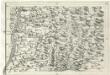
Geographica Provinciarum Sveviae Descriptio =
Mollova mapová sbírka Hurter, Johann Christoph Bodenehr, Johann Georg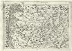
Geographica Provinciarum Sveviae Descriptio =
Mollova mapová sbírka Hurter, Johann Christoph Bodenehr, Johann Georg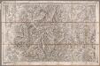
Rottweil
1 : 100000 Annotatie: Linksonder: T-28 [Paris : Depôt de la Guerre]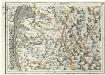
Geographica Provinciarum Sveviae Descriptio =
Mollova mapová sbírka Hurter, Johann Christoph Bodenehr, Gabriel
177. Offenburg, uit: Topographische Uebersichtskarte des Deutschen Reiches / herausgegeben v. d. Kartogr. Abt. d. Königl. Preuß. Landesaufnahme
1 : 200000 titelvariant: Topogr. Übersichtskarte des Deutschen Reiches; Annotatie: Titel boven bladen ook: Topogr. Übersichtskarte des Deutschen Reiches; Annotatie geografische gegevens: Op elk blad twee maatstokken: 10 Kilometer = 5,5 cm; 1 geogr. Meile = 3,6 cm; Legenda onder op elk blad Königlich Preußische Landesaufnahme. Kartographische Abtheilung [S.l : Königlich Preußische Landesaufnahme, Kartographische Abtheilung]
Charte über das Grosherzogthum Baaden
1 : 180000 Bádensko (Německo)
Le cours du Rhin de Bâle à Hert près Philisbourg contenant l'Alsace et partie du Brisgau, 2
1 Blatt : 75 x 52 cm Le Rouge
Le Theatre de la Guerre Sur le Haut Rhein
1 : 142000 Mollova mapová sbírka Sanson, Guillaume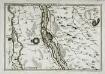
Les environs des deux Brisachs
1 Karte : Kupferdruck ; 23 x 33 cm Fer; Inselin Nicolas de Fer
Meßtischblatt [7914] : St. Peter, 1928
1 : 250000 St. Peter. - Hrsg. 1877, revid. 1907, wichtigere Nachtr. bis 1928. - 1:25000. - Leipzig: Giesecke & Devrient, 1928. - 1 Kt.
Meßtischblatt [8014] : Höllsteig, 1881
1 : 250000 Höllsteig. - [Ausg.] 1876 u. 1881. - 1:25000. - Leipzig: Giesecke & Devrient, 1881. - 1 Kt.
Meßtischblatt [7814] : Elzach, 1884
1 : 250000 Elzach. - [Ausg.] 1877 u. 1884. - 1:25000. - Leipzig: Giesecke & Devrient, 1884. - 1 Kt.
Sequani Latobrigi
1 Karte : Kupferdruck ; 40 x 43 cm Sanson; Robert de Vaugondy; Laleman chés le Sr. Robert geog. du roi quai de l'horloge du Palais