Maps of Hrdějovice

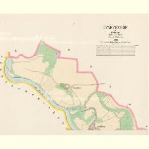
Pfaffenhöf - c3207-1-002 - Kaiserpflichtexemplar der Landkarten des stabilen Katasters
1 : 2880
Pfaffenhöf - c3207-1-001 - Kaiserpflichtexemplar der Landkarten des stabilen Katasters
1 : 2880
Kněžské Dvory, berní okres České Budějovice, země Česká
1 : 2880 Kněžské Dvory (České Budějovice, Česko) Reprodukční ústav Ministerstva financí
Hartowitz - c2344-1-006 - Kaiserpflichtexemplar der Landkarten des stabilen Katasters
1 : 2880
Hartowitz - c2344-1-005 - Kaiserpflichtexemplar der Landkarten des stabilen Katasters
1 : 2880
Hartowitz - c2344-1-002 - Kaiserpflichtexemplar der Landkarten des stabilen Katasters
1 : 2880
Hartowitz - c2344-1-003 - Kaiserpflichtexemplar der Landkarten des stabilen Katasters
1 : 2880
Hartowitz - c2344-1-001 - Kaiserpflichtexemplar der Landkarten des stabilen Katasters
1 : 2880
Hartowitz - c2344-1-004 - Kaiserpflichtexemplar der Landkarten des stabilen Katasters
1 : 2880
Vltava - list 18

Böhmisch-Fellern - c0977-1-004 - Kaiserpflichtexemplar der Landkarten des stabilen Katasters
1 : 2880
Böhmisch-Fellern - c0977-1-001 - Kaiserpflichtexemplar der Landkarten des stabilen Katasters
1 : 2880
Böhmisch-Fellern - c0977-1-002 - Kaiserpflichtexemplar der Landkarten des stabilen Katasters
1 : 2880
Böhmisch-Fellern - c0977-1-003 - Kaiserpflichtexemplar der Landkarten des stabilen Katasters
1 : 2880
Vierhöf - c1045-1-002 - Kaiserpflichtexemplar der Landkarten des stabilen Katasters
1 : 2880
Vierhöf - c1045-1-003 - Kaiserpflichtexemplar der Landkarten des stabilen Katasters
1 : 2880
Vierhöf - c1045-1-004 - Kaiserpflichtexemplar der Landkarten des stabilen Katasters
1 : 2880
Vierhöf - c1045-1-001 - Kaiserpflichtexemplar der Landkarten des stabilen Katasters
1 : 2880
Nejnovější plán župního města Č. Budějovic
1 : 10000 České Budějovice (Česko) Lenc, F. Schinko, B. J. Svátek
Nejnovější plán župního města Č. Budějovic
Project für den Bau einer Stützmauer und der Park : Anlage an der Budweisser Strasse Par
Projekt stavby opěrné zdi a parčíku pod skupinou budov, zvaných Hamburk, podél silnice do Českých Budějovic. U podpisů autorů datace s určením místa vzniku 'Karlsbad den 23. September 872'.
[Gradkartenblatt]
1 : 25000 Hluboká nad Vltavou-oblast (Česko) Vojenský zeměpisný ústav

Vltava jižně od Prahy

Gradkartenblatt
1 : 25000 Hluboká nad Vltavou-oblast (Česko) Czöppan, Johann
Umgebung von Budweis
1 : 37000 České Budějovice-oblast (Česko) Popper, Filipp L.E. Hansen
Topographische Karte ... Herrschaft Krummau ...

Topographische Karte der in Böhmen budweiser Kreises liegenden
Uibersichts-Karte der hochfürstlich zu Schwarzenbergschen Domaine Frauenberg nach dem Stande im Jahre 1876
1 : 58000 Hluboká nad Vltavou-oblast (Česko) Danesch, Jos. Kreibich, František Jakub Jindřich