Maps of Crete
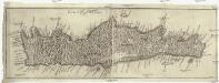
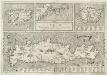
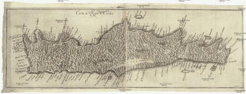
Carta del regno di Candia
Kréta (Řecko) Bouttats, Gaspar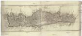
Carta del regno di Candia
Kréta (Řecko) Bouttats, Gaspar
Creta insula hodie Ca[n]dia in medio ponto sita est
Kréta (Řecko) Duchet, Claude Claudij Ducheti
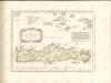
Insvla di Candia del mare Mediteranea
Kréta (Řecko) Peeters, Jacob Lauwers, Conrad Ioannes Peeters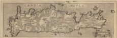
Candia Insula. [Karte], in: Theatrum orbis terrarum, S. 341.
1 Karte aus Atlas Ortelius, Abraham Vrients, Jan Baptista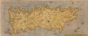
[Candia, Olim Creta.] [Karte], in: Theatrum orbis terrarum, S. 93.
1 Karte aus Atlas Ortelius, Abraham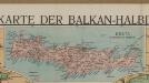
[Kreta]
Griechenland Kreta Osmanisches Reich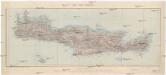
Ile de Crete
1 : 400000 Kréta (Řecko : ostrov) Service géographique de l'armée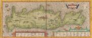
Creta Iovis magni, medio iacet insula ponto. [Karte], in: Theatrum orbis terrarum, S. 416.
1 Karte aus Atlas Ortelius, Abraham
[Nebenkarte Kreta] Ethnographische Karte der europäischen Türkei und ihrer Dependenzen zu Anfang des Jahres 1877
Griechenland Kreta Ethnische Gruppe Sax, Carl
Isle et royaume de Candie
1 : 810000 Kréta (Řecko) Sanson, Nicolas Cordier, Louis Pierre Mariette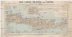
Die Insel Candia oder Creta
1 : 500000 Kréta (Řecko : ostrov) Dietrich Reimer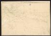
Candia cum Insulis aliquot circa Graeciam[:] [Zypern] [Karte], in: Gerardi Mercatoris Atlas, sive, Cosmographicae meditationes de fabrica mundi et fabricati figura, S. 493.
1 Karte aus Atlas Mercator, Gerhard Montanus, Petrus
Candia cum insulis aliquot circa Græciam
1 Karte : Kupferdruck ; 22 x 46 cm, Bildgrösse 34 x 48 cm Mercator; Hondius Henricus Hondius
Candia cum insulis aliquot circa Græciam
1 Karte : Kupferdruck ; 22 x 46 cm, Bildgrösse 34 x 48 cm Mercator s.n.

Candia
Mollova mapová sbírka Merian, Matthaeus Merian, Matthäus - dědici
Carte orographique et géognostique de l'île de Crête (H KPHTH)
1 : 300000 Westblatt Raulin, Victor R. Janson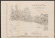
Carte orographique et géognostique de l'île de Crête
1 : 300000 Westblatt Raulin, Victor R. Janson
Greece 1:250, 000, Khania
Greece 1:250,000 , Series GSGS 4410. Great Britain. War Office. [London] : War Office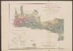
Carte orographique et géognostique de l'île de Crête
1 : 300000 Westblatt Raulin, Victor R. Janson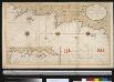
Een gedeelte van het eijland Candia vertoonende de de Noord Oost zijde
Greece Gerard van Keulen
Greece 1:250, 000, Iraklion (Candia)
Greece 1:250,000 , Series GSGS 4410. Great Britain. War Office. [London] : War Office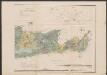
Carte orographique et géognostique de l'île de Crête
1 : 300000 Ostblatt Raulin, Victor R. Janson
Carte orographique et géognostique de l'île de Crête (H KPHTH)
1 : 300000 Ostblatt Raulin, Victor R. Janson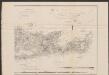
Carte orographique et géognostique de l'île de Crête
1 : 300000 Ostblatt Raulin, Victor R. Janson
Een gedeelte van het eijland Candia vertoonende de Noord West zijde
Greece Gerard van Keulen