Maps of Austria
Strassen und Gebirgs-Karte zur Reise von Wien durch Oesterreich, Salzburg, Kärnthen, Steyermark und Tyrol bis München
1 : 576000 Alpy rakouské Schulz, R. A. Biller, Dominik Artaria & Co.
Strassen und Gebirgs-Karte zur Reise von Wien durch Österreich, Salzburg, Kärnthen, Steyermark und Tyrol bis München : mit Berücksichtigung der oesterreichischen Alpen und des Bayerischen Hochgebirgs
Artaria Co.
Geologische Uibersichts-Karte zur Reise von Wien durch Oesterreich, Salzburg, Kärnthen, Steyermark und Tyrol bis München, mit Berücksichtigung der österreichischen Alpen und des Bayer. Hochgebirgs
1 : 576000 Morlot, Adolph von Artaria & Co.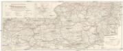
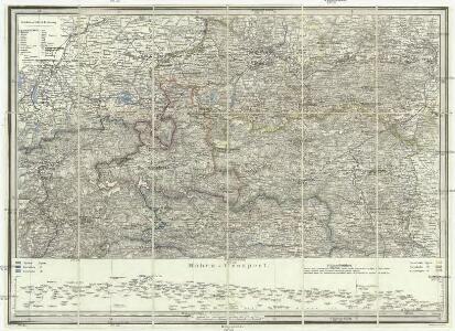
Wintersportverkehr in Österreich
1 : 600000 Rakousko Kartographisches, früher Militärgeographisches Institut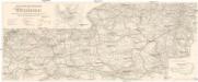
Wintersportverkehr in Österreich
1 : 600000 Rakousko Kartographisches, früher Militärgeographisches Institut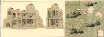
Plann deren Bergwerg Wendelstein, und Stagevoi
Mollova mapová sbírka Geyer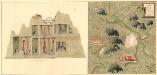
Plan des Bergwergs Weispriach
Mollova mapová sbírka Geyer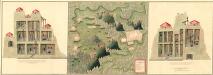
Plan der Bergwerg in der Creitzen
Mollova mapová sbírka Geyer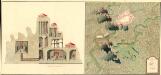
Plan des Bergwergs St. Anna an der Miss
Mollova mapová sbírka Geyer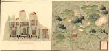
Plan des Bergwergs Wipenstein
Mollova mapová sbírka Geyer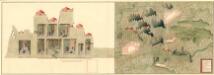
Plan der Bergwerg Schreflhoff, und Theifenegg
Mollova mapová sbírka Geyer
Plan des Bergwergs Serniz
Mollova mapová sbírka Geyer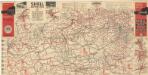
Strassen Zustands-Karte und Stadtpläne mit Durchfahrten von Österreich

VII, uit: General-Karte des oesterreichischen Kaiserstaates mit einem grossen Theile der angrenzenden Länder / durch Josef Scheda ... bearb. und hrsg
1 : 576000 Annotatie geografische gegevens: Maatstokken: oesterreichische Meilen, geografische oder deutsche Meilen, preussische Meilen, türkische Berri, französische Lieues, russische Werste; Maatstok per blad: wiener Klafter, öster. Meilen; Blad XIX: statistische en taalkundige informatie; Blad XIX: legenda [Wien : K.K. Militärisch-Geografisches Institut]
Sheet VII: Karte Des Oesterreichischen Kaiserstaates.
1 : 576000 Scheda, Josef
Vogels Karte des Deutschen Reichs und der Alpenländer
1 : 500000 Augsburg-oblast (Německo) Vogel, Karl Langhans, Paul Justus Perthes
Evropa

[München-Linz-Bruck].
1 : 576000 Rakousko Blumtritt, H. Oesfeld, C. W.
Austriae ducatus chorographia
1 : 590000 Rakousko Lazius, Wolfgang Ortelius, Abraham A. Ortelius
Erzherzogthum Österreich

Le Cercle de Baviere, et Partie de Celuy D'Autriche, les Confins du Royaume de Boheme et du Duché de Moravie
1 : 710000 Mollova mapová sbírka Fer, Nicolas de Inselin, Charles Danet, Guillaume
Karte des Erzherzogthumes Oesterreich ob und unter der Enns und des Herzogthumes Salzburg
1 : 432000 Dolní Rakousko (Rakousko) Steinhauser, Anton Artaria
Oesterreich ob- und unter der Enns
1 : 925000 Dolní Rakousko (Rakousko) Mollo, Tranquillo T. Mollo
Salisburgensis Iurisdictionis, locorumque vicinorum vera descriptio [Karte], in: Theatrum orbis terrarum, S. 168.
1 Karte aus Atlas Ortelius, Abraham
Circuli Austriaci in quo Sunt Archiducatus Austriae Ducatus Stiriae Carintiae Carniolae et Episcopatus Tridentini Novissima Descriptio
1 : 900000 Mollova mapová sbírka Danckerts, Justus Danckerts, Justus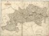
Erzherzogthum Österreich

Erzherzogthum Österreich
Rakousko
Die Krönlander Oesterreich unter und ob der Enns und Salzburg
Dolní Rakousko (Rakousko) Marco Berra
Salisburgensis Iurisdictionis, locorumque vicinorum vera descriptio [Karte], in: Theatrum orbis terrarum, S. 260.
1 Karte aus Atlas Ortelius, Abraham Vrients, Jan Baptista