Maps of Notio Aigaio

Turkey
1 : 6170000 Kréta (Řecko) Walker, C. Baldwin & Cradock
GRAECIAE ANTIQUAE DESIGNATIO NOVA
Řecko Lotter, Tobias Conrad impensis T. Conr. Lotteri
Graeciae antiquae designatio nova
Řecko Lotter, Tobias Conrad impensis T. Conr. Lotteri
Königreich Griechenland
1 : 1600000 nach den neuesten und besten Hülfsmitteln entworfen und gezeichnet von C.F. Weiland. Weimar : im Verlage des Geograph. Instituts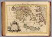
Graeciae pars Meridionalis.
1 : 1280000 L'Isle, Guillaume de, 1675-1726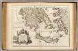
Graeciae pars Meridionalis.
1 : 1280000 L'Isle, Guillaume de, 1675-1726
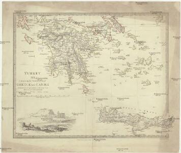
Turkey III : containing the southern part of Greece and Candia
published under the superintendence of the Society for the Diffusion of Useful Knowledge engraved by J. & C. Walker London : Baldwin and Cradock
Ancient Greece : southern part
1 : 1500000 published under the superintendence of the Society for the Diffusion of Useful Knowledge engraved by J. & C. Walker London : Baldwin and Cradock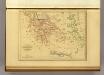
Grece et de l'Archipel.
1 : 2650000 Malte-Brun, Conrad, 1775-1826
Greece.
1 : 1470000 Mitchell, Samuel Augustus
Greece.
1 : 1470000 Mitchell, Samuel Augustus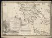
La Morea, la Livadia, e porzione della Tessaglia, e Dell' Epiro con la parte occidentale dell' arcipelago, V. Foglio della carta generale dell' Ungheria e della Turchia Europea
1 : 1584000
Griechenland
1 : 3000000 Foiníkie Eduard Hölzel
Griechenland
1 : 3000000 Libanon Kocen, Blaž Eduard Hölzel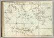
Carte De La Mer Mediterranee. XI.
Roux, Joseph
Greece.
1 : 1480000 Mitchell, Samuel Augustus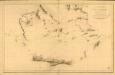
Carte réduite de la partie Méridionale de l’Archipel
Carte réduite de la partie Méridionale de l'Archipel, rédigée d'après les travaux exécutées dans les années 1818 & 1819 par M. Gauttier. [Paris] : Dépôt Général de la Marine
[General-Karte der Europaeischen Türkei und des Königreiches Griechenland]
1 : 864000 osmanská říše Scheda, Joseph von Artaria & Comp.
Neueste Karte von Griechenland
Grosser Hand-Atlas über alle Theile der Erde in 170 Karten Meyer, J. Verlag des Bibliographischen Instituts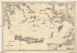
Mittelmeer
1 : 600000 Egejské moře Reichs-Marine-Amt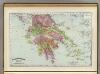
Greece.
1 : 1470000 Rand McNally and Company
Griechenland und die Jonischen Inseln
Schul-Atlas in 36 Karten Völter, Daniel Verlag der J.M. Dannheimer'schen Buchhandlung
Griechenland.
1 : 1600000 Meyer, Joseph, 1796-1856
Greece And The Ionian Republic.
1 : 1584000 Colton, G.W.
Greece and the Ionian Republic.
1 : 2000000 Colton, G.W.
Griechenland.
1 : 1400000 Flemming, Carl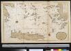
Het zuijderdeel van de Archipel Lagusche Eijlanden int groodt
Greece Gerard van Keulen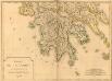
Carte de la Morée anciennement Peloponnèse, 1785
Carte de la Morée anciennement Peloponnèse, 1785. Gravé par L.A. Dupuis ... Lieues communes de France, 20[ = 128 mm] [Paris]
Greece.
1 : 1500000 Tanner, Henry S.